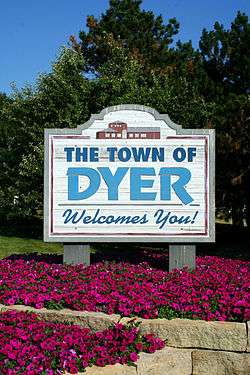
Dyer, Indiana
| Dyer, Indiana | |
|---|---|
| Town | |
 | |
| Motto(s): Striving Higher in Dyer | |
 Location of Dyer in Lake County, Indiana. | |
| Coordinates: 41°30′1″N 87°30′44″W / 41.50028°N 87.51222°WCoordinates: 41°30′1″N 87°30′44″W / 41.50028°N 87.51222°W | |
| Country |
|
| State |
|
| County | Lake |
| Township | St. John |
| Settled[1] | 1838 |
| Incorporated | January 24, 1910 |
| Government[2] | |
| • Type | Town |
| • Body | Town Council |
| • President | Jeffrey Dekker (R, 2nd) |
| • Vice-President | Mary Tanis (R, 4th) |
| • Members: | (R, 2nd) Joe cinko (D, 1st) Debbie Astor (R, 5th) |
| • Clerk-Treasurer | Patricia A. Hawrot (D) |
| Area[3] | |
| • Total | 6.20 sq mi (16.06 km2) |
| • Land | 6.20 sq mi (16.06 km2) |
| • Water | 0.00 sq mi (0.00 km2) |
| Elevation | 640 ft (200 m) |
| Population (2010)[4] | |
| • Total | 16,390 |
| • Estimate (2016)[5] | 15,941 |
| • Density | 2,571.13/sq mi (992.77/km2) |
| Standard of living (2008-12)[4] | |
| Time zone | UTC-6 (Central) |
| • Summer (DST) | UTC-5 (Central) |
| ZIP code | 46311 |
| Area code | 219 |
| FIPS code | 18-19270[6] |
| GNIS feature ID | 0433824[7] |
| Website | www.townofdyer.com |
| Demographics (2010)[8] | |||
|---|---|---|---|
| White | Black | Asian | |
| 90.1% | 2.5% | 2.9% | |
| Islander | Native | Other | Hispanic (any race) |
| 0.0% | 0.2% | 4.3% | 9.3% |
Dyer is a town in St. John Township, Lake County, Indiana, United States. The population was 16,390 at the 2010 census. It is a southeastern suburb of Chicago.
Geography
Dyer borders Munster to the north, unincorporated St. John Township to the south, Schererville to the east, and Lynwood and Sauk Village in Illinois to the west. The Illinois state line comprises Dyer's entire western border. One of Dyer's neighborhoods, Briar Ridge, spans both Dyer and adjacent Schererville.[9] Dyer is roughly 30 miles from downtown Chicago and 12 miles from Chicago's south side.
Dyer is built on mostly flat land with an exception being the steep sand ridge south of US Highway 30. This is the Glenwood Shoreline.
According to the 2010 census, Dyer has a total area of 6.1 square miles (15.80 km2), all land.[10]
Demographics
| Historical population | |||
|---|---|---|---|
| Census | Pop. | %± | |
| 1910 | 545 | — | |
| 1920 | 479 | −12.1% | |
| 1930 | 672 | 40.3% | |
| 1940 | 976 | 45.2% | |
| 1950 | 1,556 | 59.4% | |
| 1960 | 3,993 | 156.6% | |
| 1970 | 4,906 | 22.9% | |
| 1980 | 9,555 | 94.8% | |
| 1990 | 10,923 | 14.3% | |
| 2000 | 13,895 | 27.2% | |
| 2010 | 16,390 | 18.0% | |
| Est. 2016 | 15,941 | [5] | −2.7% |
| Source:[6] | |||
As of 2009, the median income for a household in the town was $76,599 while the mean income for a household in the town was $93,308. The median income for a family was $87,127 and the mean income for a family was $103,563. The estimated per capita income for the town was $34,275. About 0.7% of families and 1.2% of the population were estimated to be below the poverty line.[11]
2010 census
As of the census[4] of 2010, there were 16,390 people, 5,985 households, and 4,552 families residing in the town. The population density was 2,686.9 inhabitants per square mile (1,037.4/km2). There were 6,125 housing units at an average density of 1,004.1 per square mile (387.7/km2). The racial makeup of the town was 90.1% White, 2.5% African American, 0.2% Native American, 2.9% Asian, 2.4% from other races, and 1.8% from two or more races. Hispanic or Latino of any race were 9.3% of the population.
There were 5,985 households of which 33.5% had children under the age of 18 living with them, 63.8% were married couples living together, 8.4% had a female householder with no husband present, 3.9% had a male householder with no wife present, and 23.9% were non-families. 20.8% of all households were made up of individuals and 9.7% had someone living alone who was 65 years of age or older. The average household size was 2.68 and the average family size was 3.12.
The median age in the town was 42.9 years. 23.1% of residents were under the age of 18; 7.1% were between the ages of 18 and 24; 22.9% were from 25 to 44; 31.4% were from 45 to 64; and 15.5% were 65 years of age or older. The gender makeup of the town was 48.4% male and 51.6% female.
History
In 1830, the first permanent white settlers came to Northwest Indiana.[1] The earliest historical records date back to 1838. On June 1, 1855, the original plat of the town[1] was established. Aaron Norton Hart, a settler from Philadelphia, Pennsylvania, played a key role in developing Dyer's infrastructure in the 1860s and 1870s. Hart supervised construction of roads and the implementation of a drainage ditch system, allowing agricultural and commercial use of the marshy land. Hart was killed in 1883 while working on a ditch near Plum Creek. Hart Street, one of Dyer's major north–south streets, bears his name. Hart's wife, Martha Dyer Hart, is the town's namesake.[12]
Dyer was incorporated as a town under Indiana law on February 8, 1910.[1] Upon incorporation, Dyer was divided into three wards: The first ward consisted of all land within town limits lying west of Hart Street; the second ward comprised the section east of Hart Street and south of Lincoln Highway; the land north of Lincoln Highway and east of Hart Street formed the third ward.[1]
Meyer's Castle was listed in the National Register of Historic Places in 1984.[13]
Transportation
Roads
Dyer's primary arterial road is U.S. Route 30/Lincoln Highway, which runs east–west through the town. A 1.3-mile (2.1 km) stretch of this route traversing Dyer and Schererville was considered one of the most prominent Seedling Mile projects on the Lincoln Highway when it was constructed in the early 1920s, and came to be known as the highway's "Ideal Section." It remains in use to this day.
Amtrak
Amtrak, the national passenger rail system, provides service to Dyer at the Dyer Amtrak Station. The station is served by the Cardinal with service to Chicago Union Station and New York Penn Station via Washington D.C.'s Union Station. On the days that the Cardinal does not run, the Hoosier State connects Indianapolis to Chicago, where connecting trains take passengers to other destinations in the Amtrak system.[14]
Education
Lake County Public Library operates the Dyer-Schererville Branch at 1001 West Lincoln Highway in adjacent Schererville.[15]
Dyer is served by the Lake Central School Corporation. Public high school students living in Dyer are served by Lake Central High School located outside the town limits on Route 41 in St. John.[16] Three of the system's schools are located within Dyer town limits: Kahler Middle School, on Route 30 west of Hart Street, Protsman Elementary, located north of 213th Street, and Bibich elementary, located just off of 81st street.
It is also the home of Protestant Reformed Christian School (PRCS), a Christian school started by members of the Protestant Reformed Churches.
Mid-America Reformed Seminary is an independent Reformed and Presbyterian theological institution. −
Sports
Dyer is home to the Chi-Town Shooters, a minor league professional ice hockey team that is a member of the All American Hockey League. The team's home arena is Midwest Training & Ice Center.
References
- 1 2 3 4 5 Town of Dyer history page
- ↑ "2014 Public Officials Directory". Lake County Board of Elections and Voter's Registration. Retrieved 2014-06-10.
- ↑ "2016 U.S. Gazetteer Files". United States Census Bureau. Retrieved Jul 28, 2017.
- 1 2 3 "American FactFinder". United States Census Bureau. Retrieved 2014-06-09.
- 1 2 "Population and Housing Unit Estimates". Retrieved June 9, 2017.
- 1 2 "American FactFinder". United States Census Bureau. Archived from the original on 2013-09-11. Retrieved 2008-01-31.
- ↑ "US Board on Geographic Names". United States Geological Survey. 2007-10-25. Retrieved 2008-01-31.
- ↑ U.S. Census Bureau. American Community Survey, Profile of General Population and Housing Characteristics 2010, Table DP-1, 2010 Demographic Profile Data. American FactFinder Archived September 11, 2013, at the Wayback Machine.. Retrieved 2014-06-14.
- ↑ "US Gazetteer files: 2010, 2000, and 1990". United States Census Bureau. 2011-02-12. Retrieved 2011-04-23.
- ↑ "G001 - Geographic Identifiers - 2010 Census Summary File 1". United States Census Bureau. Retrieved 2015-07-16.
- ↑ http://www.factfinder.census.gov/servlet/ADPTable?_bm=y&-geo_id=16000US1819270&-qr_name=ACS_2009_5YR_G00_DP5YR3&-ds_name=ACS_2009_5YR_G00_&-_lang=en&-_sse=on
- ↑ http://www.northwestindiana.com/cities/dyer/dyer.html
- ↑ National Park Service (2010-07-09). "National Register Information System". National Register of Historic Places. National Park Service.
- ↑ "Amtrak - Stations - Dyer, IN (DYE)". Amtrak. Retrieved August 5, 2010.
- ↑ "Locations and Hours Archived December 25, 2008, at the Wayback Machine.." Lake County Public Library. Retrieved on January 21, 2009.
- ↑ http://www.lcsc.us/
External links
Municipalities and communities of Lake County, Indiana, United States | ||
|---|---|---|
| Cities | ||
| Towns | ||
| Townships | ||
| CDPs | ||
| Other unincorporated communities |
| |
| Ghost towns |
| |
| Footnotes | ‡This populated place also has portions in an adjacent county or counties | |
| Major city |  | |
|---|---|---|
| Cities (over 30,000 in 2010) | ||
| Towns and villages (over 30,000 in 2010) |
| |
| Counties | ||
| Regions | ||
| Sub-regions | ||
