Putnam County, Indiana
| Putnam County, Indiana | |
|---|---|
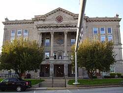 Putnam County Courthouse in Greencastle | |
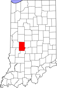 Location in the U.S. state of Indiana | |
 Indiana's location in the U.S. | |
| Founded | December 31, 1822 |
| Named for | Israel Putnam |
| Seat | Greencastle |
| Largest city | Greencastle |
| Area | |
| • Total | 482.69 sq mi (1,250 km2) |
| • Land | 480.53 sq mi (1,245 km2) |
| • Water | 2.16 sq mi (6 km2), 0.45% |
| Population | |
| • (2010) | 37,963 |
| • Density | 78.7/sq mi (30.37/km2) |
| Congressional district | 4th |
| Time zone | Eastern: UTC−5/−4 |
| Website |
co |
|
Footnotes: Indiana county number 67 | |
Putnam County is a county located in the U.S. state of Indiana. As of 2010, the population was 37,963.[1] The county seat is Greencastle.[2] The name is in honor of Israel Putnam, who was a hero in the French and Indian War and a general in the American Revolutionary War. The county was formed on April 1, 1822 from Owen and Vigo Counties and parts of the Wabash New Purchase attached to Monroe and Parke Counties.[3]
Putnam County is included in the Indianapolis-Carmel-Anderson, IN Metropolitan Statistical Area.
Geography
According to the 2010 census, the county has a total area of 482.69 square miles (1,250.2 km2), of which 480.53 square miles (1,244.6 km2) (or 99.55%) is land and 2.16 square miles (5.6 km2) (or 0.45%) is water.[4]
Cities
Towns
Census-designated places
Other unincorporated places
- Barnard
- Belle Union
- Blakesburg
- Brick Chapel
- Broad Park
- Brunerstown
- Cagle Mill
- Carpentersville
- Cary
- Clinton Falls
- Cradick Corner
- Edgewood Lake
- Fincastle
- Fox Ridge
- Groveland
- Hirt Corner
- Jenkinsville
- Keytsville
- Limedale
- Manhattan
- Morton
- Mount Meridian
- New Maysville
- Pleasant Gardens
- Portland Mills
- Putnamville
- Raab Crossroads
- Raccoon
- Reelsville
- Vivalia
- Westland
Townships
Adjacent counties
- Montgomery County (north)
- Hendricks County (east)
- Morgan County (southeast)
- Owen County (south)
- Clay County (southwest)
- Parke County (west)
Major highways
Climate and weather
| Greencastle, Indiana | ||||||||||||||||||||||||||||||||||||||||||||||||||||||||||||
|---|---|---|---|---|---|---|---|---|---|---|---|---|---|---|---|---|---|---|---|---|---|---|---|---|---|---|---|---|---|---|---|---|---|---|---|---|---|---|---|---|---|---|---|---|---|---|---|---|---|---|---|---|---|---|---|---|---|---|---|---|
| Climate chart (explanation) | ||||||||||||||||||||||||||||||||||||||||||||||||||||||||||||
| ||||||||||||||||||||||||||||||||||||||||||||||||||||||||||||
| ||||||||||||||||||||||||||||||||||||||||||||||||||||||||||||
In recent years, average temperatures in Greencastle have ranged from a low of 18 °F (−8 °C) in January to a high of 86 °F (30 °C) in July, although a record low of −23 °F (−31 °C) was recorded in January 1985 and a record high of 107 °F (42 °C) was recorded in July 1954. Average monthly precipitation ranged from 2.40 inches (61 mm) in January to 5.14 inches (131 mm) in July.[5]
Government
The county government is a constitutional body, and is granted specific powers by the Constitution of Indiana, and by the Indiana Code.
County Council: The county council is the legislative branch of the county government and controls all the spending and revenue collection in the county. Representatives are elected from county districts. The council members serve four-year terms. They are responsible for setting salaries, the annual budget, and special spending. The council also has limited authority to impose local taxes, in the form of an income and property tax that is subject to state level approval, excise taxes, and service taxes.[6][7]
Board of Commissioners: The executive body of the county is made of a board of commissioners. The commissioners are elected county-wide, in staggered terms, and each serves a four-year term. One of the commissioners, typically the most senior, serves as president. The commissioners are charged with executing the acts legislated by the council, collecting revenue, and managing the day-to-day functions of the county government.[6][7]
Court: The county maintains a small claims court that can handle some civil cases. The judge on the court is elected to a term of four years and must be a member of the Indiana Bar Association. The judge is assisted by a constable who is also elected to a four-year term. In some cases, court decisions can be appealed to the state level circuit court.[7]
County Officials: The county has several other elected offices, including sheriff, coroner, auditor, treasurer, recorder, surveyor, and circuit court clerk. Each of these elected officers serves a term of four years and oversees a different part of county government. Members elected to county government positions are required to declare party affiliations and to be residents of the county.[7]
| Year | Republican | Democratic | Third parties |
|---|---|---|---|
| 2016 | 72.3% 10,637 | 22.8% 3,356 | 4.9% 722 |
| 2012 | 65.1% 9,005 | 32.6% 4,507 | 2.3% 317 |
| 2008 | 55.1% 8,086 | 43.2% 6,334 | 1.7% 255 |
| 2004 | 67.8% 8,908 | 31.2% 4,103 | 1.0% 125 |
| 2000 | 61.9% 7,352 | 34.7% 4,123 | 3.3% 396 |
| 1996 | 51.3% 5,958 | 34.1% 3,962 | 14.6% 1,696 |
| 1992 | 44.3% 5,341 | 28.9% 3,487 | 26.7% 3,220 |
| 1988 | 64.6% 7,119 | 34.9% 3,850 | 0.5% 52 |
| 1984 | 69.4% 7,820 | 30.1% 3,392 | 0.5% 60 |
| 1980 | 60.4% 7,090 | 34.0% 3,996 | 5.6% 662 |
| 1976 | 53.7% 6,063 | 45.3% 5,116 | 1.0% 118 |
| 1972 | 70.1% 7,879 | 29.7% 3,339 | 0.2% 25 |
| 1968 | 51.5% 5,873 | 32.4% 3,692 | 16.2% 1,845 |
| 1964 | 45.8% 5,331 | 54.0% 6,275 | 0.2% 24 |
| 1960 | 57.6% 6,583 | 42.0% 4,798 | 0.4% 42 |
| 1956 | 59.3% 6,684 | 40.5% 4,572 | 0.2% 24 |
| 1952 | 59.7% 6,632 | 40.0% 4,446 | 0.4% 40 |
| 1948 | 50.9% 5,072 | 48.3% 4,814 | 0.8% 77 |
| 1944 | 52.4% 5,386 | 47.2% 4,857 | 0.4% 40 |
| 1940 | 49.0% 5,832 | 50.6% 6,020 | 0.4% 49 |
| 1936 | 44.3% 4,961 | 55.1% 6,177 | 0.6% 69 |
| 1932 | 40.5% 4,438 | 56.2% 6,168 | 3.3% 362 |
| 1928 | 55.7% 5,351 | 43.5% 4,177 | 0.8% 75 |
| 1924 | 49.1% 4,930 | 47.4% 4,759 | 3.4% 343 |
| 1920 | 47.8% 5,140 | 50.4% 5,417 | 1.8% 189 |
| 1916 | 43.3% 2,453 | 52.3% 2,965 | 4.4% 250 |
| 1912 | 24.4% 1,354 | 52.7% 2,922 | 22.9% 1,269 |
| 1908 | 44.3% 2,626 | 52.8% 3,131 | 2.9% 169 |
| 1904 | 44.4% 2,586 | 51.5% 3,005 | 4.1% 239 |
| 1900 | 43.5% 2,632 | 53.7% 3,251 | 2.8% 166 |
| 1896 | 44.4% 2,622 | 54.5% 3,218 | 1.2% 69 |
| 1892 | 42.4% 2,289 | 51.0% 2,754 | 6.7% 362 |
| 1888 | 45.1% 2,570 | 53.0% 3,016 | 1.9% 110 |
Demographics
| Historical population | |||
|---|---|---|---|
| Census | Pop. | %± | |
| 1830 | 8,262 | — | |
| 1840 | 16,843 | 103.9% | |
| 1850 | 18,615 | 10.5% | |
| 1860 | 20,681 | 11.1% | |
| 1870 | 21,514 | 4.0% | |
| 1880 | 22,501 | 4.6% | |
| 1890 | 22,335 | −0.7% | |
| 1900 | 21,478 | −3.8% | |
| 1910 | 20,520 | −4.5% | |
| 1920 | 19,880 | −3.1% | |
| 1930 | 20,448 | 2.9% | |
| 1940 | 20,839 | 1.9% | |
| 1950 | 22,950 | 10.1% | |
| 1960 | 24,927 | 8.6% | |
| 1970 | 26,932 | 8.0% | |
| 1980 | 29,163 | 8.3% | |
| 1990 | 30,315 | 4.0% | |
| 2000 | 36,019 | 18.8% | |
| 2010 | 37,963 | 5.4% | |
| Est. 2016 | 37,436 | [9] | −1.4% |
| U.S. Decennial Census[10] 1790-1960[11] 1900-1990[12] 1990-2000[13] 2010-2013[1] | |||
As of the 2010 United States Census, there were 37,963 people, 12,917 households, and 9,256 families residing in the county.[14] The population density was 79.0 inhabitants per square mile (30.5/km2). There were 14,706 housing units at an average density of 30.6 per square mile (11.8/km2).[4] The racial makeup of the county was 93.4% white, 4.0% black or African American, 0.7% Asian, 0.3% American Indian, 0.5% from other races, and 1.1% from two or more races. Those of Hispanic or Latino origin made up 1.5% of the population.[14] In terms of ancestry, 23.6% were German, 15.3% were American, 12.7% were Irish, and 12.6% were English.[15]
Of the 12,917 households, 32.9% had children under the age of 18 living with them, 58.1% were married couples living together, 9.0% had a female householder with no husband present, 28.3% were non-families, and 23.9% of all households were made up of individuals. The average household size was 2.52 and the average family size was 2.96. The median age was 37.9 years.[14]
The median income for a household in the county was $47,697 and the median income for a family was $59,354. Males had a median income of $44,615 versus $29,211 for females. The per capita income for the county was $20,441. About 7.7% of families and 10.3% of the population were below the poverty line, including 12.1% of those under age 18 and 7.7% of those age 65 or over.[16]
Points of Interest
Big Walnut Sports Park
Big Walnut Sports Park began as an all-volunteer effort in 1988. In May 2014, the nearly 80-acre (32 ha) park on Greencastle's far east side was deeded to the city of Greencastle. The park offers baseball, softball, and little league fields along with soccer fields, a walking trail, picnic tables, Frisbee golf, and a new dog park.[17]
Cagles Mill Lake
In 1952,Cagles Mill Lake was built as Indiana's first flood control reservoir, protecting the Eel and White river watersheds. Mill Creek feeds the 1,400-acre (570 ha) lake and is home to Cataract Falls. In the 1800s, Lieber State Recreation Area was populated by the Miami, Shawnee, and Potawatomi. In 1809, what was left of the great Miami Indian Confederacy sold the now southern one-third of Indiana to the U.S. government, when the 10 O'Clock Treaty Line, which passes through Lieber SRA, was laid out.[18]
DePauw University Nature Park
The DePauw Nature Park is a {{convert|9}mi|adj=on)) moderately trafficked loop trail that features a lake, wildlife, and bird-watching. The trails are rated as moderate, offer a number of activity options and are accessible year round. Between 1917 and 1977, the nature park was the site of a limestone quarry, owned and operated by Hanson Aggregates. With the quarry dormant for decades, Hanson Aggregates donated 280 acres (110 ha) of the land and leased the remaining 178 acres (72 ha) to DePauw University for $1 per year for 99 years. DePauw acquired adjacent property to increase the total size of the Nature Park to 520 acres (210 ha). DePauw commissioned Mansur Developers in 2002 to design a master plan for possible uses of the nature park. DePauw completed phase 1 of the master plan in 2004 and opened the Nature Park to the public in September 2004.[19]
Fern Cliff
Fern Cliff and its sandstone cliffs have long been a popular Indiana refuge. Steep forested, sandstone cliffs, lush wooded ravines, and a profusion of ferns and bryophytes characterize the preserve. The preserve is open for hiking, photography, and bird watching on its moderate to rugged terrain.[20]
Glenn Flint Lake
Located in Putnam County, north and a bit west of Greencastle, 371-acre (150 ha) Glenn Flint Lake is home to a relatively new population of game fish, including panfish. The lake renovation that took place in 1995 removed large numbers of carp, so the blugills and crappies are now doing well. Little Walnut Creek Conservancy District owns the lake. The Indiana Department of Natural Resources, Division of Fish and Wildlife (DFW) manages the fishery at Glenn Flint.[21]
Greencastle People Pathways
People Pathways is a planning and implementation group established with the approval of the Greencastle Park Board of Commissioners. People Pathways has successfully developed a multi-use recreation trail plan. The paths connect public spaces such as schools, parks, libraries, and community resources. The paths are used primarily by walkers, joggers, and cyclists. Implementation of the People Pathways plan is being done in phases as opportunities develop.[22]
Lincoln Park Speedway
Lincoln Park Speedway is located in Putnamville and features Nonwing Sprint Cars, UMP Modifieds, UMP Super Stocks, and Bombers at weekly racing events on Saturday nights.[23]
Putnam Park Road Course
The Putnam Park Road Course is a 1.78-mile (2.86 km), 10-turn road course that opened in 1992. The facility is located 35 miles (56 km) west of Indianapolis and is open for club events and professional team testing.[24]
Putnam County Playhouse
The Putnam County Playhouse was organized in late 1961 by a group of people in Greencastle. Their purpose was "To provide the people of the county and the surrounding area with the opportunity to participate in and enjoy live theatre." For the first seasons, the plays and musicals were presented in various venues around the Greencastle. For the seasons of 1981 and 1982, plays and musicals were presented on an outdoor stage with bleacher seating. By 1983, the funds had been raised to convert a larger structure, a barn built in 1918, into an intimate 220-seat theater. The Hazel Day Longden Barn Theatre had its grand opening on June 4, 1983. Past performers presented a program of scenes and songs that had been produced by the PCP in its early years. In 1993, extensive work was done on the physical plant. A fly area was added and a new workshop and costume loft were constructed. The following year, a moderate cooling system was added and posts in the auditorium were removed. In April 2000, aluminum siding was added to the barn. Most recently, the seating system was completely replaced and the theater now seats 198 people.
The Putnam County Playhouse is active from June through September each year. It presents two musicals and two plays during those sixteen weeks. Every other year, a children's workshop play is also produced.[25]
Covered Bridges
.JPG)
The Dick Huffman or Webster CB is the furthest south, just off I-70. This route is not at an interstate exit.
Houck CB is out in the country, south of Greencastle. Oakala CB is just a short distance away from Houk CB.
According to the Encyclopedia of Haunted Indiana, the Edna Collins CB is considered to be haunted.[26]
The Dunbar CB is nearest to Greencastle, which can be accessed via US 231 north, under the concrete railroad viaduct.
The Baker's Camp CB is east of Bainbridge on the old US 36.
The Rolling Stone CB which is the next parallel north of US 36. A third covered bridge is one parallel north of the Rolling Stone. This and Pine Bluff CB are on gravel roads.
The Cornstalk CB is the furthest north. It's east of the town of Raccoon, which is just off US 231. It is on a secondary road out of town to the south.
Athletics
Putnam County, Indiana offers many athletics. In Putnam County Indiana Smoke Softball and Baseball, the Putnam County Swim Team (PSCT-IN). Others include athletics at the Big Walnut Sports Park. Indiana Smoke has its HQ in Coatesville. The PCST is HQ in Greencastle and the Big Walnuts Sports Park is in Greencastle on the border with Fillmore.
See also
References
- 1 2 "Putnam County QuickFacts". United States Census Bureau. Retrieved 2011-09-25.
- ↑ "Find a County". National Association of Counties. Retrieved 2011-06-07.
- ↑ Peggy Tuck Sinko: Indiana Atlas of Historical County Boundaries, John H. Long, Ed., Charles Scribner's Sons, Simon & Schuster Macmillan, New York, N.Y., 1996, p. 245.
- 1 2 "Population, Housing Units, Area, and Density: 2010 - County". United States Census Bureau. Retrieved 2015-07-10.
- 1 2 "Monthly Averages for Greencastle, Indiana". The Weather Channel. Retrieved 2011-01-27.
- 1 2 Indiana Code. "Title 36, Article 2, Section 3". IN.gov. Retrieved 2008-09-16.
- 1 2 3 4 Indiana Code. "Title 2, Article 10, Section 2" (PDF). IN.gov. Retrieved 2008-09-16.
- ↑ Leip, David. "Dave Leip's Atlas of U.S. Presidential Elections". uselectionatlas.org.
- ↑ "Population and Housing Unit Estimates". Retrieved June 9, 2017.
- ↑ "U.S. Decennial Census". United States Census Bureau. Retrieved July 10, 2014.
- ↑ "Historical Census Browser". University of Virginia Library. Retrieved July 10, 2014.
- ↑ "Population of Counties by Decennial Census: 1900 to 1990". United States Census Bureau. Retrieved July 10, 2014.
- ↑ "Census 2000 PHC-T-4. Ranking Tables for Counties: 1990 and 2000" (PDF). United States Census Bureau. Retrieved July 10, 2014.
- 1 2 3 "DP-1 Profile of General Population and Housing Characteristics: 2010 Demographic Profile Data". United States Census Bureau. Retrieved 2015-07-10.
- ↑ "DP02 SELECTED SOCIAL CHARACTERISTICS IN THE UNITED STATES – 2006-2010 American Community Survey 5-Year Estimates". United States Census Bureau. Retrieved 2015-07-10.
- ↑ "DP03 SELECTED ECONOMIC CHARACTERISTICS – 2006-2010 American Community Survey 5-Year Estimates". United States Census Bureau. Retrieved 2015-07-10.
- ↑ "Big Walnut Sports Park – Putnam County". goputnam.com.
- ↑ "Cagles Mill Lake – Putnam County". goputnam.com.
- ↑ "DePauw University Nature Park – Putnam County". goputnam.com.
- ↑ "Fern Cliff – Putnam County". goputnam.com.
- ↑ "Glenn Flint Lake – Putnam County". goputnam.com.
- ↑ "Greencastle People Pathways – Putnam County". goputnam.com.
- ↑ "Lincoln Park Speedway – Putnam County". goputnam.com.
- ↑ "Putnam Park Road Course – Putnam County". goputnam.com.
- ↑ "Putnam County Playhouse - History of the Putnam County Playhouse". www.putnamcountyplayhouse.com.
- ↑ Kobrowski, Nicole Encyclopedia of Haunted Indiana 1st Ed. ISBN 978-0-9774130-2-7
Further reading
- Etcheson, Nicole. A Generation at War: The Civil War Era in a Northern Community (2011); scholarly study focused on Putnam County
Places adjacent to Putnam County, Indiana | ||||||||||
|---|---|---|---|---|---|---|---|---|---|---|
| ||||||||||
Municipalities and communities of Putnam County, Indiana, United States | ||
|---|---|---|
| City | ||
| Towns | ||
| Townships | ||
| CDPs | ||
| Other unincorporated communities |
| |
| Footnotes | ‡This populated place also has portions in an adjacent county or counties | |
.jpg)
