Ripley County, Indiana
| Ripley County, Indiana | |
|---|---|
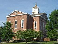 Ripley County Courthouse in Versailles | |
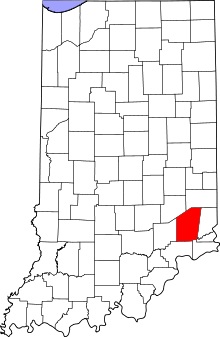 Location in the U.S. state of Indiana | |
 Indiana's location in the U.S. | |
| Founded | 27 December 1816 |
| Named for | Eleazer Wheelock Ripley |
| Seat | Versailles |
| Largest city | Batesville |
| Area | |
| • Total | 448.06 sq mi (1,160 km2) |
| • Land | 446.43 sq mi (1,156 km2) |
| • Water | 1.64 sq mi (4 km2), 0.37% |
| Population | |
| • (2010) | 28,818 |
| • Density | 65/sq mi (24.93/km2) |
| Congressional district | 6th |
| Time zone | Eastern: UTC−5/−4 |
|
Footnotes: Indiana county number 69 FIPS Code 137 | |
Ripley County is a county located at the southeastern corner of the U.S. state of Indiana. According to the 2010 Census, the population was 28,818.[1] The county seat is Versailles.[2]
History
Ripley County was formed on 27 December 1816, in the same legislative act that created Jennings County. It was named for Gen. Eleazer Wheelock Ripley, an officer in the War of 1812, who figured in the Battle of Lundy's Lane and the Siege of Fort Erie during 1814.[3]
Geography
The county seat of Ripley County is Versailles, Indiana. It was selected as the county seat in 1818, and was laid out in 1819.
According to the 2010 census, the county has a total area of 448.06 square miles (1,160.5 km2), of which 446.43 square miles (1,156.2 km2) (or 99.64%) is land and 1.64 square miles (4.2 km2) (or 0.37%) is water.[4]
| Township | Established Year | Area mi² | Area km² | Population | Incorporated Towns |
|---|---|---|---|---|---|
| Adams | 1858 | 43.79 | 113.42 | 5119 | Batesville (part), Sunman |
| Brown | 1823 | 53.67 | 139 | 1597 | |
| Center | 1858 | 29.51 | 76.43 | 2657 | Osgood |
| Delaware | 1823 | 33.27 | 86.17 | 1437 | |
| Franklin | 1823 | 36.6 | 94.79 | 3773 | Milan (part) |
| Jackson | 1823 | 29.87 | 77.36 | 965 | Napoleon |
| Johnson | 1823 | 54.98 | 142.4 | 3685 | Versailles |
| Laughery | 1819 | 25.97 | 67.26 | 4736 | Batesville (part) |
| Otter Creek | 1858 | 41.69 | 107.98 | 1410 | Holton |
| Shelby | 1823 | 69.39 | 179.72 | 999 | |
| Washington | 1823 | 29.33 | 75.96 | 2440 | Milan (part) |
| Ripley County | 1816 | 448.06 | 1160.471 | 28,181 |
Unincorporated towns
- Allen Crossing
- Ballstown
- Behlmer Corner
- Benham
- Clinton
- Correct
- Cross Plains
- Cross Roads
- Dabney
- Delaware
- Dewberry
- Elrod
- Friendship
- Haney Corner
- Jackson
- Jolleyville
- Laughery Switch
- Laugheryville
- Lookout
- Morris
- Negangards Corner
- New Carrollton
- New Marion
- Old Milan
- Olean
- Otter Village
- Penntown
- Pierceville
- Prattsburg
- Rexville
- Spades
- Stringtown
- Stumpke Corner
Ghost towns
Adjacent counties
- Dearborn County (east)
- Decatur County (northwest)
- Franklin County (north)
- Jefferson County (south)
- Jennings County (west)
- Ohio County (east–southeast)
- Switzerland County (at southeast tip)
Major highways


National protected area
Climate and weather
| Versailles, Indiana | ||||||||||||||||||||||||||||||||||||||||||||||||||||||||||||
|---|---|---|---|---|---|---|---|---|---|---|---|---|---|---|---|---|---|---|---|---|---|---|---|---|---|---|---|---|---|---|---|---|---|---|---|---|---|---|---|---|---|---|---|---|---|---|---|---|---|---|---|---|---|---|---|---|---|---|---|---|
| Climate chart (explanation) | ||||||||||||||||||||||||||||||||||||||||||||||||||||||||||||
| ||||||||||||||||||||||||||||||||||||||||||||||||||||||||||||
| ||||||||||||||||||||||||||||||||||||||||||||||||||||||||||||
In recent years, average temperatures in Versailles have ranged from a low of 18 °F (−8 °C) in January to a high of 84 °F (29 °C) in July, although a record low of −28 °F (−33 °C) was recorded in January 1994 and a record high of 100 °F (38 °C) was recorded in July 1999. Average monthly precipitation ranged from 2.71 inches (69 mm) in February to 5.27 inches (134 mm) in May.[7]
Government
The county government is a constitutional body, and is granted specific powers by the Constitution of Indiana, and by the Indiana Code.
County Council: The county council is the legislative branch of the county government and controls all the spending and revenue collection in the county. Representatives are elected from county districts, serving four-year terms. They are responsible for setting salaries, the annual budget, and special spending. The council also has limited authority to impose local taxes, in the form of an income and property tax that is subject to state level approval, excise taxes, and service taxes.[8][9]
Board of Commissioners: The Board of Commissioners is the executive body of the county. Commissioners are elected county–wide in staggered four–year terms. One commissioner serves as board president. They are charged with executing the acts legislated by the council, collecting revenue, and managing the day-to-day functions of the county government.[8][9]
County Officials: The county has several other elected offices, including sheriff, coroner, auditor, treasurer, recorder, surveyor and circuit court clerk. Each of these elected officers serves a term of four years and oversees a different part of county government. Members elected to county government positions are required to declare party affiliations and to be residents of the county.[9]
State Government: At the State level, Ripley County is divided in its representation. Adams and Laughery Townships are located in the 55th House District which is represented by Rep. Cindy Ziemke. The rest of Ripley County is located in the 67th district represented by Rep. Randy Frye. Adams and Laughery Townships are in the 42nd Senate District represented by State Senator Jean Leising. The rest of Ripley County is in Senate District 43 represented by Senator Chip Perfect.
Federal Government: Ripley County is part of Indiana's 6th congressional district and is represented in Congress by Republican Luke Messer. Along with the rest of Indiana, its Senators are Joe Donnelly and Todd Young.
| Year | Republican | Democratic | Third parties |
|---|---|---|---|
| 2016 | 75.8% 9,806 | 19.1% 2,471 | 5.1% 658 |
| 2012 | 67.9% 7,484 | 29.4% 3,241 | 2.6% 290 |
| 2008 | 63.7% 7,794 | 34.2% 4,187 | 2.1% 253 |
| 2004 | 69.5% 8,224 | 29.7% 3,510 | 0.9% 100 |
| 2000 | 65.5% 6,988 | 32.8% 3,498 | 1.8% 189 |
| 1996 | 49.7% 5,303 | 38.4% 4,097 | 12.0% 1,276 |
| 1992 | 46.0% 5,033 | 31.8% 3,480 | 22.2% 2,424 |
| 1988 | 63.8% 6,414 | 35.9% 3,605 | 0.3% 32 |
| 1984 | 68.0% 7,143 | 31.8% 3,336 | 0.3% 27 |
| 1980 | 56.4% 5,770 | 39.3% 4,022 | 4.3% 441 |
| 1976 | 52.1% 5,293 | 47.2% 4,792 | 0.7% 72 |
| 1972 | 64.5% 6,594 | 35.2% 3,601 | 0.4% 36 |
| 1968 | 51.8% 5,389 | 36.4% 3,787 | 11.8% 1,223 |
| 1964 | 43.5% 4,587 | 56.2% 5,933 | 0.3% 32 |
| 1960 | 56.0% 6,053 | 43.7% 4,730 | 0.3% 35 |
| 1956 | 61.9% 6,577 | 37.9% 4,026 | 0.3% 30 |
| 1952 | 62.0% 6,650 | 37.6% 4,031 | 0.4% 44 |
| 1948 | 53.3% 5,313 | 45.9% 4,574 | 0.7% 74 |
| 1944 | 59.1% 5,642 | 40.2% 3,835 | 0.7% 67 |
| 1940 | 55.4% 6,061 | 44.2% 4,834 | 0.4% 38 |
| 1936 | 46.0% 4,919 | 51.8% 5,546 | 2.2% 233 |
| 1932 | 41.0% 4,240 | 57.9% 5,987 | 1.2% 121 |
| 1928 | 53.4% 5,059 | 46.3% 4,387 | 0.3% 30 |
| 1924 | 49.0% 4,694 | 44.5% 4,257 | 6.5% 625 |
| 1920 | 56.8% 5,372 | 42.1% 3,976 | 1.1% 104 |
| 1916 | 49.9% 2,686 | 47.3% 2,549 | 2.8% 150 |
| 1912 | 29.4% 1,492 | 48.0% 2,431 | 22.6% 1,147 |
| 1908 | 47.7% 2,660 | 49.3% 2,749 | 3.1% 173 |
| 1904 | 52.3% 2,850 | 45.1% 2,457 | 2.6% 143 |
| 1900 | 49.2% 2,737 | 49.1% 2,732 | 1.7% 94 |
| 1896 | 49.6% 2,690 | 50.1% 2,714 | 0.4% 19 |
| 1892 | 45.2% 2,250 | 49.0% 2,442 | 5.8% 289 |
| 1888 | 49.8% 2,404 | 49.3% 2,381 | 0.9% 45 |
Demographics
| Historical population | |||
|---|---|---|---|
| Census | Pop. | %± | |
| 1820 | 1,822 | — | |
| 1830 | 3,989 | 118.9% | |
| 1840 | 10,392 | 160.5% | |
| 1850 | 14,820 | 42.6% | |
| 1860 | 19,054 | 28.6% | |
| 1870 | 20,977 | 10.1% | |
| 1880 | 21,627 | 3.1% | |
| 1890 | 19,350 | −10.5% | |
| 1900 | 19,881 | 2.7% | |
| 1910 | 19,452 | −2.2% | |
| 1920 | 18,694 | −3.9% | |
| 1930 | 18,078 | −3.3% | |
| 1940 | 18,898 | 4.5% | |
| 1950 | 18,763 | −0.7% | |
| 1960 | 20,641 | 10.0% | |
| 1970 | 21,138 | 2.4% | |
| 1980 | 24,398 | 15.4% | |
| 1990 | 24,616 | 0.9% | |
| 2000 | 26,523 | 7.7% | |
| 2010 | 28,818 | 8.7% | |
| Est. 2016 | 28,846 | [11] | 0.1% |
| U.S. Decennial Census[12] 1790-1960[13] 1900-1990[14] 1990-2000[15] 2010-2013[1] | |||
As of the 2010 United States Census, there were 28,818 people, 10,789 households, and 7,910 families residing in the county.[16] The population density was 64.6 inhabitants per square mile (24.9/km2). There were 11,952 housing units at an average density of 26.8 per square mile (10.3/km2).[4] The racial makeup of the county was 97.6% white, 0.5% Asian, 0.2% American Indian, 0.2% black or African American, 0.5% from other races, and 0.9% from two or more races. Those of Hispanic or Latino origin made up 1.5% of the population.[16] In terms of ancestry, 43.4% were German, 14.2% were American, 13.9% were Irish, and 8.7% were English.[17]
Of the 10,789 households, 36.2% had children under the age of 18 living with them, 58.1% were married couples living together, 10.2% had a female householder with no husband present, 26.7% were non-families, and 22.8% of all households were made up of individuals. The average household size was 2.63 and the average family size was 3.08. The median age was 39.2 years.[16]
The median income for a household in the county was $47,697 and the median income for a family was $57,305. Males had a median income of $41,711 versus $31,927 for females. The per capita income for the county was $22,025. About 7.5% of families and 9.8% of the population were below the poverty line, including 14.3% of those under age 18 and 8.6% of those age 65 or over.[18]
See also
References
- 1 2 "Ripley County QuickFacts". United States Census Bureau. Retrieved 25 September 2011.
- ↑ "Find a County". National Association of Counties. Retrieved 7 June 2011.
- ↑ De Witt Clinton Goodrich & Charles Richard Tuttle (1875). An Illustrated History of the State of Indiana. Indiana: R. S. Peale & Co. p. 572.
- 1 2 "Population, Housing Units, Area, and Density: 2010 - County". US Census Bureau. Retrieved 10 July 2015.
- ↑ Bureau, U.S. Census. "American FactFinder - Results". factfinder.census.gov. Retrieved 10 April 2018.
- ↑ Ripley County IA Google Maps (accessed 16 August 2018)
- 1 2 "Monthly Averages for Versailles, Indiana". The Weather Channel. Retrieved 27 January 2011.
- 1 2 Indiana Code. "Title 36, Article 2, Section 3". IN.gov. Retrieved 16 September 2008.
- 1 2 3 Indiana Code. "Title 2, Article 10, Section 2" (PDF). IN.gov. Retrieved 16 September 2008.
- ↑ Leip, David. "Dave Leip's Atlas of U.S. Presidential Elections". uselectionatlas.org. Retrieved 10 April 2018.
- ↑ "Population and Housing Unit Estimates". Retrieved 9 June 2017.
- ↑ "U.S. Decennial Census". United States Census Bureau. Retrieved 10 July 2014.
- ↑ "Historical Census Browser". University of Virginia Library. Retrieved 10 July 2014.
- ↑ "Population of Counties by Decennial Census: 1900 to 1990". United States Census Bureau. Retrieved 10 July 2014.
- ↑ "Census 2000 PHC-T-4. Ranking Tables for Counties: 1990 and 2000" (PDF). United States Census Bureau. Retrieved 10 July 2014.
- 1 2 3 "Profile of General Population and Housing Characteristics: 2010 Demographic Profile Data". US Census Bureau. Retrieved 10 July 2015.
- ↑ "Selected Social Characteristics in the United States – 2006-2010 American Community Survey 5-Year Estimates". US Census Bureau. Retrieved 10 July 2015.
- ↑ "Selected Economic Characteristics – 2006-2010 American Community Survey 5-Year Estimates". US Census Bureau. Retrieved 10 July 2015.
Places adjacent to Ripley County, Indiana | ||||||||||
|---|---|---|---|---|---|---|---|---|---|---|
| ||||||||||
Municipalities and communities of Ripley County, Indiana, United States | ||
|---|---|---|
| City | ||
| Towns | ||
| Townships | ||
| Unincorporated communities |
| |
| Ghost town | ||
| Footnotes | ‡This populated place also has portions in an adjacent county or counties | |
