Henry County, Indiana
| Henry County, Indiana | |
|---|---|
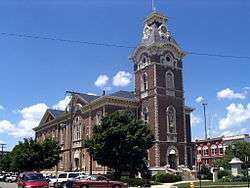 Henry County Courthouse | |
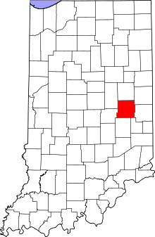 Location in the U.S. state of Indiana | |
 Indiana's location in the U.S. | |
| Founded | 1822 |
| Named for | Patrick Henry |
| Seat | New Castle |
| Largest city | New Castle |
| Area | |
| • Total | 394.83 sq mi (1,023 km2) |
| • Land | 391.88 sq mi (1,015 km2) |
| • Water | 2.96 sq mi (8 km2), 0.75% |
| Population | |
| • (2010) | 49,462 |
| • Density | 126/sq mi (48.6/km2) |
| Congressional district | 6th |
| Time zone | Eastern: UTC−5/−4 |
| Website |
www |
|
Footnotes: Indiana county number 33 | |
Henry County is a county located in the U.S. state of Indiana. As of 2010, the population was 49,462.[1] The county seat is New Castle.[2] Henry County is the main setting of the novel Raintree County by Ross Lockridge, Jr..
History
Henry County was formed in 1822. It was named for Patriot Patrick Henry, governor of Virginia.[3]
Geography
According to the 2010 census, the county has a total area of 394.83 square miles (1,022.6 km2), of which 391.88 square miles (1,015.0 km2) (or 99.25%) is land and 2.96 square miles (7.7 km2) (or 0.75%) is water.[4]

Cities
Towns
Unincorporated areas
Townships
Reservoirs
- Castle Lake
- Giboney Lake
- Haven, Lake
- Summit Lake Reservoir
- Westwood Park Reservoir
Adjacent counties
- Delaware County (north)
- Randolph County (northeast)
- Wayne County (east)
- Fayette County (southeast)
- Rush County (south)
- Hancock County (southwest)
- Madison County (northwest)
Major highways
Climate and weather
| New Castle, Indiana | ||||||||||||||||||||||||||||||||||||||||||||||||||||||||||||
|---|---|---|---|---|---|---|---|---|---|---|---|---|---|---|---|---|---|---|---|---|---|---|---|---|---|---|---|---|---|---|---|---|---|---|---|---|---|---|---|---|---|---|---|---|---|---|---|---|---|---|---|---|---|---|---|---|---|---|---|---|
| Climate chart (explanation) | ||||||||||||||||||||||||||||||||||||||||||||||||||||||||||||
| ||||||||||||||||||||||||||||||||||||||||||||||||||||||||||||
| ||||||||||||||||||||||||||||||||||||||||||||||||||||||||||||
In recent years, average temperatures in New Castle have ranged from a low of 16 °F (−9 °C) in January to a high of 84 °F (29 °C) in July, although a record low of −26 °F (−32 °C) was recorded in January 1994 and a record high of 103 °F (39 °C) was recorded in June 1988. Average monthly precipitation ranged from 2.24 inches (57 mm) in January to 4.70 inches (119 mm) in May.[7]
Government
The county government is a constitutional body, and is granted specific powers by the Constitution of Indiana, and by the Indiana Code.
County Council: The county council is the legislative branch of the county government and controls all the spending and revenue collection in the county. Representatives are elected from county districts. The council members serve four-year terms. They are responsible for setting salaries, the annual budget, and special spending. The council also has limited authority to impose local taxes, in the form of an income and property tax that is subject to state level approval, excise taxes, and service taxes.[8][9]
County Commissioners: The executive body of the county is made of a board of commissioners. The commissioners are elected county-wide, in staggered terms, and each serves a four-year term. One of the commissioners, typically the most senior, serves as president. The commissioners are charged with executing the acts legislated by the council, collecting revenue, and managing the day-to-day functions of the county government.[8][9]
County Courts: The county maintains three courts. Circuit Court I, Circuit Court II and Circuit Court III . The judge on the court is elected to a term of four years and must be a member of the Indiana Bar Association. In some cases, court decisions can be appealed to the state level circuit court.[9]
County Officials: The county has several other elected offices, including sheriff, coroner, auditor, treasurer, recorder, surveyor, and circuit court clerk Each of these elected officers serves a term of four years and oversees a different part of county government. Members elected to county government positions are required to declare party affiliations and to be residents of the county.[9]
Henry County is part of Indiana's 6th congressional district; Indiana Senate district 28;[10] and Indiana House of Representatives districts 54 and 56.[11]
| Year | Republican | Democratic | Third parties |
|---|---|---|---|
| 2016 | 68.9% 13,895 | 25.4% 5,124 | 5.6% 1,136 |
| 2012 | 57.0% 10,838 | 40.1% 7,613 | 2.9% 556 |
| 2008 | 51.1% 10,896 | 47.2% 10,059 | 1.7% 364 |
| 2004 | 64.1% 13,137 | 35.0% 7,176 | 0.9% 191 |
| 2000 | 56.4% 10,321 | 41.8% 7,647 | 1.9% 347 |
| 1996 | 45.7% 8,537 | 41.0% 7,667 | 13.3% 2,484 |
| 1992 | 43.6% 8,720 | 34.0% 6,794 | 22.4% 4,475 |
| 1988 | 59.0% 11,280 | 40.7% 7,779 | 0.3% 57 |
| 1984 | 62.6% 11,926 | 37.1% 7,064 | 0.4% 72 |
| 1980 | 60.0% 12,724 | 36.0% 7,626 | 4.0% 846 |
| 1976 | 53.2% 11,620 | 46.4% 10,137 | 0.4% 91 |
| 1972 | 71.9% 14,538 | 27.8% 5,610 | 0.3% 60 |
| 1968 | 52.6% 11,626 | 36.4% 8,045 | 11.0% 2,426 |
| 1964 | 44.9% 10,184 | 54.5% 12,374 | 0.6% 139 |
| 1960 | 58.4% 13,752 | 40.9% 9,629 | 0.6% 149 |
| 1956 | 61.3% 13,750 | 37.9% 8,502 | 0.7% 166 |
| 1952 | 62.0% 14,184 | 36.6% 8,378 | 1.4% 320 |
| 1948 | 54.0% 10,487 | 43.9% 8,523 | 2.1% 411 |
| 1944 | 54.9% 10,583 | 43.0% 8,297 | 2.2% 416 |
| 1940 | 53.0% 11,051 | 46.1% 9,623 | 0.9% 184 |
| 1936 | 46.9% 9,099 | 52.4% 10,172 | 0.8% 149 |
| 1932 | 48.7% 8,430 | 47.7% 8,255 | 3.7% 634 |
| 1928 | 68.5% 10,502 | 29.7% 4,554 | 1.8% 268 |
| 1924 | 60.9% 8,800 | 37.2% 5,376 | 2.0% 285 |
| 1920 | 57.0% 8,742 | 38.0% 5,824 | 5.0% 762 |
| 1916 | 50.0% 4,386 | 40.6% 3,560 | 9.4% 825 |
| 1912 | 32.1% 2,479 | 34.8% 2,687 | 33.1% 2,551 |
| 1908 | 54.6% 4,358 | 40.1% 3,197 | 5.3% 423 |
| 1904 | 60.0% 4,391 | 33.9% 2,482 | 6.1% 446 |
| 1900 | 56.7% 4,047 | 38.6% 2,754 | 4.7% 334 |
| 1896 | 56.4% 4,001 | 42.0% 2,980 | 1.5% 109 |
| 1892 | 55.0% 3,336 | 30.9% 1,871 | 14.1% 854 |
| 1888 | 60.1% 3,849 | 35.5% 2,277 | 4.4% 281 |
Demographics
| Historical population | |||
|---|---|---|---|
| Census | Pop. | %± | |
| 1830 | 6,497 | — | |
| 1840 | 15,128 | 132.8% | |
| 1850 | 17,605 | 16.4% | |
| 1860 | 20,119 | 14.3% | |
| 1870 | 22,986 | 14.3% | |
| 1880 | 24,016 | 4.5% | |
| 1890 | 23,879 | −0.6% | |
| 1900 | 25,088 | 5.1% | |
| 1910 | 29,758 | 18.6% | |
| 1920 | 34,682 | 16.5% | |
| 1930 | 35,238 | 1.6% | |
| 1940 | 40,208 | 14.1% | |
| 1950 | 45,505 | 13.2% | |
| 1960 | 48,899 | 7.5% | |
| 1970 | 52,603 | 7.6% | |
| 1980 | 53,336 | 1.4% | |
| 1990 | 48,139 | −9.7% | |
| 2000 | 48,508 | 0.8% | |
| 2010 | 49,462 | 2.0% | |
| Est. 2016 | 48,521 | [13] | −1.9% |
| U.S. Decennial Census[14] 1790-1960[15] 1900-1990[16] 1990-2000[17] 2010-2013[1] | |||
As of the 2010 United States Census, there were 49,462 people, 19,077 households, and 13,020 families residing in the county.[18] The population density was 126.2 inhabitants per square mile (48.7/km2). There were 21,288 housing units at an average density of 54.3 per square mile (21.0/km2).[4] The racial makeup of the county was 95.7% white, 2.2% black or African American, 0.3% Asian, 0.1% American Indian, 0.4% from other races, and 1.2% from two or more races. Those of Hispanic or Latino origin made up 1.4% of the population.[18] In terms of ancestry, 19.9% were German, 13.3% were American, 11.8% were Irish, and 9.1% were English.[19]
Of the 19,077 households, 31.2% had children under the age of 18 living with them, 52.1% were married couples living together, 11.6% had a female householder with no husband present, 31.8% were non-families, and 27.3% of all households were made up of individuals. The average household size was 2.43 and the average family size was 2.94. The median age was 41.4 years.[18]
The median income for a household in the county was $47,697 and the median income for a family was $52,701. Males had a median income of $42,628 versus $30,226 for females. The per capita income for the county was $19,879. About 10.2% of families and 13.7% of the population were below the poverty line, including 20.0% of those under age 18 and 8.8% of those age 65 or over.[20]
Recreation
Notable people
- Omar Bundy, Major General, World War One
- William Grose, Major General, Civil War
- Robert Indiana, artist
- Arthur C. Mellette, first Governor of South Dakota
- Wilbur Wright, aviation pioneer
- Steve Alford, NCAA basketball coach and former player
- Kent Benson, Former NCAA and NBA basketball player
- Ira Hough, Congressional Medal of Honor winner, 1864
See also
- National Register of Historic Places listings in Henry County, Indiana
- Edward E. Moore, Indiana state senator and Los Angeles City Council member
External links
References
- 1 2 "Henry County QuickFacts". United States Census Bureau. Archived from the original on 2011-07-11. Retrieved 2011-09-20.
- ↑ "Find a County". National Association of Counties. Archived from the original on 2011-05-31. Retrieved 2011-06-07.
- ↑ Gannett, Henry (1905). The Origin of Certain Place Names in the United States. Govt. Print. Off. p. 155.
- 1 2 "Population, Housing Units, Area, and Density: 2010 - County". United States Census Bureau. Retrieved 2015-07-10.
- ↑ National Atlas Archived 2008-12-05 at the Wayback Machine.
- ↑ GEO. "Directory Browsing is Not Allowed". www.census.gov. Retrieved 8 April 2018.
- 1 2 "Monthly Averages for New Castle, Indiana". The Weather Channel. Retrieved 2011-01-27.
- 1 2 Indiana Code. "Title 36, Article 2, Section 3". IN.gov. Retrieved 2008-09-16.
- 1 2 3 4 Indiana Code. "Title 2, Article 10, Section 2" (PDF). IN.gov. Retrieved 2008-09-16.
- ↑ "Indiana Senate Districts". State of Indiana. Retrieved 2011-07-14.
- ↑ "Indiana House Districts". State of Indiana. Retrieved 2011-07-14.
- ↑ Leip, David. "Dave Leip's Atlas of U.S. Presidential Elections". uselectionatlas.org. Retrieved 8 April 2018.
- ↑ "Population and Housing Unit Estimates". Retrieved June 9, 2017.
- ↑ "U.S. Decennial Census". United States Census Bureau. Archived from the original on May 12, 2015. Retrieved July 10, 2014.
- ↑ "Historical Census Browser". University of Virginia Library. Retrieved July 10, 2014.
- ↑ "Population of Counties by Decennial Census: 1900 to 1990". United States Census Bureau. Retrieved July 10, 2014.
- ↑ "Census 2000 PHC-T-4. Ranking Tables for Counties: 1990 and 2000" (PDF). United States Census Bureau. Retrieved July 10, 2014.
- 1 2 3 "DP-1 Profile of General Population and Housing Characteristics: 2010 Demographic Profile Data". United States Census Bureau. Retrieved 2015-07-10.
- ↑ "DP02 SELECTED SOCIAL CHARACTERISTICS IN THE UNITED STATES – 2006-2010 American Community Survey 5-Year Estimates". United States Census Bureau. Retrieved 2015-07-10.
- ↑ "DP03 SELECTED ECONOMIC CHARACTERISTICS – 2006-2010 American Community Survey 5-Year Estimates". United States Census Bureau. Retrieved 2015-07-10.
Places adjacent to Henry County, Indiana | ||||||||||
|---|---|---|---|---|---|---|---|---|---|---|
| ||||||||||
Municipalities and communities of Henry County, Indiana, United States | ||
|---|---|---|
| City | ||
| Towns | ||
| Townships | ||
| Unincorporated communities | ||
| Footnotes | ‡This populated place also has portions in an adjacent county or counties | |
