Wells County, Indiana
| Wells County, Indiana | |
|---|---|
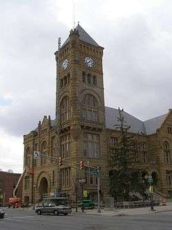 Wells County Courthouse | |
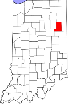 Location in the U.S. state of Indiana | |
 Indiana's location in the U.S. | |
| Founded | 1837 |
| Named for | William A. Wells |
| Seat | Bluffton |
| Largest city | Bluffton |
| Area | |
| • Total | 370.25 sq mi (959 km2) |
| • Land | 368.09 sq mi (953 km2) |
| • Water | 2.16 sq mi (6 km2), 0.58% |
| Population | |
| • (2010) | 27,636 |
| • Density | 75/sq mi (29/km2) |
| Congressional district | 3rd |
| Time zone | Eastern: UTC−5/−4 |
| Website |
www |
|
Footnotes: Indiana county number 90 | |
Wells County is a county located in the U.S. state of Indiana. As of the 2010 census, the population was 27,636.[1] The county seat is Bluffton.[2]
Geography
According to the 2010 census, the county has a total area of 370.25 square miles (958.9 km2), of which 368.09 square miles (953.3 km2) (or 99.42%) is land and 2.16 square miles (5.6 km2) (or 0.58%) is water.[3]
Adjacent counties
- Allen County (north)
- Adams County (east)
- Jay County (southeast)
- Blackford County (south)
- Grant County (west)
- Huntington County (northwest)
Cities and towns
Unincorporated towns
Townships
Major highways
History
Wells County was formed in 1837. It was named for Capt. William A. Wells, who was captured by Native Americans as a young boy and adopted by the Miami chief Little Turtle. He eventually became a scout for Gen. "Mad Anthony" Wayne. Capt. Wells was killed by Potawatomi allied with the British at the Battle of Fort Dearborn at the outbreak of the War of 1812. The Potawatomi ate Capt. Wells' heart to gain part of his courage.
There was also an accident that occurred at the clock tower of the county courthouse. While either fixing or building the roof, a man fell to the grounds of Main Street. He landed on his legs, and he lived for about a week before dying. The force of the fall thrust his pelvis into his rib cage. Had he fallen any other way, he would have died on the spot.
Climate and weather
| Bluffton, Indiana | ||||||||||||||||||||||||||||||||||||||||||||||||||||||||||||
|---|---|---|---|---|---|---|---|---|---|---|---|---|---|---|---|---|---|---|---|---|---|---|---|---|---|---|---|---|---|---|---|---|---|---|---|---|---|---|---|---|---|---|---|---|---|---|---|---|---|---|---|---|---|---|---|---|---|---|---|---|
| Climate chart (explanation) | ||||||||||||||||||||||||||||||||||||||||||||||||||||||||||||
| ||||||||||||||||||||||||||||||||||||||||||||||||||||||||||||
| ||||||||||||||||||||||||||||||||||||||||||||||||||||||||||||
In recent years, average temperatures in Bluffton have ranged from a low of 16 °F (−9 °C) in January to a high of 84 °F (29 °C) in July, although a record low of −24 °F (−31 °C) was recorded in January 1985 and a record high of 104 °F (40 °C) was recorded in July 1980. Average monthly precipitation ranged from 1.83 inches (46 mm) in February to 4.11 inches (104 mm) in May.[4]
Government
The county government is a constitutional body, and is granted specific powers by the Constitution of Indiana, and by the Indiana Code.
County Council: The county council is the legislative branch of the county government and controls all the spending and revenue collection in the county. Representatives are elected from county districts. The council members serve four-year terms. They are responsible for setting salaries, the annual budget, and special spending. The council also has limited authority to impose local taxes, in the form of an income and property tax that is subject to state level approval, excise taxes, and service taxes.[5][6]
Board of Commissioners: The executive body of the county is made of a board of commissioners. The commissioners are elected county-wide, in staggered terms, and each serves a four-year term. One of the commissioners, typically the most senior, serves as president. The commissioners are charged with executing the acts legislated by the council, collecting revenue, and managing the day-to-day functions of the county government.[5][6]
Court: The county maintains a small claims court that can handle some civil cases. The judge on the court is elected to a term of four years and must be a member of the Indiana Bar Association. The judge is assisted by a constable who is also elected to a four-year term. In some cases, court decisions can be appealed to the state level circuit court.[6]
County Officials: The county has several other elected offices, including sheriff, coroner, auditor, treasurer, recorder, surveyor, and circuit court clerk. Each of these elected officers serves a term of four years and oversees a different part of county government. Members elected to county government positions are required to declare party affiliations and to be residents of the county.[6]
| Year | Republican | Democratic | Third parties |
|---|---|---|---|
| 2016 | 75.3% 10,005 | 19.5% 2,586 | 5.2% 695 |
| 2012 | 71.5% 9,256 | 26.5% 3,436 | 2.0% 260 |
| 2008 | 65.0% 8,504 | 33.6% 4,403 | 1.4% 181 |
| 2004 | 74.2% 9,168 | 25.2% 3,112 | 0.6% 74 |
| 2000 | 68.7% 7,755 | 29.4% 3,319 | 1.8% 207 |
| 1996 | 56.0% 6,322 | 33.2% 3,752 | 10.8% 1,220 |
| 1992 | 48.2% 5,799 | 27.3% 3,282 | 24.6% 2,958 |
| 1988 | 68.9% 7,712 | 30.7% 3,437 | 0.4% 39 |
| 1984 | 69.4% 7,579 | 30.0% 3,274 | 0.6% 67 |
| 1980 | 56.1% 5,864 | 36.0% 3,760 | 7.9% 821 |
| 1976 | 56.3% 5,596 | 42.8% 4,250 | 0.9% 88 |
| 1972 | 65.8% 6,425 | 33.2% 3,244 | 1.0% 100 |
| 1968 | 53.1% 5,361 | 37.9% 3,827 | 9.0% 913 |
| 1964 | 40.0% 4,018 | 59.1% 5,945 | 0.9% 92 |
| 1960 | 58.9% 6,034 | 40.3% 4,128 | 0.8% 80 |
| 1956 | 58.3% 5,703 | 40.7% 3,984 | 0.9% 91 |
| 1952 | 55.9% 5,380 | 41.1% 3,963 | 3.0% 290 |
| 1948 | 47.2% 4,288 | 52.0% 4,726 | 0.9% 80 |
| 1944 | 50.0% 4,708 | 47.6% 4,475 | 2.4% 227 |
| 1940 | 47.8% 4,898 | 51.1% 5,236 | 1.2% 123 |
| 1936 | 36.6% 3,606 | 62.8% 6,189 | 0.6% 59 |
| 1932 | 32.3% 3,073 | 65.5% 6,236 | 2.3% 219 |
| 1928 | 48.9% 4,142 | 50.2% 4,246 | 0.9% 77 |
| 1924 | 44.9% 3,932 | 51.8% 4,537 | 3.3% 285 |
| 1920 | 47.6% 4,430 | 50.0% 4,653 | 2.4% 222 |
| 1916 | 37.3% 1,947 | 56.0% 2,928 | 6.7% 351 |
| 1912 | 16.0% 812 | 54.2% 2,760 | 29.9% 1,520 |
| 1908 | 35.9% 2,185 | 55.0% 3,345 | 9.1% 553 |
| 1904 | 40.7% 2,565 | 49.7% 3,127 | 9.6% 604 |
| 1900 | 37.5% 2,290 | 58.9% 3,599 | 3.6% 217 |
| 1896 | 36.6% 2,212 | 61.7% 3,728 | 1.6% 98 |
| 1892 | 33.9% 1,668 | 55.4% 2,725 | 10.7% 528 |
| 1888 | 37.2% 1,926 | 56.8% 2,942 | 6.1% 314 |
Demographics
| Historical population | |||
|---|---|---|---|
| Census | Pop. | %± | |
| 1840 | 1,822 | — | |
| 1850 | 6,152 | 237.7% | |
| 1860 | 10,844 | 76.3% | |
| 1870 | 13,585 | 25.3% | |
| 1880 | 18,442 | 35.8% | |
| 1890 | 21,514 | 16.7% | |
| 1900 | 23,449 | 9.0% | |
| 1910 | 22,418 | −4.4% | |
| 1920 | 20,509 | −8.5% | |
| 1930 | 18,411 | −10.2% | |
| 1940 | 19,099 | 3.7% | |
| 1950 | 19,564 | 2.4% | |
| 1960 | 21,220 | 8.5% | |
| 1970 | 23,821 | 12.3% | |
| 1980 | 25,401 | 6.6% | |
| 1990 | 25,948 | 2.2% | |
| 2000 | 27,600 | 6.4% | |
| 2010 | 27,636 | 0.1% | |
| Est. 2016 | 27,949 | [8] | 1.1% |
| U.S. Decennial Census[9] 1790-1960[10] 1900-1990[11] 1990-2000[12] 2010-2013[1] | |||
As of the 2010 United States Census, there were 27,636 people, 10,780 households, and 7,684 families residing in the county.[13] The population density was 75.1 inhabitants per square mile (29.0/km2). There were 11,659 housing units at an average density of 31.7 per square mile (12.2/km2).[3] The racial makeup of the county was 97.3% white, 0.4% Asian, 0.3% American Indian, 0.3% black or African American, 0.8% from other races, and 0.9% from two or more races. Those of Hispanic or Latino origin made up 2.0% of the population.[13] In terms of ancestry, 38.4% were German, 12.3% were English, 10.8% were Irish, and 10.3% were American.[14]
Of the 10,780 households, 33.1% had children under the age of 18 living with them, 58.1% were married couples living together, 8.6% had a female householder with no husband present, 28.7% were non-families, and 24.8% of all households were made up of individuals. The average household size was 2.52 and the average family size was 3.00. The median age was 40.2 years.[13]
The median income for a household in the county was $47,697 and the median income for a family was $56,885. Males had a median income of $41,871 versus $30,031 for females. The per capita income for the county was $23,169. About 6.2% of families and 8.0% of the population were below the poverty line, including 10.8% of those under age 18 and 3.6% of those age 65 or over.[15]
See also
External links
References
- 1 2 "Wells County QuickFacts". United States Census Bureau. Retrieved 2011-09-25.
- ↑ "Find a County". National Association of Counties. Retrieved 2011-06-07.
- 1 2 "Population, Housing Units, Area, and Density: 2010 - County". United States Census Bureau. Retrieved 2015-07-10.
- 1 2 "Monthly Averages for Bluffton, Indiana". The Weather Channel. Retrieved 2011-01-27.
- 1 2 Indiana Code. "Title 36, Article 2, Section 3". IN.gov. Retrieved 2008-09-16.
- 1 2 3 4 Indiana Code. "Title 2, Article 10, Section 2" (PDF). IN.gov. Retrieved 2008-09-16.
- ↑ Leip, David. "Dave Leip's Atlas of U.S. Presidential Elections". uselectionatlas.org. Retrieved 2018-05-21.
- ↑ "Population and Housing Unit Estimates". Retrieved June 9, 2017.
- ↑ "U.S. Decennial Census". United States Census Bureau. Retrieved July 10, 2014.
- ↑ "Historical Census Browser". University of Virginia Library. Retrieved July 10, 2014.
- ↑ "Population of Counties by Decennial Census: 1900 to 1990". United States Census Bureau. Retrieved July 10, 2014.
- ↑ "Census 2000 PHC-T-4. Ranking Tables for Counties: 1990 and 2000" (PDF). United States Census Bureau. Retrieved July 10, 2014.
- 1 2 3 "DP-1 Profile of General Population and Housing Characteristics: 2010 Demographic Profile Data". United States Census Bureau. Retrieved 2015-07-10.
- ↑ "DP02 SELECTED SOCIAL CHARACTERISTICS IN THE UNITED STATES – 2006-2010 American Community Survey 5-Year Estimates". United States Census Bureau. Retrieved 2015-07-10.
- ↑ "DP03 SELECTED ECONOMIC CHARACTERISTICS – 2006-2010 American Community Survey 5-Year Estimates". United States Census Bureau. Retrieved 2015-07-10.
Places adjacent to Wells County, Indiana | ||||||||||
|---|---|---|---|---|---|---|---|---|---|---|
| ||||||||||
Municipalities and communities of Wells County, Indiana, United States | ||
|---|---|---|
| City | ||
| Towns | ||
| Townships | ||
| Unincorporated communities | ||
| Footnotes | ‡This populated place also has portions in an adjacent county or counties | |
| Counties | 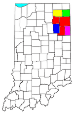 | |
|---|---|---|
| Municipalities with population over 10,000 in 2010 | ||
| Municipalities with population 1,000-10,000 in 2010 | ||
| Municipalities with population under 1,000 in 2010 | ||
| CDPs | ||
