Greene County, Indiana
| Greene County, Indiana | |
|---|---|
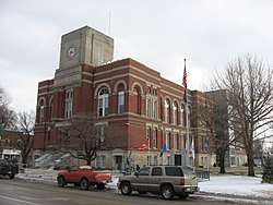 Greene County Courthouse in Bloomfield | |
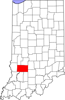 Location in the U.S. state of Indiana | |
 Indiana's location in the U.S. | |
| Founded | 5 January 1821 |
| Named for | Nathanael Greene |
| Seat | Bloomfield |
| Largest city | Linton |
| Area | |
| • Total | 545.92 sq mi (1,414 km2) |
| • Land | 542.50 sq mi (1,405 km2) |
| • Water | 3.42 sq mi (9 km2), 0.63% |
| Population | |
| • (2010) | 33,165 |
| • Density | 61/sq mi (23.64/km2) |
| Congressional district | 8th |
| Time zone | Eastern |
| Website |
www |
|
Footnotes: Indiana county number 28 | |
Greene County is a county in the U.S. state of Indiana. As of 2010, the population was 33,165.[1] The county seat is Bloomfield.[2] The county was determined by the US Census Bureau to include the mean center of U.S. population in 1930.[3]
Greene County is part of the Bloomington, Indiana, Metropolitan Statistical Area.
History
Greene County was formed in 1821, from unincorporated territory and from a portion of the previous Sullivan County. It was named for General Nathanael Greene, who commanded the southern theater in the American Revolutionary War, which eventually forced the British army under Charles Cornwallis to retreat to Yorktown. There it was forced to surrender, ensuring American independence.[4]
Climate and weather
| Bloomfield, Indiana | ||||||||||||||||||||||||||||||||||||||||||||||||||||||||||||
|---|---|---|---|---|---|---|---|---|---|---|---|---|---|---|---|---|---|---|---|---|---|---|---|---|---|---|---|---|---|---|---|---|---|---|---|---|---|---|---|---|---|---|---|---|---|---|---|---|---|---|---|---|---|---|---|---|---|---|---|---|
| Climate chart (explanation) | ||||||||||||||||||||||||||||||||||||||||||||||||||||||||||||
| ||||||||||||||||||||||||||||||||||||||||||||||||||||||||||||
| ||||||||||||||||||||||||||||||||||||||||||||||||||||||||||||
In recent years, average temperatures in Bloomfield have ranged from a low of 18 °F (−8 °C) in January to a high of 87 °F (31 °C) in July, although a record low of −21 °F (−29 °C) was recorded in January 1963 and a record high of 106 °F (41 °C) was recorded in June 1953. Average monthly precipitation ranged from 2.20 inches (56 mm) in January to 5.00 inches (127 mm) in May.[5]
Government
The county government is a constitutional body, and is granted specific powers by the Constitution of Indiana, and by the Indiana Code.
County Council: The county council is the legislative branch of the county government and controls all the spending and revenue collection in the county. Representatives are elected from county districts. The council members serve four-year terms. They are responsible for setting salaries, the annual budget, and special spending. The council also has limited authority to impose local taxes, in the form of an income and property tax that is subject to state level approval, excise taxes, and service taxes.[6][7]
Board of Commissioners: The executive body of the county is made of a board of commissioners. The commissioners are elected county-wide, in four-year staggered terms. This board is charged with executing the acts legislated by the council, collecting revenue, and managing the day-to-day functions of the county government.[6][7]
Court: The county maintains a small claims court that can handle some civil cases. The judge on the court is elected to a term of four years and must be a member of the Indiana Bar Association. The judge is assisted by a constable who is also elected to a four-year term. In some cases, court decisions can be appealed to the state level circuit court.[7]
County Officials: The county has several other elected offices, including sheriff, coroner, auditor, treasurer, recorder, surveyor and circuit court clerk. Each serves a term of four years and oversees a different part of county government. Members elected to county government positions are required to declare party affiliations and to be residents of the county.[7]
Greene County is part of Indiana's 8th congressional district; Indiana Senate districts 39 and 48;[8] and Indiana House of Representatives districts 45, 60 and 62.[9]
Greene County tends to vote Republican. Since 1888, county voters have chosen the Republican Party nominee in 73% (24 of 33) of the elections through 2016.
| Year | Republican | Democratic | Third parties |
|---|---|---|---|
| 2016 | 74.1% 10,277 | 21.1% 2,929 | 4.7% 655 |
| 2012 | 64.4% 8,457 | 33.1% 4,350 | 2.5% 334 |
| 2008 | 56.3% 7,691 | 41.8% 5,709 | 1.8% 250 |
| 2004 | 64.5% 8,609 | 34.5% 4,606 | 1.0% 137 |
| 2000 | 59.1% 7,452 | 38.8% 4,898 | 2.1% 269 |
| 1996 | 44.7% 5,746 | 41.0% 5,277 | 14.3% 1,839 |
| 1992 | 39.8% 5,410 | 39.9% 5,431 | 20.3% 2,767 |
| 1988 | 55.9% 7,689 | 43.5% 5,979 | 0.6% 78 |
| 1984 | 60.7% 8,438 | 37.9% 5,267 | 1.4% 193 |
| 1980 | 52.9% 7,452 | 42.8% 6,027 | 4.4% 619 |
| 1976 | 46.5% 6,442 | 52.5% 7,263 | 1.0% 138 |
| 1972 | 64.8% 8,453 | 34.1% 4,450 | 1.1% 142 |
| 1968 | 48.4% 6,525 | 40.7% 5,493 | 10.9% 1,473 |
| 1964 | 40.6% 5,919 | 58.9% 8,574 | 0.5% 77 |
| 1960 | 57.8% 8,810 | 41.5% 6,325 | 0.7% 104 |
| 1956 | 54.6% 8,722 | 45.0% 7,186 | 0.4% 61 |
| 1952 | 53.3% 8,620 | 45.8% 7,417 | 0.9% 152 |
| 1948 | 48.2% 7,453 | 49.9% 7,709 | 2.0% 301 |
| 1944 | 54.4% 8,213 | 44.7% 6,744 | 0.9% 129 |
| 1940 | 50.7% 9,071 | 48.7% 8,718 | 0.6% 100 |
| 1936 | 43.0% 7,460 | 56.1% 9,730 | 0.9% 154 |
| 1932 | 40.2% 6,397 | 55.5% 8,845 | 4.3% 691 |
| 1928 | 57.8% 8,262 | 40.3% 5,761 | 1.9% 268 |
| 1924 | 45.9% 6,670 | 41.1% 5,966 | 13.0% 1,885 |
| 1920 | 48.7% 7,486 | 41.2% 6,335 | 10.2% 1,567 |
| 1916 | 43.3% 3,878 | 44.6% 3,990 | 12.1% 1,081 |
| 1912 | 25.1% 2,156 | 39.3% 3,373 | 35.6% 3,057 |
| 1908 | 44.2% 4,145 | 44.5% 4,172 | 11.4% 1,068 |
| 1904 | 53.1% 4,698 | 40.3% 3,559 | 6.6% 586 |
| 1900 | 48.5% 3,502 | 48.3% 3,491 | 3.2% 233 |
| 1896 | 50.3% 3,434 | 49.0% 3,344 | 0.8% 52 |
| 1892 | 48.1% 2,809 | 42.6% 2,488 | 9.4% 548 |
| 1888 | 52.0% 2,934 | 47.1% 2,659 | 1.0% 54 |
Geography
According to the 2010 census, the county has a total area of 545.92 square miles (1,413.9 km2), of which 542.50 square miles (1,405.1 km2) (or 99.37%) is land and 3.42 square miles (8.9 km2) (or 0.63%) is water.[11]
Adjacent counties
- Clay County – north
- Owen County – north
- Monroe County – east
- Lawrence County – southeast
- Martin County – south
- Daviess County – south
- Knox County – southwest
- Sullivan County – west
Cities
Towns
Census-designated places
Other unincorporated places
- Antioch
- Beehunter
- Bushrod
- Calvertville
- Cincinnati
- Dixon
- Doans
- Dresden[12]
- Elliston
- Furnace
- Gilmour (partial)
- Hashtown
- Hendricksville
- Hobbieville (called Jonesville 1837-1840)
- Hoosier
- Ilene
- Island City
- Johnstown
- Koleen
- Lone Tree
- Marco
- McVille
- Midland
- Midland Junction
- Mineral City (also called Mineral)
- Newark
- Park
- Plummer
- Point Commerce
- Redcuff Corner
- Ridgeport
- Rincon
- Solsberry
- Sponsler
- Stalcup Corner
- Summit
- Tanner
- Tulip
- Vicksburg
- Victoria
- White Rose
Townships
Major highways
Economy
The Greene County Economic Development Corporation (GCEDC) currently serves to develop new businesses and support current businesses in Greene County, Indiana.[13] This asset was established to assist in bringing projects to the county. Coupled with The Indiana Economic Development Corporation, Greene County has developed an incentive portfolio to assist potential new employers.
The county has been designated a Labor Surplus Area and an SBA HUB Zone (Historically Underutilized Business Zone), which provides advantages to county businesses in government contract bidding and eligibility for federal and state assistance. Employee location and screening services are offered by WorkOne Linton, the local branch of the Indiana State Workforce Development office. Worker training programs are available onsite and at the Greene County Community Learning Center, which serves as a local access site for area colleges and universities.
Demographics
| Historical population | |||
|---|---|---|---|
| Census | Pop. | %± | |
| 1830 | 4,242 | — | |
| 1840 | 8,321 | 96.2% | |
| 1850 | 12,313 | 48.0% | |
| 1860 | 16,041 | 30.3% | |
| 1870 | 19,514 | 21.7% | |
| 1880 | 22,996 | 17.8% | |
| 1890 | 24,379 | 6.0% | |
| 1900 | 28,530 | 17.0% | |
| 1910 | 36,873 | 29.2% | |
| 1920 | 36,770 | −0.3% | |
| 1930 | 31,481 | −14.4% | |
| 1940 | 31,330 | −0.5% | |
| 1950 | 27,886 | −11.0% | |
| 1960 | 26,327 | −5.6% | |
| 1970 | 26,894 | 2.2% | |
| 1980 | 30,416 | 13.1% | |
| 1990 | 30,410 | 0.0% | |
| 2000 | 33,157 | 9.0% | |
| 2010 | 33,165 | 0.0% | |
| Est. 2016 | 32,211 | [14] | −2.9% |
| US Decennial Census[15] 1790-1960[16] 1900-1990[17] 1990-2000[18] 2010-2013[1] | |||
As of the 2010 United States Census, there were 33,165 people, 13,487 households, and 9,276 families in the county.[19] The population density was 61.1 inhabitants per square mile (23.6/km2). There were 15,211 housing units at an average density of 28.0 per square mile (10.8/km2).[11] The racial makeup of the county was 98.1% white, 0.3% Asian, 0.3% American Indian, 0.1% black or African American, 0.3% from other races, and 0.9% from two or more races. Those of Hispanic or Latino origin made up 1.0% of the population.[19] In terms of ancestry, 25.5% were German, 16.8% were Irish, 12.9% were American, and 11.2% were English.[20]
Of the 13,487 households, 31.8% had children under the age of 18 living with them, 54.3% were married couples living together, 9.4% had a female householder with no husband present, 31.2% were non-families, and 27.0% of all households were made up of individuals. The average household size was 2.44 and the average family size was 2.92. The median age was 41.1 years.[19]
The median income for a household in the county was $47,697 and the median income for a family was $50,740. Males had a median income of $41,524 versus $31,890 for females. The per capita income for the county was $20,676. About 10.0% of families and 14.4% of the population were below the poverty line, including 19.7% of those under age 18 and 8.9% of those age 65 or over.[21]
See also
References
- 1 2 "Greene County QuickFacts". US Census Bureau. Retrieved 17 September 2011.
- ↑ "Find a County". National Association of Counties. Retrieved 7 June 2011.
- ↑ "Mean Center of Population for the United States: 1790 to 2000" (PDF). US Census Bureau. Retrieved 17 September 2011.
- ↑ Baker, Ronald L.; Carmony, Marvin (1975). Indiana Place Names. Bloomington IN: Indiana University Press. p. 63.
- 1 2 "Monthly Averages for Bloomfield IN". The Weather Channel. Retrieved 27 January 2011.
- 1 2 Indiana Code. "Title 36, Article 2, Section 3". IN.gov. Retrieved 16 September 2008.
- 1 2 3 4 Indiana Code. "Title 2, Article 10, Section 2" (PDF). IN.gov. Retrieved 16 September 2008.
- ↑ "Indiana Senate Districts". State of Indiana. Retrieved 14 July 2011.
- ↑ "Indiana House Districts". State of Indiana. Retrieved 14 July 2011.
- ↑ Leip, David. "Dave Leip's Atlas of U.S. Presidential Elections". Retrieved 16 May 2018.
- 1 2 "Population, Housing Units, Area, and Density: 2010 - County". US Census Bureau. Retrieved 10 July 2015.
- ↑ Dresden (Visit Greene County)
- ↑ Greene County Economic Development Corporation
- ↑ "Population and Housing Unit Estimates". Retrieved 9 June 2017.
- ↑ "US Decennial Census". US Census Bureau. Retrieved 10 July 2014.
- ↑ "Historical Census Browser". University of Virginia Library. Retrieved 10 July 2014.
- ↑ "Population of Counties by Decennial Census: 1900 to 1990". US Census Bureau. Retrieved 10 July 2014.
- ↑ "Census 2000 PHC-T-4. Ranking Tables for Counties: 1990 and 2000" (PDF). US Census Bureau. Retrieved 10 July 2014.
- 1 2 3 "Profile of General Population and Housing Characteristics: 2010 Demographic Profile Data". US Census Bureau. Retrieved 10 July 2015.
- ↑ "Selected Social Characteristics in the United States – 2006-2010 American Community Survey 5-Year Estimates". US Census Bureau. Retrieved 10 July 2015.
- ↑ "Selected Economic Characteristics – 2006-2010 American Community Survey 5-Year Estimates". US Census Bureau]]. Retrieved 10 July 2015.
Places adjacent to Greene County, Indiana | ||||||||||
|---|---|---|---|---|---|---|---|---|---|---|
| ||||||||||
Municipalities and communities of Greene County, Indiana, United States | ||
|---|---|---|
| Cities | ||
| Towns | ||
| Townships | ||
| CDPs | ||
| Other unincorporated communities |
| |
| Footnotes | ‡This populated place also has portions in an adjacent county or counties | |
