St. John Township, Lake County, Indiana
| St. John Township | |
|---|---|
| Township | |
 | |
| Coordinates: 41°28′36″N 87°27′45″W / 41.47667°N 87.46250°WCoordinates: 41°28′36″N 87°27′45″W / 41.47667°N 87.46250°W | |
| Country | United States |
| State | Indiana |
| County | Lake |
| Government | |
| • Type | Indiana township |
| Area | |
| • Total | 39.37 sq mi (102.0 km2) |
| • Land | 39.2 sq mi (102 km2) |
| • Water | 0.17 sq mi (0.4 km2) |
| Elevation[1] | 679 ft (207 m) |
| Population (2010) | |
| • Total | 66,741 |
| • Density | 1,702.6/sq mi (657.4/km2) |
| FIPS code | 18-66870[2] |
| GNIS feature ID | 453819 |
St. John Township is one of eleven townships in Lake County, Indiana. As of the 2010 census, its population was 66,741 and it contained 25,691 housing units.[3]
History
St. John Township was established in 1848. It was named for John Hack, the first German settler.[4]
Geography
According to the 2010 census, the township has a total area of 39.37 square miles (102.0 km2), of which 39.2 square miles (102 km2) (or 99.57%) is land and 0.17 square miles (0.44 km2) (or 0.43%) is water.[3]
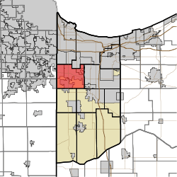
The township includes the towns of Dyer, Schererville and St. John as well as the unincorporated areas of these towns.[5]
Zip codes in the township include 46307, 46311, 46319, 46373, and 46375. The State House districts are IN-11 and IN-15, and the State Senate districts are IN-1, IN-6, and a small portion of IN-2.[6]
Demographics
The racial makeup of the township is 82.1% non-Hispanic White, 11.3% Hispanic, 2.73% African American, 2.23% Asian, 0.58% from other races, and 1.13% from two or more races. The percentages of Hispanic and African American residents are, respectively, 5.4 and 22.6 percent lower than Lake County as a whole.
Native-born citizens make up 91.9% of the population. Naturalized citizens are 5.3% of the population, while 1.9% are not citizens. The top ten countries of birth for foreign-born residents are Mexico, India, Croatia, Poland, Serbia, Greece, Macedonia, Philippines, Germany, and Bosnia and Herzegovina. The most common self-reported ancestries are: German (23.1%), Polish (17%), Irish (15.9%), Mexican (8.72%), Unclassified/Unreported (8.5%), Italian (8.1%), English (7.3%), Dutch (5.6%), American (4.7%), and Serbian (2.8%).[6]
References
- ↑ "US Board on Geographic Names". United States Geological Survey. 2007-10-25. Retrieved 2008-01-31.
- ↑ "American FactFinder". United States Census Bureau. Retrieved 2008-01-31.
- 1 2 "Population, Housing Units, Area, and Density: 2010 - County -- County Subdivision and Place -- 2010 Census Summary File 1". United States Census. Retrieved 2013-05-10.
- ↑ Howat, William Frederick (1915). A Standard History of Lake County, Indiana, and the Calumet Region, Volume 1. Lewis Publishing Company. p. 105.
- ↑ "St. John Township Trustee". St. John Township Trustee. Retrieved 2 May 2015.
- 1 2 "Overview of the St. John Township, Lake County, Indiana (Township) - Statistical Atlas". statisticalatlas.com. Retrieved 2017-02-02.
External links
Municipalities and communities of Lake County, Indiana, United States | ||
|---|---|---|
| Cities | ||
| Towns | ||
| Townships | ||
| CDPs | ||
| Other unincorporated communities |
| |
| Ghost towns |
| |
| Footnotes | ‡This populated place also has portions in an adjacent county or counties | |