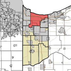
Calumet Township, Lake County, Indiana
| Calumet Township | |
|---|---|
| Township | |
 | |
| Coordinates: 41°35′07″N 87°21′15″W / 41.58528°N 87.35417°WCoordinates: 41°35′07″N 87°21′15″W / 41.58528°N 87.35417°W | |
| Country | United States |
| State | Indiana |
| County | Lake |
| Government | |
| • Type | Indiana township |
| Area | |
| • Total | 68.71 sq mi (178.0 km2) |
| • Land | 61.38 sq mi (159.0 km2) |
| • Water | 7.32 sq mi (19.0 km2) |
| Elevation[1] | 604 ft (184 m) |
| Population (2010) | |
| • Total | 104,258 |
| • Density | 1,698.4/sq mi (655.8/km2) |
| FIPS code | 18-09820[2] |
| GNIS feature ID | 453154 |
Calumet Township is one of eleven townships in Lake County, Indiana. As of the 2010 census, its population was 104,258 and it contained 49,554 housing units.[3]
Calumet Township was established in 1883.[4]
Geography
According to the 2010 census, the township has a total area of 68.71 square miles (178.0 km2), of which 61.38 square miles (159.0 km2) (or 89.33%) is land and 7.32 square miles (19.0 km2) (or 10.65%) is water.[3]
Cities and Towns
References
- ↑ "US Board on Geographic Names". United States Geological Survey. 2007-10-25. Retrieved 2008-01-31.
- ↑ "American FactFinder". United States Census Bureau. Archived from the original on 2013-09-11. Retrieved 2008-01-31.
- 1 2 "Population, Housing Units, Area, and Density: 2010 - County -- County Subdivision and Place -- 2010 Census Summary File 1". United States Census. Retrieved 2013-05-10.
- ↑ Howat, William Frederick (1915). A Standard History of Lake County, Indiana, and the Calumet Region, Volume 1. Lewis Publishing Company. p. 105.
External links
Municipalities and communities of Lake County, Indiana, United States | ||
|---|---|---|
| Cities | ||
| Towns | ||
| Townships | ||
| CDPs | ||
| Other unincorporated communities |
| |
| Ghost towns |
| |
| Footnotes | ‡This populated place also has portions in an adjacent county or counties | |
This article is issued from
Wikipedia.
The text is licensed under Creative Commons - Attribution - Sharealike.
Additional terms may apply for the media files.