Brownsburg, Indiana
| Brownsburg, Indiana | |
|---|---|
| Town | |
| Motto(s): "Community on the Move" | |
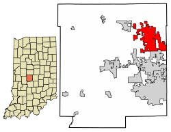 Location of Brownsburg in Hendricks County, Indiana. | |
| Coordinates: 39°50′31″N 86°23′44″W / 39.84194°N 86.39556°WCoordinates: 39°50′31″N 86°23′44″W / 39.84194°N 86.39556°W | |
| Country | United States |
| State | Indiana |
| County | Hendricks |
| Area[1] | |
| • Total | 15.78 sq mi (40.87 km2) |
| • Land | 15.70 sq mi (40.65 km2) |
| • Water | 0.09 sq mi (0.22 km2) |
| Elevation | 879 ft (268 m) |
| Population (2010)[2] | |
| • Total | 21,285 |
| • Estimate (2016)[3] | 25,408 |
| • Density | 1,618.65/sq mi (624.98/km2) |
| Time zone | UTC-5 (EST) |
| • Summer (DST) | UTC-4 (EDT) |
| ZIP code | 46112 |
| Area code(s) | 317 |
| FIPS code | 18-08416[4] |
| GNIS feature ID | 0431646[5] |
| Website |
www |
Brownsburg is a town in Hendricks County, Indiana, United States. The population was 21,285 at the 2010 Census, an increase from 14,520 in 2000.[6] As of 2016 the estimated population was 25,408.[3]
In 2009, Brownsburg was ranked #33 (and highest ranking town in Indiana) on CNN Money Magazine's list of America's best small towns. The magazine cited Brownsburg's low crime, strong economy and excellent schools as factors for placing Brownsburg at the top.[7]
Geography
Brownsburg is located in northeastern Hendricks County at 39°50′31″N 86°23′44″W / 39.84194°N 86.39556°W (39.842032, -86.395641).[8] It is bordered to the east by Clermont and Indianapolis in Marion County, to the south by Avon, and to the northwest by Pittsboro. U.S. Route 136 is Brownsburg's Main Street, leading southeast 15 miles (24 km) to downtown Indianapolis and northwest through Pittsboro 30 miles (48 km) to Crawfordsville. Interstate 74 parallels US-136 and runs through the northern side of Brownsburg, with access from Exits 66 and 68. I-74 leads southeast to Indianapolis and west-northwest 107 miles (172 km) to Urbana–Champaign, Illinois. Interstate 65 passes approximately 8 miles (13 km) northeast of the community, and Interstate 70 about 13 miles (21 km) south. State Road 267 (Green Street) runs north and south through the middle of Brownsburg and serves as one of the town's main thoroughfares.
According to the 2010 census, Brownsburg has a total area of 11.16 square miles (28.90 km2), of which 11.08 square miles (28.70 km2) (or 99.28%) is land and 0.08 square miles (0.21 km2) (or 0.72%) is water.[9] White Lick Creek, a tributary of the White River, flows from north to south through the town, passing just west of the town center.
Demographics
| Historical population | |||
|---|---|---|---|
| Census | Pop. | %± | |
| 1850 | 132 | — | |
| 1870 | 551 | — | |
| 1880 | 667 | 21.1% | |
| 1890 | 623 | −6.6% | |
| 1900 | 676 | 8.5% | |
| 1910 | 876 | 29.6% | |
| 1920 | 1,063 | 21.3% | |
| 1930 | 1,042 | −2.0% | |
| 1940 | 1,136 | 9.0% | |
| 1950 | 1,578 | 38.9% | |
| 1960 | 4,478 | 183.8% | |
| 1970 | 5,751 | 28.4% | |
| 1980 | 6,242 | 8.5% | |
| 1990 | 7,628 | 22.2% | |
| 2000 | 14,520 | 90.4% | |
| 2010 | 21,285 | 46.6% | |
| Est. 2016 | 25,408 | [3] | 19.4% |
| Source: US Census Bureau | |||
2010 census
As of the census[2] of 2010, there were 21,285 people, 7,948 households, and 5,816 families residing in the town. The population density was 1,921.0 inhabitants per square mile (741.7/km2). There were 8,376 housing units at an average density of 756.0 per square mile (291.9/km2). The racial makeup of the town was 93.4% White, 2.2% African American, 0.1% Native American, 1.6% Asian, 0.1% Pacific Islander, 1.2% from other races, and 1.4% from two or more races. Hispanic or Latino of any race were 3.0% of the population.
There were 7,948 households of which 40.9% had children under the age of 18 living with them, 58.7% were married couples living together, 10.5% had a female householder with no husband present, 4.0% had a male householder with no wife present, and 26.8% were non-families. 22.4% of all households were made up of individuals and 8.5% had someone living alone who was 65 years of age or older. The average household size was 2.64 and the average family size was 3.11.
The median age in the town was 36 years. 28.4% of residents were under the age of 18; 6.8% were between the ages of 18 and 24; 28.8% were from 25 to 44; 24.1% were from 45 to 64; and 12% were 65 years of age or older. The gender makeup of the town was 48.0% male and 52.0% female.
2000 census
As of the census[4] of 2000, there were 14,520 people, and 5,366 households residing in the town. The population density was 1,983.5 people per square mile (765.9/km²). There were 5,574 housing units at an average density of 761.4 per square mile (294.0/km²). The racial makeup of the town was 97.44% White, 0.32% African American, 0.17% Native American, 0.78% Asian, 0.08% Pacific Islander, 0.35% from other races, and 0.86% from two or more races. Hispanic or Latino of any race were 1.18% of the population. There were 5,366 households out of which 41.8% had children under the age of 18 living with them, 64.0% were married couples living together, 8.6% had a female householder with no husband present, and 24.6% were non-families. 20.8% of all households were made up of individuals and 8.2% had someone living alone who was 65 years of age or older. The average household size was 2.65 and the average family size was 3.10.
In the town, the population was spread out with 29.2% under the age of 18, 6.8% from 18 to 24, 34.5% from 25 to 44, 17.9% from 45 to 64, and 11.7% who were 65 years of age or older. The median age was 33 years. For every 100 females, there were 92.7 males. For every 100 females age 18 and over, there were 89.0 males.
The median income for a household in the town was $63,629, and the median income for a family was $74,245. Males had a median income of $56,240 versus $38,685 for females. The per capita income for the town was $33,196. About 1.5% of families and 2.3% of the population were below the poverty line, including 1.3% of those under age 18 and 4.4% of those age 65 or over.
History
Brownsburg's first settler was James B. Brown, a Kentucky native, who settled in Brown Township in 1824. At the time the area was dense and unbroken wilderness with only hunters and trappers in the area. Delaware Indians (Lenape) lived in what is now Lincoln Township, along White Lick Creek, which was then called Wa-pe-ke-way or "White Salt".
In 1828, the first log school house was built in Brown Township. One-room brick schools were built every 4 miles (6 km), and everyone in the family except the mothers went to school when it was not crop season. The age range in the classroom was from six years to 43 years. Brown Township was divided in 1863, becoming Brown Township to the north, named after its first resident. Lincoln Township was created to the south, named after President Abraham Lincoln as a sign of support during the Civil War. A stagecoach line was established along a road built in 1820 connecting all of the small outlying communities with Indianapolis.
Brownsburg was originally called "Harrisburg", and under the latter name was laid out in 1835 by William Harris.[10] The first post office in town was established as "Brownsburgh" in 1836.[11] The first church building to be erected in Brownsburg was a log structure built in 1840. From the 1840s to the 1870s, the town almost tripled in area, from its original 6 acres (2.4 ha) to more than 16 acres (6.5 ha). 1848 brought the area's first election, with a total of ten male votes cast.
In 1869, the Big Four Railroad opened service to Brownsburg. By 1910, the Interurban was making daily trips between Indianapolis and Crawfordsville, with scheduled hourly stops in Brownsburg.
In 1917, Superintendent of Schools Sylvester Moore and his wife were instrumental in forming Brownsburg's first public library, funded by local gifts as well as a $12,500 gift from the Carnegie Corporation. This building served as the Brownsburg Police Department headquarters for several years and is currently empty. The first two-story schoolhouse was built in 1917 on College Avenue. Later a gym was added to the site and was one of gymnasiums used for the filming of the movie Hoosiers. The late 1950s saw construction of the town's first high school. During this time the first suburban shopping area was established on the east edge of the town.
Public safety
Brownsburg, Brown Township and Lincoln Township are served by the Brownsburg Fire Territory (BFT), covering 52 square miles (130 km2). The BFT currently employs 87 firefighters, civilian medics, and administrative staff.[12] The incorporated town of Brownsburg is served by the Brownsburg Police Department (BPD). Within the BPD there are seven divisions:
- Interstate Crime Enforcement team (I.C.E.); patrols I-74 as well as I-65 outside of Brownsburg limits
- K9 Unit; consists of four canines and their officers
- Uniform Patrol and Reserves; makes up 80% of BPD
- Motorcycle Unit consisting of two Harley-Davidson police motorcycles
- Bicycle Unit; consist of five officers operating eight months of the year
- Training Unit
- Emergency Response Team; commonly called a SWAT team; not a full-time department and is used only in crises.[13]
The townships of Brown and Lincoln are served by the Hendricks County Sheriff's office, though BPD often responds first.
Education
Public schools
Brownsburg Community School Corporation maintains all public schools in Brownsburg. All public schools are fully accredited. During the 2013-14 school year all Brownsburg schools earned an A for ISTEP testing.
High schools
- The ISTEP scores have averaged 13.6% above the statewide average for the past 7 years. Graduation rate as of 2006 was 85.3% with 406 students graduating. As of the 2006-2007 school year, 88% of the 2008 students are White,7% are Hispanic, 2% are Black, 2% are Asian, and 2% are Multiracial.
- Harris Academy[14]
Middle schools
- Brownsburg West Middle School
- The ISTEP scores have averaged 12.6% above the statewide average for the past 7 years. As of the 2006-2007 school year, 88% of the 720 students are White, 6% are Hispanic, 3% are Black, 2% are Asian, and 1% are Multiracial.
- Brownsburg East Middle School
- The ISTEP scores have averaged 13.2% above the statewide average for the past 2 years. It became a new school in 2005. As of the 2006-2007 school year, 86% of the 952 students are White, 6% are Hispanic, 4% are Black, 2% are Asian, and 2% are Multiracial.
Elementary schools
- Brown Elementary School
- The ISTEP scores have averaged 16.0% above the statewide average for the past 7 years. As of the 2006-2007 school year, 92% of the 701 students are White, 2% are Black, 3% are Hispanic, 1% are Asian, and 2% are Multiracial. 4-Star School.
- White Lick Elementary School
- The ISTEP scores have averaged 10.5% above the statewide average for the past 7 years. As of the 2006-2007 school year, 78% of the 557 students are White, 11% are Black, 3% are Hispanic, 3% are Asian, and 4% are Multiracial.
- Delaware Trail Elementary School
- The ISTEP scores have averaged 12.6% above the statewide average for the past 6 years. It became a new school in 2005. As of the 2006-2007 school year, 83% of the 633 students are White, 10% are Black, 2% are Hispanic, 2% are Asian, and 3% are Multiracial. 4-Star School.
- Cardinal Elementary School
- The ISTEP scores have averaged 12.6% above the statewide average for the past 6 years. It became a new school in 2005. As of the 2006-2007 school year, 90% of the 588 students are White, 1% are Black, 4% are Hispanic, 2% are Asian, 1% Native American, and 2% are Multiracial. 4-Star School.
- Eagle Elementary School
- The ISTEP scores have averaged 18.9% above the statewide average for the past 7 years. As of the 2006-2007 school year, 89% of the 728 students are White, 5% are Black, 2% are Hispanic, 1% are Asian, and 4% are Multiracial. 4-Star School.
- Reagan Elementary School
- Opened for 2008 School year. It was completed in July, 2008. Reagan Elementary School is expected to hold a capacity of 684 students.
Private schools
- The ISTEP scores have averaged 27.0% above the statewide average for the past 4 years. Graduation rate as of 2006 was 95.7% with 22 students graduating. As of the 2006-2007 school year, 96% of the 408 students are White, .2% are Asian, and 1% are Multiracial. Bethesda Christian School is PK-12 grades and is an Accredited-Freeway School.
- St. Malachy
- Created in 1955, the original building is demolished but the entire church and school campus now is on the North Eastern side of town. Currently serving more than 800 students the new school was built in 2013.
Public library
The town has a lending library, the Brownsburg Public Library.[15]
Notable people
- Aldo Andretti, former racecar driver
- John Andretti, racecar driver and former resident
- Pat Angerer, Indianapolis Colts linebacker
- Tucker Barnhart, Cincinnati Reds MLB catcher, 2009 Mr. Baseball for the state of Indiana
- Kent Bottenfield, former Major League pitcher, 1999 All Star
- Pancho Carter, racecar driver and resident
- Chloé Dygert, professional bicyclist; 2016 Olympic silver medalist, 2016 World Championship gold medalist
- Bobby East, racecar driver and resident
- Chris Estridge, professional soccer player
- Arthur W Graham III, creator of first fully automatic electronic race timing and scoring system; long-time Indy 500 executive race official
- Gordon Hayward, former Butler Bulldogs basketball player who is currently with the Boston Celtics; 9th overall pick of the 2010 NBA draft
- Allen Hughes, Brownsburg native and former New York Times music and dance critic[16]
- Lance Lynn, St. Louis Cardinals MLB pitcher, 2012 MLB All-Star selection and 2005 Indiana Mr. Baseball
- Pat McAfee, Indianapolis Colts punter, resides in Brownsburg
- Tony Pedregon, Two time NHRA Funny Car Champion current NHRA on Fox broadcaster
- Joe Saldana, former racecar driver, resident
- Joey Saldana, World of Outlaws sprint car driver
- Bill Sampen, former Major League Baseball pitcher for three teams
- Robbie Stanley, racecar driver
- Joe Staysniak, former Indianapolis Colts offensive linemen and current co-host of The Grady and Big Joe Show
- Drew Storen, Cincinnati Reds MLB pitcher
- Mike Vanderjagt, former NFL kicker and former resident[17]
Neighboring communities
Places adjacent to Brownsburg, Indiana | ||||||||||
|---|---|---|---|---|---|---|---|---|---|---|
| ||||||||||
References
- ↑ "2016 U.S. Gazetteer Files". United States Census Bureau. Retrieved Jul 28, 2017.
- 1 2 "American FactFinder". United States Census Bureau. Retrieved 2012-12-11.
- 1 2 3 "Population and Housing Unit Estimates". Retrieved June 9, 2017.
- 1 2 "American FactFinder". United States Census Bureau. Archived from the original on 2013-09-11. Retrieved 2008-01-31.
- ↑ "US Board on Geographic Names". United States Geological Survey. 2007-10-25. Retrieved 2008-01-31.
- ↑ "U.S Census Bureau American Fact Finder".
- ↑ "BEST PLACES TO LIVE, Money's list of America's best small towns". CNNMoney. CNN. Archived from the original on 14 March 2014. Retrieved 19 October 2010.
- ↑ "US Gazetteer files: 2010, 2000, and 1990". United States Census Bureau. 2011-02-12. Retrieved 2011-04-23.
- ↑ "G001 - Geographic Identifiers - 2010 Census Summary File 1". United States Census Bureau. Retrieved 2015-07-13.
- ↑ Hadley, John Vestal (1914). History of Hendricks County, Indiana: Her People, Industries and Institutions. B.F. Bowen. p. 89.
- ↑ "Hendricks County". Jim Forte Postal History. Retrieved 20 September 2014.
- ↑ "Archived copy". Archived from the original on 2012-03-26. Retrieved 2011-06-30.
- ↑ "Town of Brownsburg, Indiana > Operations Division". www.brownsburg.org. Retrieved 10 October 2018.
- ↑ "Home Page". archive.org. 18 July 2011. Retrieved 10 October 2018.
- ↑ "Indiana public library directory" (PDF). Indiana State Library. Retrieved 7 March 2018.
- ↑ "Brownsburg People: Pitchers, Racers, and Quarterbacks - FunCityFinder". brownsburg-indiana.funcityfinder.com. Retrieved 10 October 2018.
- ↑ "Mike Vanderjagt: Colts Kicker from Canada - FunCityFinder". brownsburg-indiana.funcityfinder.com. Retrieved 10 October 2018.
External links
Municipalities and communities of Hendricks County, Indiana, United States | ||
|---|---|---|
| Towns | ||
| Townships | ||
| Unincorporated communities | ||
| Footnotes | ‡This populated place also has portions in an adjacent county or counties | |
.jpg)