Arzenc-d'Apcher
| Arzenc-d'Apcher | |
|---|---|
| Commune | |
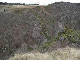 The Gorge of Bès, in Arzenc-d'Apcher | |
 Arzenc-d'Apcher Location within Occitanie region  Arzenc-d'Apcher | |
| Coordinates: 44°51′08″N 3°07′10″E / 44.8522°N 3.1194°ECoordinates: 44°51′08″N 3°07′10″E / 44.8522°N 3.1194°E | |
| Country | France |
| Region | Occitanie |
| Department | Lozère |
| Arrondissement | Mende |
| Canton | Aumont-Aubrac |
| Intercommunality | CC Hautes Terres Aubrac |
| Government | |
| • Mayor (2014-2020) | Jean-Marie Tardieu |
| Area1 | 7.88 km2 (3.04 sq mi) |
| Population (2015)2 | 50 |
| • Density | 6.3/km2 (16/sq mi) |
| Time zone | UTC+1 (CET) |
| • Summer (DST) | UTC+2 (CEST) |
| INSEE/Postal code | 48007 /48310 |
| Elevation |
760–1,137 m (2,493–3,730 ft) (avg. 1,100 m or 3,600 ft) |
|
1 French Land Register data, which excludes lakes, ponds, glaciers > 1 km2 (0.386 sq mi or 247 acres) and river estuaries. 2 Population without double counting: residents of multiple communes (e.g., students and military personnel) only counted once. | |
Arzenc-d'Apcher is a commune in the Lozère department in southern France.
Population
| Historical population | ||
|---|---|---|
| Year | Pop. | ±% |
| 1793 | 300 | — |
| 1800 | 192 | −36.0% |
| 1806 | 310 | +61.5% |
| 1821 | 303 | −2.3% |
| 1831 | 276 | −8.9% |
| 1836 | 320 | +15.9% |
| 1841 | 317 | −0.9% |
| 1846 | 249 | −21.5% |
| 1851 | 232 | −6.8% |
| 1856 | 202 | −12.9% |
| 1861 | 208 | +3.0% |
| 1866 | 175 | −15.9% |
| 1872 | 156 | −10.9% |
| 1876 | 192 | +23.1% |
| 1881 | 181 | −5.7% |
| 1886 | 182 | +0.6% |
| 1891 | 176 | −3.3% |
| 1896 | 170 | −3.4% |
| 1901 | 156 | −8.2% |
| 1906 | 168 | +7.7% |
| 1911 | 157 | −6.5% |
| 1921 | 134 | −14.6% |
| 1926 | 134 | +0.0% |
| 1931 | 122 | −9.0% |
| 1936 | 135 | +10.7% |
| 1946 | 119 | −11.9% |
| 1954 | 93 | −21.8% |
| 1962 | 67 | −28.0% |
| 1968 | 54 | −19.4% |
| 1975 | 51 | −5.6% |
| 1982 | 44 | −13.7% |
| 1990 | 49 | +11.4% |
| 1999 | 58 | +18.4% |
| 2006 | 46 | −20.7% |
| 2009 | 49 | +6.5% |
| 2015 | 50 | +2.0% |
See also
References
External links
| Wikimedia Commons has media related to Arzenc-d'Apcher. |
This article is issued from
Wikipedia.
The text is licensed under Creative Commons - Attribution - Sharealike.
Additional terms may apply for the media files.