Muktainagar
| Muktainagar | |
|---|---|
| Town | |
 Muktainagar Location in Maharashtra, India | |
| Coordinates: 21°3′8″N 76°3′18″E / 21.05222°N 76.05500°ECoordinates: 21°3′8″N 76°3′18″E / 21.05222°N 76.05500°E | |
| Country | India |
| State | Maharashtra |
| District | Jalgaon |
| Named for | Muktabai |
| Government | |
| • Type | City Council |
| • Body | City council Committee |
| Elevation | 243 m (797 ft) |
| Population (2011) | |
| • Total | 23,970 |
| • Density | 258/km2 (670/sq mi) |
| Languages-Marathi | |
| • Official | Marathi |
| Time zone | UTC+5:30 (IST) |
| PIN | 425306 |
| Telephone code | 91-02583 |
| Vehicle registration | MH-19 |
| Lok Sabha constituency | Raver |
| Vidhan Sabha constituency | Muktainagar |
Muktainagar (formerly known as Edlabad) is a small town situated near the National Highway 6 (or Asian Highway 46), in Jalgaon district near the northern border of Maharashtra State, India. Muktainagar is located in the Khandesh region of North Maharashtra.
Administration
Muktainagar is one of 15 tehsils in the Jalgaon district (formerly known as East Khandesh) and is in the Bhusawal subdivision for administrative purposes. It recorded a population of 60,853 in the 2017 census. Muktainagar town is the administrative center of Muktainagar taluka,[1] and contains a police station, a government hospital and the panchayat samiti offices.
Demographics
According to the 2011 Census of India Muktainagar contained 5,352 households and a population of 23,970, of which 12,433 were males and 11,537 females.[1] The population of children aged 0–6 was 3,201, making up 13.35% of the total population of the village. The sex ratio of Muktainagar village is 928 which is close to the Maharashtra state average of 929. The child sex ratio is 820, lower than the Maharashtra average of 894.
Muktainagar village has a high literacy rate compared to Maharashtra; in 2011, the literacy rate of Muktainagar village was 84.41% compared to 82.34% in Maharashtra. In Muktainagar male literacy stands at 88.86% and female literacy at 79.70%.
Members of scheduled castes (SC) constituted 10.75% of the population of Muktainagar village, while scheduled tribes (ST) made up 5.25%.[1]
Politics
The Indian National Congress (INC) has dominated Muktainagar politics since India's independence. Former president of India Pratibha Patil started her political career in Muktainagar in the early 1960s.[2]
The revenue minister of Maharashtra, Eknath Khadse, has been the MLA representative from Muktainagar since 1989. He was an opposition leader from 2009 to 2014.[3] Khadse was Patbandhare Mantri in the earlier Bharatiya Janata Party (BJP) Maharashtra Government around 2000. His daughter-in-law Raksha Khadse is also a well-known member of Parliament who came from Muktainagar.[3]
The Shiv Sena far-right party fielded Chandrakant Patil against the BJP in the 2014 assembly election.
Election results
| Party | Candidate | Votes | % | ± | |
|---|---|---|---|---|---|
| BJP | Eknathrao Ganpatrao Khadse | 85,657 | 46.68 | −4.24 | |
| Shiv Sena | Chandrakant Nimbaji Patil | 75,949 | 41.39 | +41.39 | |
| NCP | Arun Pandurang Patil | 6,499 | 3.55 | −36.45 | |
| INC | Yogendrasing Bhagwan Patil | 4,495 | 2.45 | +2.45 | |
| BSP | Suresh Shivram Thakare | 2,895 | 1.58 | +1.58 | |
| NOTA | None of the above | 2,264 | 1.24 | +1.24 | |
| Margin of victory | 9,708 | 5.29 | −5.63 | ||
| Turnout | 1,83,527 | 69.47 | −4.71 | ||
| BJP gain from INC | Swing | ||||
| Party | Candidate | Votes | % | ± | |
|---|---|---|---|---|---|
| BJP | Eknath Khadse | 85,708 | 50.92 | ||
| NCP | Adv. Ravindra Patil | 67,319 | 40.00 | ||
| MNS | Dr. Jagdish Patil | 5,786 | 3.44 | ||
| Majority | 18,389 | 10.92 | |||
| Turnout | 1,68,332 | 74.23 | |||
| BJP hold | Swing | ||||
See also
References
- 1 2 3 "Census of India: Search Details". Census of India 2011. Office of the Registrar General & Census Commissioner, India. Retrieved 5 January 2018.
- ↑ "PERSONAL PROFILE". pratibhapatil.info.
- 1 2 "Rise and fall of former BJP minister Eknath Khadse". The Economic Times. 5 June 2016.
External links
- "Census 2011 of India: Muktainagar". census2011.co.in. Retrieved 4 January 2018.
Jalgaon district topics | ||
|---|---|---|
| History | 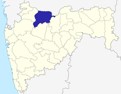 | |
| Tehsils | ||
| Lok Sabha constituencies | ||
| Vidhan Sabha constituencies | ||
| Towns and villages |
| |
| Places of interest | ||