Bhusawal
| Bhusawal | |
|---|---|
 Bhusawal Location in Maharashtra, India | |
| Coordinates: 21°03′N 75°46′E / 21.05°N 75.77°ECoordinates: 21°03′N 75°46′E / 21.05°N 75.77°E | |
| Country |
|
| State | Maharashtra |
| District | Jalgaon |
| Government | |
| • Type | Municipal Council |
| Elevation | 209 m (686 ft) |
| Population (2011) | |
| • Total | 187,421 |
| Demonym(s) | Bhusawalkar |
| Language | |
| • Official | Marathi |
| Time zone | UTC+5:30 (IST) |
| PIN CODE | 425201 |
| Vehicle registration | MH-19 |
Bhusawal is a city as well as a municipal council (established in 1882) in the Jalgaon district in the Indian state of Maharashtra.[1] Bhusawal is the second biggest town in the district. Situated on river tapi and National Highway 6 (old numbering) passes through it. The Ajanta Caves are about 63 km (via Jamner) from Bhusawal. It was ranked 69th in cleanest cities of India.
Geography
Bhusawal sits on the banks of the Tapi river, also known as the Tapti river. The Tapi flows through central India, between the Satpura Range and the Ajanta Hills of the Deccan plateau. It is one of the major rivers on the Indian peninsula with a length of around 724 kilometres (450 miles). The Tapi River, along with the Narmada River and the Mahi River, flows from east to west.
Demographics
The population is 187,421 (2011 census), with 96,147 males 91,274 females. The literacy rate is 88.38% including 91.74% of men and 84.87% for women.[2]
Hinduism is the religion followed by 64.06% of its population, followed by Muslims (24.40%) and Buddhists (8.79%).[2]
Transport
Rail
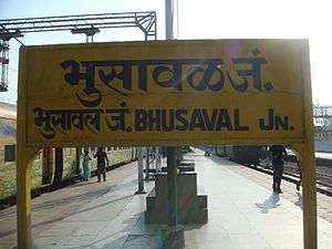
Bhusawal Junction railway station has good rail service and is a divisional headquarters of Central Railway. It is on both the Howrah-Allahabad-Mumbai line and the Howrah-Nagpur-Mumbai line. Bhusawal railway division is a subdivision under Central Railway. Its headquarters is at the station. Bhusawal railway yard is one of the biggest yards in Asia. Bhusawal is the nearest junction to Ajanta (83 km away). During the steam locomotive era, a locomotive shed was there. The shed was located there due to the proximity of the river. The train usually stopped there to get water and stock as well as for passenger utility. The shed was later converted to service electrics.
Air
Jalgaon Airport is the nearest airport to Bhusawal. Aurangabad airport has a direct link to Delhi, Pune, Nagpur and Mumbai.
Economy
Major industrial facilities include:
- Bhusawal Thermal Power Station (7 km)
- Ordnance Factory Bhusawal (8.3 km)
- Ordnance Factory Varangaon
- Orient Cement Grinding Unit (12 km)
- Indian Oil Corporation Limited Depot (15 km)
- Railway's Zonal Training School
- Electricity Locomotive Workshop Bhusawal
Bhusawal is known for banana cultivation.[3] Traders come to Bhusawal to buy raw bananas. Bananas are exported across the world. Bhusawal is also known for its special white brinjals (Eggplant) which is grown locally.
Brinjals often constitute the delicacies in local marriages, along with daal baati toop (a lentil dish served with ghee). Banducha Vada-Pav, Ghashilal Vada-Pav and Patel's Tea of Bhusawal are local dishes.The dish made fom White Brinjals is called "BHARIT"; however the quality test of it depends upon source of heat. Leva patil are the famous community who makes such dishes.
In fiction
- The fictional Indian town of Bhowani, the setting of the historical novels Nightrunners of Bengal and Bhowani Junction by John Masters, is thought to be modeled on Bhusawal.
- 27 Down, a 1974 Bollywood drama film directed by Awtar Krishna Kaul, features Bhusawal Railway Station, Railway Colony. Its storyline revolves around people working with Railways at Bhusawal and their families.
- Director Vijaya Mehta's film 'Pestonjee' (1988) also features Bhusawal.
- Lt. Col. Sanjoy Banerji, adventurer and photographer had published a photo feature on Bhusawal railway station in National Geographic magazine.
See also
References
- ↑ "Jatra gets its flavour from Maharashtra for authentic taste". The Times of India. Indore. 7 October 2017. Retrieved 19 October 2017.
- 1 2 "Bhusawal City Population Census 2011 | Maharashtra". www.census2011.co.in. Retrieved 2017-07-02.
- ↑ Harish Damodaran (16 July 2005). "The story of Jalgaon district in Maharashtra as the 'new' banana republic". The Indian Express. Retrieved 20 October 2017.
Jalgaon district topics | ||
|---|---|---|
| History | 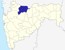 | |
| Tehsils | ||
| Lok Sabha constituencies | ||
| Vidhan Sabha constituencies | ||
| Towns and villages |
| |
| Places of interest | ||