Swain County, North Carolina
Swain County is a county located in the western portion of the U.S. state of North Carolina. As of the 2010 census, the population was 13,981.[1] Its county seat is Bryson City.[2]
Swain County | |
|---|---|
 Old Swain County Courthouse in Bryson City | |
 Seal | |
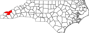 Location within the U.S. state of North Carolina | |
 North Carolina's location within the U.S. | |
| Coordinates: 35.49°N 83.49°W | |
| Country | |
| State | |
| Founded | 1871 |
| Named for | David L. Swain |
| Seat | Bryson City |
| Largest town | Bryson City |
| Area | |
| • Total | 541 sq mi (1,400 km2) |
| • Land | 528 sq mi (1,370 km2) |
| • Water | 13 sq mi (30 km2) 2.3%% |
| Population | |
| • Estimate (2018) | 14,245 |
| • Density | 26/sq mi (10/km2) |
| Time zone | UTC−5 (Eastern) |
| • Summer (DST) | UTC−4 (EDT) |
| Congressional district | 11th |
| Website | www |

In mountainous terrain, Swain County is home of three rivers. The Nantahala is one of the most popular whitewater rafting rivers in the nation.[3] The Oconaluftee River also flows through Swain County in the town of Cherokee. The Tuckasegee River flows through the center of Bryson City passing and completely surrounding the Bryson City Island Park then enters Fontana Lake and then flows into the Little Tennessee River.
History
The county was formed in 1871 from parts of Jackson County and Macon County. It was named for David L. Swain, governor of North Carolina from 1832 to 1835, and president of the University of North Carolina from 1835 to 1868. The Cherokee Indians were the primary occupier of the region until the Andrew Jackson administration's (1829-1837) federal army forced move of most Cherokee to Oklahoma. In the 1870s, the Eastern Band of Cherokee Indians purchased within what is now Swain County the land area which became known the "Qualla Boundary" land trust.[4][5]
Geography
According to the U.S. Census Bureau, Swain county has a total area of 541 square miles (1,400 km2), of which 528 square miles (1,370 km2) is land and 13 square miles (34 km2) (2.3%) is water.[6] The county is located in the far western part of North Carolina in the Great Smoky Mountains and contains a larger proportion of the Great Smoky Mountains National Park than any other county in North Carolina or Tennessee. The highest point in the county is Clingmans Dome, elevation 6,643 feet, located on the NC/TN border. Clingman's is the third highest peak in North Carolina, and a walkable observation tower is located on its summit. The highest mountain in North Carolina and in the United States east of the Mississippi River is Mt. Mitchell, 6,684 feet, located northeast of Asheville.[7]
Adjacent counties
- Sevier County, Tennessee - north
- Haywood County - east
- Jackson County - southeast
- Macon County - south
- Graham County - southwest
- Blount County, Tennessee - northwest
National protected areas
Demographics
| Historical population | |||
|---|---|---|---|
| Census | Pop. | %± | |
| 1880 | 3,784 | — | |
| 1890 | 6,577 | 73.8% | |
| 1900 | 8,401 | 27.7% | |
| 1910 | 10,403 | 23.8% | |
| 1920 | 13,224 | 27.1% | |
| 1930 | 11,568 | −12.5% | |
| 1940 | 12,177 | 5.3% | |
| 1950 | 9,921 | −18.5% | |
| 1960 | 8,387 | −15.5% | |
| 1970 | 7,861 | −6.3% | |
| 1980 | 10,283 | 30.8% | |
| 1990 | 11,268 | 9.6% | |
| 2000 | 12,968 | 15.1% | |
| 2010 | 13,981 | 7.8% | |
| Est. 2018 | 14,245 | [8] | 1.9% |
| U.S. Decennial Census[9] 1790-1960[10] 1900-1990[11] 1990-2000[12] 2010-2013[1] | |||
As of the census[13] of 2000, there were 12,968 people, 5,137 households, and 3,631 families residing in the county. The population density was 25 people per square mile (9/km2). There were 7,105 housing units at an average density of 14 per square mile (5/km2). The racial makeup of the county was 66.33% White, 1.70% Black or African American, 29.03% Native American, 0.15% Asian, 0.01% Pacific Islander, 0.49% from other races, and 2.28% from two or more races. 1.47% of the population were Hispanic or Latino of any race. 16.3% were of American, 8.0% Irish, 7.6% Scots-Irish, 6.9% German and 6.6% English ancestry according to Census 2000. 95.2% spoke English, 2.9% Cherokee and 1.3% Spanish as their first language.
There were 5,137 households out of which 30.00% had children under the age of 18 living with them, 52.30% were married couples living together, 13.90% had a female householder with no husband present, and 29.30% were non-families. 25.80% of all households were made up of individuals and 11.10% had someone living alone who was 65 years of age or older. The average household size was 2.44 and the average family size was 2.91.
In the county, the population was spread out with 24.30% under the age of 18, 8.30% from 18 to 24, 26.70% from 25 to 44, 25.40% from 45 to 64, and 15.30% who were 65 years of age or older. The median age was 39 years. For every 100 females there were 94.60 males. For every 100 females age 18 and over, there were 91.20 males.
The median income for a household in the county was $28,608, and the median income for a family was $33,786. Males had a median income of $26,570 versus $20,722 for females. The per capita income for the county was $14,647. About 13.30% of families and 18.30% of the population were below the poverty line, including 25.60% of those under age 18 and 19.10% of those age 65 or over.
Communities of Swain County

Town
- Bryson City, population 1,424. (2010)
Census-designated place
Townships
- Charleston
- Forney Creek
- Nantahala
Politics, law and government
Politics
Swain has historically been a closely contested swing county, with no candidate from either major party obtaining under 37 percent of the county's vote between 1976 and 2012, and no margin larger than twelve percentage points occurring in any election between 1984 and 2012. However, in 2016 Donald Trump won the county by twenty-three percentage points with the typical strong anti-Democrat swing of most counties in Appalachia. Swain was solidly Democratic during the Third Party System, but the Populist movement and fusion against the dominant Democratic Party of the South led it to become strongly Republican between 1896 and 1928 – it even voted for Theodore Roosevelt over Woodrow Wilson in 1912.
County government
Board of Commissioners
Swain County is governed by an elected Board of Commissioners. The County Manager oversees the day-to-day management of the county and supervises the administration of all County offices, departments, boards, commissions and agencies. The county manager attends all meetings of the Board of Commissioners, recommends measures that he considers expedient, and executes decisions made by the Board.
| Year | Republican | Democratic | Third parties |
|---|---|---|---|
| 2016 | 58.2% 3,565 | 35.9% 2,196 | 5.9% 363 |
| 2012 | 52.0% 2,976 | 45.7% 2,618 | 2.3% 134 |
| 2008 | 50.0% 2,900 | 48.4% 2,806 | 1.6% 92 |
| 2004 | 51.4% 2,593 | 48.0% 2,419 | 0.6% 32 |
| 2000 | 50.9% 2,224 | 48.0% 2,097 | 1.1% 49 |
| 1996 | 38.8% 1,444 | 50.2% 1,869 | 11.0% 409 |
| 1992 | 37.9% 1,640 | 48.9% 2,117 | 13.2% 573 |
| 1988 | 49.5% 1,795 | 50.2% 1,821 | 0.3% 9 |
| 1984 | 50.0% 2,012 | 49.7% 2,000 | 0.3% 10 |
| 1980 | 41.4% 1,457 | 56.5% 1,987 | 2.2% 76 |
| 1976 | 42.6% 1,608 | 57.0% 2,151 | 0.3% 12 |
| 1972 | 64.5% 2,052 | 34.6% 1,101 | 1.0% 31 |
| 1968 | 45.9% 1,494 | 37.7% 1,227 | 16.5% 537 |
| 1964 | 40.1% 1,534 | 59.9% 2,294 | |
| 1960 | 49.3% 2,112 | 50.7% 2,171 | |
| 1956 | 53.0% 2,026 | 47.0% 1,794 | |
| 1952 | 46.3% 1,680 | 53.7% 1,949 | |
| 1948 | 41.3% 1,389 | 56.7% 1,908 | 2.1% 70 |
| 1944 | 41.6% 1,505 | 58.4% 2,110 | |
| 1940 | 37.0% 1,425 | 63.0% 2,422 | |
| 1936 | 44.3% 2,084 | 55.7% 2,619 | |
| 1932 | 43.8% 1,893 | 55.8% 2,412 | 0.4% 19 |
| 1928 | 59.0% 2,484 | 41.0% 1,723 | |
| 1924 | 54.9% 2,178 | 44.6% 1,769 | 0.6% 24 |
| 1920 | 61.0% 2,239 | 39.0% 1,434 | |
| 1916 | 57.6% 1,128 | 42.4% 829 | |
| 1912 | 11.9% 220 | 41.5% 766 | 46.5% 858 |
Swain County is a member of the regional Southwestern Commission council of governments.
Qualla Boundary government
The town of Cherokee is within the Qualla Boundary, land purchased by the Eastern Band of Cherokee Indians in the 1870s.[16] It has its own government, consisting of an elected chief and elected council members from each community within the tribe. The tribe is considered sovereign and only adheres to its own laws and the laws of the federal government. This allows the town of Cherokee to have a casino, despite casinos being outlawed in North Carolina. This was conditional on the adoption of a tribal-state gaming compact agreed to by both the tribe and the state, as well as approved by the federal government.
Policing and law enforcement
The Swain County Sheriff provides court protection, jail administration, patrol and detective services for the unincorporated areas of the county. Bryson City has a municipal police department.
Transportation
Railroads
Swain County has one railroad, the Great Smoky Mountains Railroad, which has its headquarters in Bryson City.
See also
References
- "State & County QuickFacts". United States Census Bureau. Retrieved October 30, 2013.
- "Find a County". National Association of Counties. Retrieved 2011-06-07.
- "Travel Guide to Bryson City and the Great Smoky Mountains". Swain County NC Chamber of Commerce. Retrieved 2018-03-17.
- http://www.ncpedia.org/qualla-boundary
- Cherokee Indians - Part 1: Overview | NCpediawww.ncpedia.org › cherokee › "These people and their descendants were recognized in 1868 by the federal government as the Eastern Band of Cherokee Indians. In the early 2000s these Cherokee, living on the Qualla Boundary in the western part of the state, were the only Indian tribe in North Carolina fully recognized by the federal government."
- "2010 Census Gazetteer Files". United States Census Bureau. August 22, 2012. Archived from the original on January 12, 2015. Retrieved January 19, 2015.
- Mount Mitchell State Park, North Carolina State Park System; www.ncparks.gov.
- "Population and Housing Unit Estimates". Retrieved July 24, 2019.
- "U.S. Decennial Census". United States Census Bureau. Retrieved January 19, 2015.
- "Historical Census Browser". University of Virginia Library. Retrieved January 19, 2015.
- Forstall, Richard L., ed. (March 27, 1995). "Population of Counties by Decennial Census: 1900 to 1990". United States Census Bureau. Retrieved January 19, 2015.
- "Census 2000 PHC-T-4. Ranking Tables for Counties: 1990 and 2000" (PDF). United States Census Bureau. April 2, 2001. Retrieved January 19, 2015.
- "U.S. Census website". United States Census Bureau. Retrieved 2008-01-31.
- https://dc.lib.unc.edu/cdm/singleitem/collection/ncmaps/id/1055
- Leip, David. "Dave Leip's Atlas of U.S. Presidential Elections". uselectionatlas.org. Retrieved 2018-03-17.
- https://ncpedia.org/qualla-boundary
External links
| Wikivoyage has a travel guide for Swain County. |
- Official website
- NCGenWeb Swain County—free genealogy resources for the county
- History of Bryson City and Swain County North Carolina
Places adjacent to Swain County, North Carolina | ||||||||||
|---|---|---|---|---|---|---|---|---|---|---|
| ||||||||||
Municipalities and communities of Swain County, North Carolina, United States | ||
|---|---|---|
| Town | 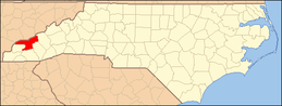 | |
| CDP | ||
| Unincorporated communities | ||
| Indian reservation | ||
| Footnotes | ‡This populated place also has portions in an adjacent county or counties | |


| Authority control |
|
|---|