Henderson, North Carolina
Henderson, a city with a population of 15,368 at the 2010 census, is the county seat of Vance County, North Carolina, United States.[5]
Henderson, North Carolina | |
|---|---|
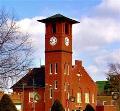 Historic downtown Henderson | |
 Seal | |
| Nickname(s): The Gateway City, Triangle North, The Gate's motto = Progress, Pride, Potential | |
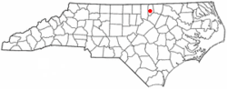 Location of Henderson, North Carolina | |
| Coordinates: 36°19′29″N 78°24′31″W | |
| Country | United States |
| State | North Carolina |
| County | Vance |
| Named for | Leonard Henderson[1] |
| Government | |
| • Type | Municipality |
| • Mayor | Eddie Ellington |
| Area | |
| • Total | 8.3 sq mi (21.4 km2) |
| • Land | 8.2 sq mi (21.3 km2) |
| • Water | 0.0 sq mi (0.0 km2) |
| Elevation | 505 ft (154 m) |
| Population (2010) | |
| • Total | 15,368 |
| • Estimate (2019)[2] | 14,911 |
| • Density | 1,900/sq mi (720/km2) |
| Demonym(s) | Hendersonian |
| Time zone | UTC−5 (Eastern (EST)) |
| • Summer (DST) | UTC−4 (EDT) |
| ZIP codes | 27536-27537 |
| Area code(s) | 252 |
| FIPS code | 37-30660[3] |
| GNIS feature ID | 0986608[4] |
| Website | Ci.henderson.nc.us |
History
The city was named in honor of former North Carolina Supreme Court Chief Justice Leonard Henderson, who lived nearby and was a friend of early settler Lewis Reavis. Henderson was officially chartered by the North Carolina General Assembly in 1841.
Prior to the creation of Vance County in 1881, Henderson was located in far eastern Granville County.[6]
Ashland, Henderson Central Business Historic District, Henderson Fire Station and Municipal Building, Library and Laboratory Building-Henderson Institute, Mistletoe Villa, Maria Parham Hospital, Daniel Stone Plank House, Vance County Courthouse, West End School, Zollicoffer's Law Office, and Barker House are listed on the National Register of Historic Places.[7][8]
Geography
According to the United States Census Bureau, the city has a total area of 8.2 square miles (21 km2), of which, 8.2 square miles (21 km2) of it is land and 0.12% is water.
Henderson benefits from its location near Interstate 85 and U.S. 1. Highway 39 also runs through Henderson.
Demographics
| Historical population | |||
|---|---|---|---|
| Census | Pop. | %± | |
| 1860 | 186 | — | |
| 1870 | 1,635 | 779.0% | |
| 1880 | 1,421 | −13.1% | |
| 1890 | 4,191 | 194.9% | |
| 1900 | 3,746 | −10.6% | |
| 1910 | 4,503 | 20.2% | |
| 1920 | 5,222 | 16.0% | |
| 1930 | 6,345 | 21.5% | |
| 1940 | 7,647 | 20.5% | |
| 1950 | 10,996 | 43.8% | |
| 1960 | 12,740 | 15.9% | |
| 1970 | 13,896 | 9.1% | |
| 1980 | 13,522 | −2.7% | |
| 1990 | 15,655 | 15.8% | |
| 2000 | 16,095 | 2.8% | |
| 2010 | 15,368 | −4.5% | |
| Est. 2019 | 14,911 | [2] | −3.0% |
| U.S. Decennial Census[9] | |||
At the 2000 census there were 16,095 people, 6,332 households, and 4,122 families living in the city. The population density was 1,953.7 people per square mile (754.2/km²). There were 6,870 housing units at an average density of 833.9 per square mile (321.9/km²). The racial makeup of the city was 59.17% African American, 32.76% White, 0.27% Native American, 0.64% Asian, 0.02% Pacific Islander, 2.36% from other races, and 0.77% from two or more races. Hispanic or Latino of any race were 5.13%.[3]
Of the 6,332 households 31.3% had children under the age of 18 living with them, 34.1% were married couples living together, 26.7% had a female householder with no husband present, and 34.9% were non-families. 30.7% of households were one person and 14.4% were one person aged 65 or older. The average household size was 2.47 and the average family size was 3.05.
The age distribution was 27.4% under the age of 18, 8.9% from 18 to 24, 26.8% from 25 to 44, 20.6% from 45 to 64, and 16.4% 65 or older. The median age was 36 years. For every 100 females, there were 82.2 males. For every 100 females age 18 and over, there were 75.5 males.
The median household income was $23,745 and the median family income was $30,222. Males had a median income of $26,804 versus $19,910 for females. The per capita income for the city was $15,130. About 23.4% of families and 28.3% of the population were below the poverty line, including 40.5% of those under age 18 and 20.9% of those age 65 or over.
Notable people
- Gerald Alston (1951 – ), member of R&B vocal group The Manhattans [10]
- George Lincoln Blackwell (1861 – 1926), theologian and author
- Charlotte Hawkins Brown (1883 – 1961), educator and founder of the Palmer Institute
- Jason Brown (1983 – ), professional football player with the St. Louis Rams
- Danny Flowers (1948 – ), songwriter of "Tulsa Time"
- Elson Floyd (1956 – 2015), educator and 10th president of Washington State University
- Rachel Henderlite (1905 –1991), Presbyterian minister and educator
- Isaiah Hicks (1994 – ), basketball player for the New York Knicks
- Sammy Jackson (1937 – 1995), actor.
- Ben E. King (1938 – 2015), soul and pop singer, best known as the singer and co-composer of "Stand by Me"
- Shirley Owens (1941 – ), singer, member of the Shirelles
- Charlie Rose )1942 – ), television talk show host and journalist, was born and raised in Henderson
- Wilbur Fisk Tillett (1854–1936), theologian and dean of Vanderbilt Divinity School
- Duke Buchan (1963 – ), United States Ambassador to Spain and Andorra, raised near Henderson[11]
References
- "About : Welcome to City of Henderson". Ci.henderson.nc.us. Retrieved 27 February 2019.
- "Population and Housing Unit Estimates". Retrieved May 21, 2020.
- "U.S. Census website". United States Census Bureau. Retrieved 2008-01-31.
- "US Board on Geographic Names". United States Geological Survey. 2007-10-25. Retrieved 2008-01-31.
- "Find a County". National Association of Counties. Archived from the original on 2011-05-31. Retrieved 2011-06-07.
- "Map of old County Areas". 2012-11-03. Archived from the original (XSL) on 2012-11-03. Retrieved 27 February 2019.
- "National Register Information System". National Register of Historic Places. National Park Service. July 9, 2010.
- "National Register of Historic Places Listings". Weekly List of Actions Taken on Properties: 12/01/14 through 12/05/14. National Park Service. 2014-12-12.
- "Census of Population and Housing". Census.gov. Retrieved June 4, 2015.
- Whitaker, Jamica. "Henderson native to enter N.C. Music Hall of Fame". The Henderson Daily Dispatch. Retrieved 27 January 2017.
- Moorefield, Mary (December 16, 2016). "Arts and Sciences Foundation dedicates Buchan House". College of Arts & Sciences. Retrieved May 30, 2017.
External links
- Official website of Henderson, North Carolina
- Historic Downtown Business District
- Henderson-Vance Chamber of Commerce
Municipalities and communities of Vance County, North Carolina, United States | ||
|---|---|---|
| City |  | |
| Towns | ||
| CDP | ||
| Unincorporated communities |
| |
| Footnotes | ‡This populated place also has portions in an adjacent county or counties | |


| Authority control |
|
|---|