Graham County, North Carolina
Graham County (locally /ˈɡreɪˌhæm/)[1] is a county located in the U.S. state of North Carolina. As of the 2010 census, the population was 8,861,[2] making it the third-least populous county in North Carolina. Its county seat is Robbinsville.[3]
Graham County | |
|---|---|
 Graham County Courthouse in Robbinsville | |
 Location within the U.S. state of North Carolina | |
 North Carolina's location within the U.S. | |
| Coordinates: 35°21′N 83°50′W | |
| Country | |
| State | |
| Founded | 1872 |
| Named for | William A. Graham |
| Seat | Robbinsville |
| Largest town | Robbinsville |
| Area | |
| • Total | 302 sq mi (780 km2) |
| • Land | 292 sq mi (760 km2) |
| • Water | 9.6 sq mi (25 km2) 3.2%% |
| Population | |
| • Estimate (2018) | 8,484 |
| • Density | 30/sq mi (10/km2) |
| Time zone | UTC−5 (Eastern) |
| • Summer (DST) | UTC−4 (EDT) |
| Congressional district | 11th |
| Website | www |
History
The county was formed January 30, 1872, from the northeastern part of Cherokee County. It was named for William A. Graham,[4] United States Senator from North Carolina (1840–1843) and Governor of North Carolina (1845–1849).
Geography

According to the U.S. Census Bureau, the county has a total area of 302 square miles (780 km2), of which 292 square miles (760 km2) is land and 9.6 square miles (25 km2) (3.2%) is water.[5] The terrain of the county is mountainous,[6] with elevations ranging from 1,177 feet (359 m) to 5,560 feet (1,690 m). Two-thirds of the county is the Nantahala National Forest. The soil of the valleys is fertile.[6]
Fontana Lake, an impoundment of the Little Tennessee River, forms most of the northern border of the county, with the Great Smoky Mountains National Park on the other side of the lake. Fontana Lake is formed by Fontana Dam, the tallest dam in the eastern U.S. The remainder of the northern boundary of Graham County is almost completely formed by another impoundment of the Little Tennessee River, downstream from Fontana Dam, created by Cheoah Dam. Fontana Dam and Cheoah Dam are both operated by the Tennessee Valley Authority.
The Appalachian Trail winds through Graham County. Part of the trail is located on top of Fontana Dam. The Cheoah River is noted for its Class IV and Class V whitewater rapids. The river is used for whitewater rafting about 17 days per year, based on a water-release schedule from Santeetlah Dam. Seventy-five percent of Lake Santeetlah shoreline borders national forest.
Joyce Kilmer Memorial Forest, a rare example of an old growth cove hardwood forest, is located in northwestern Graham County. Joyce Kilmer Memorial Forest is part of the Joyce Kilmer-Slickrock Wilderness area.
The eastern terminus of the Cherohala Skyway is located in northwestern Graham County. The 36-mile (58 km) Cherohala Skyway connects Graham County with Tellico Plains, Tennessee.
The Cherokee name for the area, Nantahala, is translated as "land of the noon-day sun" because 90% of the land is slopes of 30 degrees or greater, suggesting that in the valleys one sees the sun only in the middle of the day.[7]
Indian reservation
Parts of the Qualla Boundary, also known as the Eastern Cherokee Indian Reservation, are located in Graham County. These sections of the Qualla Boundary are non-contiguous from the primary part of the Qualla Boundary located in Swain, Jackson, Cherokee and Haywood counties. The Cherokees who live in Graham County form the Snowbird Cherokee community.
National protected area
- Nantahala National Forest (part)
Demographics
| Historical population | |||
|---|---|---|---|
| Census | Pop. | %± | |
| 1880 | 2,335 | — | |
| 1890 | 3,313 | 41.9% | |
| 1900 | 4,343 | 31.1% | |
| 1910 | 4,749 | 9.3% | |
| 1920 | 4,872 | 2.6% | |
| 1930 | 5,841 | 19.9% | |
| 1940 | 6,418 | 9.9% | |
| 1950 | 6,886 | 7.3% | |
| 1960 | 6,432 | −6.6% | |
| 1970 | 6,562 | 2.0% | |
| 1980 | 7,217 | 10.0% | |
| 1990 | 7,196 | −0.3% | |
| 2000 | 7,993 | 11.1% | |
| 2010 | 8,861 | 10.9% | |
| Est. 2018 | 8,484 | [8] | −4.3% |
| U.S. Decennial Census[9] 1790-1960[10] 1900-1990[11] 1990-2000[12] 2010-2013[2] | |||
As of the census[13] of 2000, there were 7,993 people, 3,354 households, and 2,411 families residing in the county. The population density was 27 people per square mile (11/km²). There were 5,084 housing units at an average density of 17 per square mile (7/km²). The racial makeup of the county was 91.91% White, 0.19% Black or African American, 6.84% Native American, 0.16% Asian, 0.01% Pacific Islander, 0.13% from other races, and 0.76% from two or more races. 0.75% of the population were Hispanic or Latino of any race. 27.6% were of American, 15.1% Irish, 12.7% English, 10.6% German and 5.1% Scots-Irish ancestry according to Census 2000. 97.7% spoke English and 1.3% Cherokee as their first language.
There were 3,354 households out of which 27.10% had children under the age of 18 living with them, 60.80% were married couples living together, 8.40% had a female householder with no husband present, and 28.10% were non-families. 26.00% of all households were made up of individuals and 12.30% had someone living alone who was 65 years of age or older. The average household size was 2.35 and the average family size was 2.82.
In the county, the population was spread out with 22.00% under the age of 18, 7.30% from 18 to 24, 25.20% from 25 to 44, 27.50% from 45 to 64, and 18.00% who were 65 years of age or older. The median age was 42 years. For every 100 females there were 95.30 males. For every 100 females age 18 and over, there were 92.60 males.
The median income for a household in the county was $26,645, and the median income for a family was $32,750. Males had a median income of $24,207 versus $18,668 for females. The per capita income for the county was $14,237. About 14.40% of families and 19.50% of the population were below the poverty line, including 24.30% of those under age 18 and 20.40% of those age 65 or over.
Law, government, public safety
Government
Graham County is governed by an elected five member Board of Commissioners. The county is a member of the regional Southwestern Commission council of governments. It is the only dry county (in which alcohol sales are generally forbidden with only a few exceptions) in North Carolina.[14]
Public safety
The Graham County Sheriff's Office protects the court and all county owned facilities, operates the jail, and provides patrol and detective services.[15]
| Year | Republican | Democratic | Third parties |
|---|---|---|---|
| 2016 | 78.8% 3,283 | 18.4% 768 | 2.8% 117 |
| 2012 | 69.7% 2,750 | 28.4% 1,119 | 2.0% 78 |
| 2008 | 67.7% 2,824 | 30.3% 1,265 | 2.0% 82 |
| 2004 | 67.5% 2,693 | 31.9% 1,272 | 0.6% 22 |
| 2000 | 68.6% 2,304 | 29.9% 1,006 | 1.5% 51 |
| 1996 | 54.8% 1,801 | 36.8% 1,210 | 8.5% 278 |
| 1992 | 49.5% 1,919 | 40.0% 1,551 | 10.5% 406 |
| 1988 | 61.2% 2,091 | 38.4% 1,313 | 0.4% 15 |
| 1984 | 62.6% 2,514 | 37.2% 1,494 | 0.2% 6 |
| 1980 | 54.3% 1,961 | 44.5% 1,608 | 1.3% 46 |
| 1976 | 47.3% 1,621 | 52.3% 1,791 | 0.4% 12 |
| 1972 | 61.1% 1,699 | 38.0% 1,057 | 1.0% 27 |
| 1968 | 52.4% 1,570 | 35.4% 1,061 | 12.1% 363 |
| 1964 | 44.6% 1,398 | 55.4% 1,737 | |
| 1960 | 56.3% 1,721 | 43.7% 1,335 | |
| 1956 | 54.3% 1,762 | 45.8% 1,486 | |
| 1952 | 46.5% 1,380 | 53.5% 1,590 | |
| 1948 | 41.1% 1,115 | 56.2% 1,527 | 2.7% 73 |
| 1944 | 41.8% 1,356 | 58.2% 1,889 | |
| 1940 | 43.7% 1,089 | 56.3% 1,404 | |
| 1936 | 47.4% 1,325 | 52.6% 1,473 | |
| 1932 | 46.3% 1,183 | 53.3% 1,364 | 0.4% 11 |
| 1928 | 56.7% 1,260 | 43.3% 963 | |
| 1924 | 51.6% 907 | 47.8% 841 | 0.6% 11 |
| 1920 | 58.7% 915 | 41.3% 644 | |
| 1916 | 49.2% 460 | 50.9% 476 | |
| 1912 | 29.0% 261 | 46.2% 416 | 24.8% 223 |
Communities

Towns
- Fontana Dam[17]
- Lake Santeetlah
- Robbinsville (county seat)
Townships
- Cheoah
- Fontana Dam
- Stecoah
- Yellow Creek
Other communities
Other communities in Graham County include Almond, Atoah, Fontana Heights, Fontana Village, Snowbird, Stecoah Valley, Sweetwater, Tapoco (named for the Tallassee Power Company[18]), and Tuskeegee. Tallulah, a community just south of Robbinsville, may have been named for a mythological Cherokee Indian. Many smaller communities in Graham County are named for bodies of water, notable landscape features, or early settlers. These include Meadow Branch, Yellow Creek, and Sawyers Creek.
In popular culture
- Portions of the movie Nell (1994), starring Jodie Foster, were filmed near Robbinsville.
- Portions of the movie The Fugitive (1993), starring Harrison Ford, were filmed at Cheoah Dam.
- The historic 1927 silent film Stark Love was filmed in Graham County and featured local residents as actors.
See also
References
| Wikimedia Commons has media related to Graham County, North Carolina. |
- Rick Aschmann (2 May 2018). "North American English Dialects, Based on Pronunciation Patterns". Aschmann.net. Retrieved 25 November 2019.
- "State & County QuickFacts". United States Census Bureau. Archived from the original on June 6, 2011. Retrieved October 19, 2013.
- "Find a County". National Association of Counties. Archived from the original on 2011-05-31. Retrieved 2011-06-07.
- Gannett, Henry (1905). The Origin of Certain Place Names in the United States. Govt. Print. Off. pp. 140.
- "2010 Census Gazetteer Files". United States Census Bureau. August 22, 2012. Archived from the original on January 12, 2015. Retrieved January 17, 2015.
-

- Historical Marker in Robbinsville, the county seat
- "Population and Housing Unit Estimates". Retrieved July 22, 2019.
- "U.S. Decennial Census". United States Census Bureau. Retrieved January 17, 2015.
- "Historical Census Browser". University of Virginia Library. Retrieved January 17, 2015.
- Forstall, Richard L., ed. (March 27, 1995). "Population of Counties by Decennial Census: 1900 to 1990". United States Census Bureau. Retrieved January 17, 2015.
- "Census 2000 PHC-T-4. Ranking Tables for Counties: 1990 and 2000" (PDF). United States Census Bureau. April 2, 2001. Retrieved January 17, 2015.
- "U.S. Census website". United States Census Bureau. Retrieved 2008-01-31.
- "Legal Sales by County: North Carolina ABC Commission". Ncabc.com. Archived from the original on 2010-04-17. Retrieved 2010-06-07.
- http://grahamcounty.org/sheriff/
- Leip, David. "Dave Leip's Atlas of U.S. Presidential Elections". uselectionatlas.org. Retrieved 2018-03-15.
- "USPS.com - ZIP Code Lookup". Tools.usps.com. 2011-03-28. Retrieved 2012-06-06.
- Graham County website.
Places adjacent to Graham County, North Carolina | ||||||||||
|---|---|---|---|---|---|---|---|---|---|---|
| ||||||||||
Municipalities and communities of Graham County, North Carolina, United States | ||
|---|---|---|
| Towns | 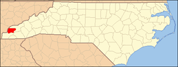 | |
| Unincorporated community | ||
| Indian reservation | ||
| Footnotes | ‡This populated place also has portions in an adjacent county or counties | |


| Authority control |
|
|---|