Craven County, North Carolina
Craven County is a county located in the U.S. state of North Carolina. As of the 2010 Census, the population was 103,505.[1] Its county seat is New Bern.[2] The county was created in 1705 as Archdale Precinct from the now-extinct Bath County. It was renamed Craven Precinct in 1712 and gained county status in 1739.[3][4] It is named for William, Earl of Craven, who lived from 1606-1697.
Craven County | |
|---|---|
 | |
 Seal | |
 Location within the U.S. state of North Carolina | |
 North Carolina's location within the U.S. | |
| Coordinates: 35°06′33″N 77°04′09″W | |
| Country | |
| State | |
| Founded | 1739 |
| Named for | William, Earl of Craven |
| Seat | New Bern |
| Largest city | New Bern |
| Area | |
| • Total | 774 sq mi (2,000 km2) |
| • Land | 709 sq mi (1,840 km2) |
| • Water | 65 sq mi (170 km2) 8.4%% |
| Population | |
| • Estimate (2018) | 102,912 |
| • Density | 146/sq mi (56/km2) |
| Time zone | UTC−5 (Eastern) |
| • Summer (DST) | UTC−4 (EDT) |
| Congressional district | 3rd |
| Website | www |
Craven County is part of the New Bern, NC, Metropolitan Statistical Area.
Geography
According to the U.S. Census Bureau, the county has a total area of 774 square miles (2,000 km2), of which 709 square miles (1,840 km2) is land and 65 square miles (170 km2) (8.4%) is water.[5]
National protected area
- Croatan National Forest (part)
Demographics
| Historical population | |||
|---|---|---|---|
| Census | Pop. | %± | |
| 1790 | 10,474 | — | |
| 1800 | 10,245 | −2.2% | |
| 1810 | 12,676 | 23.7% | |
| 1820 | 13,394 | 5.7% | |
| 1830 | 13,734 | 2.5% | |
| 1840 | 13,438 | −2.2% | |
| 1850 | 14,709 | 9.5% | |
| 1860 | 16,268 | 10.6% | |
| 1870 | 20,516 | 26.1% | |
| 1880 | 19,729 | −3.8% | |
| 1890 | 20,533 | 4.1% | |
| 1900 | 24,160 | 17.7% | |
| 1910 | 25,594 | 5.9% | |
| 1920 | 29,048 | 13.5% | |
| 1930 | 30,665 | 5.6% | |
| 1940 | 31,298 | 2.1% | |
| 1950 | 48,823 | 56.0% | |
| 1960 | 58,773 | 20.4% | |
| 1970 | 62,554 | 6.4% | |
| 1980 | 71,043 | 13.6% | |
| 1990 | 81,613 | 14.9% | |
| 2000 | 91,436 | 12.0% | |
| 2010 | 103,505 | 13.2% | |
| Est. 2018 | 102,912 | [6] | −0.6% |
| U.S. Decennial Census[7] 1790-1960[8] 1900-1990[9] 1990-2000[10] 2010-2013[1] | |||
As of the census[11] of 2000, there were 91,436 people, 34,582 households, and 25,071 families residing in the county. The population density was 129 people per square mile (50/km²). There were 38,150 housing units at an average density of 54 per square mile (21/km²). The racial makeup of the county was 69.94% White, 25.12% Black or African American, 0.42% Native American, 0.99% Asian, 0.06% Pacific Islander, 1.78% from other races, and 1.68% from two or more races. 4.02% of the population were Hispanic or Latino of any race.
There were 34,582 households out of which 33.30% had children under the age of 18 living with them, 56.80% were married couples living together, 12.50% had a female householder with no husband present, and 27.50% were non-families. 23.40% of all households were made up of individuals and 8.90% had someone living alone who was 65 years of age or older. The average household size was 2.50 and the average family size was 2.93.
In the county, the population was spread out with 24.60% under the age of 18, 12.80% from 18 to 24, 27.90% from 25 to 44, 21.20% from 45 to 64, and 13.40% who were 65 years of age or older. The median age was 34 years. For every 100 females there were 101.90 males. For every 100 females age 18 and over, there were 101.50 males.
The median income for a household in the county was $35,966, and the median income for a family was $42,574. Males had a median income of $28,163 versus $21,412 for females. The per capita income for the county was $18,423. About 9.90% of families and 13.10% of the population were below the poverty line, including 18.50% of those under age 18 and 11.00% of those age 65 or over.
Communities

Census-designated places
Other unincorporated communities
- Adams Creek
- Cherry Branch
- Ernul
- Fort Barnwell
- Harlowe
Politics, law and government
Craven is a typical “Solid South” county in its presidential voting patterns. It was solidly Democratic until the 1960s: in five elections from 1932 to 1948 the Republican Party did not reach fifteen percent of the vote, and only in 1928 when a large anti-Catholic vote was cast against Al Smith did the GOP reach twenty percent between at least 1912 and 1948. The national Democratic party’s support for the Civil Rights Movement caused its white electorate to defect to George Wallace’s American Independent campaign in 1968. After that, Craven has become a strongly Republican county. The last Democrat to carry Craven County was Jimmy Carter in 1976.
| Year | Republican | Democratic | Third parties |
|---|---|---|---|
| 2016 | 59.0% 27,731 | 37.5% 17,630 | 3.5% 1,640 |
| 2012 | 58.3% 26,928 | 40.6% 18,763 | 1.0% 479 |
| 2008 | 55.8% 24,901 | 43.4% 19,352 | 0.8% 345 |
| 2004 | 62.4% 23,575 | 37.1% 14,019 | 0.4% 162 |
| 2000 | 61.0% 19,494 | 38.2% 12,213 | 0.9% 278 |
| 1996 | 52.7% 13,264 | 41.0% 10,317 | 6.4% 1,610 |
| 1992 | 45.8% 11,575 | 39.5% 9,998 | 14.7% 3,714 |
| 1988 | 62.1% 12,057 | 37.7% 7,313 | 0.2% 47 |
| 1984 | 64.0% 12,893 | 35.7% 7,186 | 0.3% 55 |
| 1980 | 51.0% 8,554 | 46.4% 7,781 | 2.7% 448 |
| 1976 | 43.4% 5,881 | 55.8% 7,553 | 0.8% 109 |
| 1972 | 78.7% 9,372 | 20.0% 2,384 | 1.2% 147 |
| 1968 | 21.8% 2,991 | 30.9% 4,240 | 47.4% 6,509 |
| 1964 | 38.7% 4,691 | 61.3% 7,422 | |
| 1960 | 34.0% 3,680 | 66.1% 7,158 | |
| 1956 | 31.9% 2,956 | 68.1% 6,317 | |
| 1952 | 31.7% 2,822 | 68.3% 6,092 | |
| 1948 | 11.9% 745 | 80.3% 5,039 | 7.9% 494 |
| 1944 | 14.5% 826 | 85.5% 4,872 | |
| 1940 | 11.3% 626 | 88.7% 4,916 | |
| 1936 | 7.6% 453 | 92.4% 5,543 | |
| 1932 | 9.6% 466 | 90.0% 4,375 | 0.4% 19 |
| 1928 | 47.3% 2,237 | 52.7% 2,494 | |
| 1924 | 9.8% 325 | 88.9% 2,942 | 1.3% 44 |
| 1920 | 17.6% 731 | 82.4% 3,413 | |
| 1916 | 23.3% 542 | 76.7% 1,780 | |
| 1912 | 3.8% 79 | 87.1% 1,819 | 9.1% 190 |
Craven County is a member of the regional Eastern Carolina Council of Governments.
References
- "State & County QuickFacts". United States Census Bureau. Retrieved October 18, 2013.
- "Find a County". National Association of Counties. Archived from the original on 2011-05-31. Retrieved 2011-06-07.
- "North Carolina: Individual County Chronologies". North Carolina Atlas of Historical County Boundaries. The Newberry Library. 2009. Retrieved January 22, 2015.
- "Craven County". NCpedia. State Library of North Carolina. January 1, 2006. Retrieved January 22, 2015.
- "2010 Census Gazetteer Files". United States Census Bureau. August 22, 2012. Archived from the original on January 12, 2015. Retrieved January 13, 2015.
- "Population and Housing Unit Estimates". Retrieved July 22, 2019.
- "U.S. Decennial Census". United States Census Bureau. Retrieved January 13, 2015.
- "Historical Census Browser". University of Virginia Library. Retrieved January 13, 2015.
- Forstall, Richard L., ed. (March 27, 1995). "Population of Counties by Decennial Census: 1900 to 1990". United States Census Bureau. Retrieved January 13, 2015.
- "Census 2000 PHC-T-4. Ranking Tables for Counties: 1990 and 2000" (PDF). United States Census Bureau. April 2, 2001. Retrieved January 13, 2015.
- "U.S. Census website". United States Census Bureau. Retrieved 2008-01-31.
- Leip, David. "Dave Leip's Atlas of U.S. Presidential Elections". uselectionatlas.org. Retrieved 2018-03-15.
Further reading
- Browning, Judkin. Shifting Loyalties: The Union Occupation of Eastern North Carolina (Univ of North Carolina Press, 2011). focus on Craven County
- Kinsey, Marissa N. "Beyond the Vale: Visualizing Slavery in Craven County, North Carolina." (2017). online
- Farmer, Vina Hutchinson. New Bern (Arcadia Publishing, 2007).
- Todd, Vincent H., ed. (1920). Christoph von Graffenried's Account of the Founding of New Bern. Publications of the North Carolina Historical Commission. Raleigh: Edwards & Broughton Printing Co. LCCN 21027196. OCLC 1107613. OL 6640211M – via Internet Archive.
- Watson, Alan D. A History of New Bern and Craven County (Tryon Palace Commission, 1987).
External links
- Official website
- New Bern Sun Journal
- Havelock Chamber of Commerce
- New Bern Chamber of Commerce
- Craven County Economic Development
- Craven County, NCGenWeb
Places adjacent to Craven County, North Carolina | ||||||||||
|---|---|---|---|---|---|---|---|---|---|---|
| ||||||||||
Municipalities and communities of Craven County, North Carolina, United States | ||
|---|---|---|
| Cities | 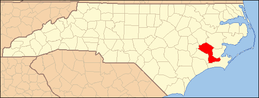 | |
| Towns | ||
| CDPs | ||
| Unincorporated communities | ||
| Military base | ||


| Authority control |
|
|---|