Harnett County, North Carolina
Harnett County is a county located in the U.S. state of North Carolina. As of the 2010 census, the population was 114,678.[1] Its county seat is Lillington,[2] and its largest city is Dunn.
Harnett County | |
|---|---|
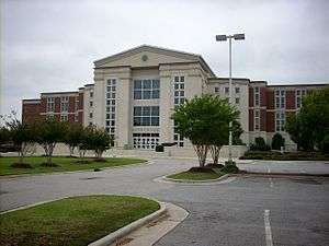 Harnett County Courthouse | |
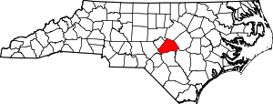 Location within the U.S. state of North Carolina | |
 North Carolina's location within the U.S. | |
| Coordinates: 35°22′N 78°52′W | |
| Country | |
| State | |
| Founded | 1855 |
| Named for | Cornelius Harnett |
| Seat | Lillington |
| Largest city | Dunn |
| Area | |
| • Total | 601 sq mi (1,560 km2) |
| • Land | 595 sq mi (1,540 km2) |
| • Water | 6.3 sq mi (16 km2) 1.1%% |
| Population | |
| • Estimate (2019) | 135,976 |
| • Density | 212.8/sq mi (82.2/km2) |
| Time zone | UTC−5 (Eastern) |
| • Summer (DST) | UTC−4 (EDT) |
| Congressional district | 2nd |
| Website | www |
Harnett County comprises the Dunn, NC Micropolitan Statistical Area, which is a part of the greater Raleigh–Durham–Chapel Hill, NC Combined Statistical Area, which had a 2018 estimated population of 2,037,430.
History
Harnett County was formed in 1855 from land given by Cumberland County. It was named for American Revolutionary war soldier Cornelius Harnett,[3] who was also a delegate to the Continental Congress. The first settlers came to the region in the mid-1720s, and were followed by Highland Scots immigrants. The Scots settled in the foothills, where land was more affordable, rather than in the rich alluvial soil area of the coastal plain. After the defeat by the British of Bonny Prince Charles at Culloden, Scots immigrants came up the Cape Fear River in ever increasing numbers and settled in western Harnett County. British immigrants had settled primarily along the banks of the Cape Fear River in the coastal area, generally from Erwin to Wilmington.
During the American Revolutionary War, many of the Scots were Loyalists. In their defeat in Scotland, they had been forced to take ironclad vows that prohibited taking up arms against the British. Some Rebels considered them traitors to the cause of Independence. Public executions of suspected spies occurred. One site near Lillington was the scene of a mass execution of "Scots Traitors."
Though Harnett County was not a site of warfare during the Civil War, one of the last battles took place near Averasborough which was once the third most populated town in North Carolina but is no longer in existence. During the Carolinas Campaign the Left Wing of General William Sherman's army under the command of Maj. General Henry W. Slocum defeated the army of General William Hardee in the Battle of Averasborough and proceeded eastward. A centennial celebration of the event was held in 1965 at the site of the battlefield.
Geography
According to the U.S. Census Bureau, the county has a total area of 601 square miles (1,560 km2), of which 595 square miles (1,540 km2) is land and 6.3 square miles (16 km2) (1.1%) is water.[4]
Demographics
| Historical population | |||
|---|---|---|---|
| Census | Pop. | %± | |
| 1860 | 8,039 | — | |
| 1870 | 8,895 | 10.6% | |
| 1880 | 10,862 | 22.1% | |
| 1890 | 13,700 | 26.1% | |
| 1900 | 15,988 | 16.7% | |
| 1910 | 22,174 | 38.7% | |
| 1920 | 28,313 | 27.7% | |
| 1930 | 37,911 | 33.9% | |
| 1940 | 44,239 | 16.7% | |
| 1950 | 47,605 | 7.6% | |
| 1960 | 48,236 | 1.3% | |
| 1970 | 49,667 | 3.0% | |
| 1980 | 59,570 | 19.9% | |
| 1990 | 67,822 | 13.9% | |
| 2000 | 91,025 | 34.2% | |
| 2010 | 114,678 | 26.0% | |
| Est. 2019 | 135,976 | [5] | 18.6% |
| U.S. Decennial Census[6] 1790-1960[7] 1900-1990[8] 1990-2000[9] 2010-2019[1] | |||
As of the census[10] of 2000, there were 91,025 people, 33,800 households, and 24,099 families residing in the county. The population density was 153 people per square mile (59/km²). There were 38,605 housing units at an average density of 65 per square mile (25/km²). The racial makeup of the county was 71.13% White, 22.50% Black or African American, 0.87% Native American, 0.65% Asian, 0.07% Pacific Islander, 3.21% from other races, and 1.57% from two or more races. 5.86% of the population were Hispanic or Latino of any race.
There were 33,800 households out of which 36.00% had children under the age of 18 living with them, 53.20% were married couples living together, 13.50% had a female householder with no husband present, and 28.70% were non-families. 23.30% of all households were made up of individuals and 8.50% had someone living alone who was 65 years of age or older. The average household size was 2.61 and the average family size was 3.07.
In the county, the population was spread out with 27.00% under the age of 18, 10.60% from 18 to 24, 32.10% from 25 to 44, 19.90% from 45 to 64, and 10.40% who were 65 years of age or older. The median age was 32 years. For every 100 females there were 97.40 males. For every 100 females age 18 and over, there were 95.00 males.
The median income for a household in the county was $35,105, and the median income for a family was $41,176. Males had a median income of $30,265 versus $22,283 for females. The per capita income for the county was $16,775. About 11.30% of families and 14.90% of the population were below the poverty line, including 17.20% of those under age 18 and 19.40% of those age 65 or over.
Communities

City
Towns
- Angier (most)
- Coats
- Erwin
- Lillington (county seat)
- Fuquay-Varina (small part)
Townships
Census-designated places
Other unincorporated communities
Politics, law and government
Harnett is a typical "Solid South" county in its political history. Apart from the 1928 election when it defected to Herbert Hoover because of opposition to the Catholicism of Al Smith,[11] Harnett voted rock-solid Democratic until the 1960s when opposition to increasing liberalism on racial policies turned the electorate toward the segregationist candidacy of George Wallace. Since then apart from when carried twice by native Southerner Jimmy Carter in 1976 and 1980, Harnett has been a solidly Republican county.
| Year | Republican | Democratic | Third parties |
|---|---|---|---|
| 2016 | 60.0% 27,614 | 36.3% 16,737 | 3.7% 1,714 |
| 2012 | 58.9% 25,565 | 39.9% 17,331 | 1.2% 519 |
| 2008 | 57.9% 23,579 | 41.2% 16,785 | 0.8% 341 |
| 2004 | 64.2% 20,922 | 35.5% 11,563 | 0.3% 86 |
| 2000 | 61.1% 14,762 | 37.9% 9,155 | 1.0% 250 |
| 1996 | 53.3% 11,596 | 40.3% 8,767 | 6.3% 1,376 |
| 1992 | 46.6% 9,751 | 40.5% 8,473 | 12.9% 2,708 |
| 1988 | 57.3% 9,749 | 42.6% 7,259 | 0.1% 21 |
| 1984 | 61.1% 11,198 | 38.8% 7,106 | 0.1% 19 |
| 1980 | 44.7% 7,284 | 54.0% 8,791 | 1.4% 220 |
| 1976 | 39.6% 5,935 | 60.0% 8,992 | 0.4% 58 |
| 1972 | 74.6% 10,259 | 24.4% 3,347 | 1.0% 138 |
| 1968 | 33.0% 5,184 | 25.5% 4,007 | 41.5% 6,531 |
| 1964 | 44.0% 5,883 | 56.0% 7,477 | |
| 1960 | 40.2% 5,301 | 59.8% 7,892 | |
| 1956 | 35.0% 3,998 | 65.0% 7,421 | |
| 1952 | 36.2% 4,306 | 63.8% 7,595 | |
| 1948 | 22.3% 1,985 | 74.1% 6,608 | 3.6% 323 |
| 1944 | 32.7% 3,191 | 67.3% 6,579 | |
| 1940 | 25.7% 2,280 | 74.3% 6,602 | |
| 1936 | 22.0% 2,264 | 78.0% 8,018 | |
| 1932 | 29.0% 2,617 | 70.4% 6,346 | 0.5% 49 |
| 1928 | 57.2% 4,740 | 42.9% 3,554 | |
| 1924 | 46.7% 2,895 | 53.1% 3,296 | 0.2% 11 |
| 1920 | 45.8% 3,311 | 54.2% 3,919 | |
| 1916 | 44.5% 1,603 | 55.3% 1,992 | 0.2% 8 |
| 1912 | 5.8% 148 | 53.4% 1,364 | 40.8% 1,041 |
Harnett County is a member of the regional Mid-Carolina Council of Governments.
Education
Harnett County is home to Campbell University and to 27[13] other different schools: 4 primary schools, 13 elementary schools, 5 middle schools, 4 high schools, and 1 alternative school.[14]
- Primary: Anderson Creek, Gentry, Harnett, North Harnett
- Elementary: Angier, Benhaven, Boone Trail, Buies Creek, Coats, Erwin, Highland, Johnsonville, LaFayette, Lillington-Shawtown, Overhills, South Harnett, Wayne Avenue
- Middle: Coats-Erwin, Dunn, Harnett Central, Overhills, Western Harnett, Highland
- High: Harnett Central, Overhills, Triton, Western Harnett
- Alternative: STAR Academy (grades 6–12)
- University: Campbell University
The county is served by the Harnett County Library System, based in Lillington with branches at Angier, Coats, Dunn, Erwin, Anderson Creek Primary School, and Boone Trail Community Center and Library.[15]
See also
References
- "State & County QuickFacts". United States Census Bureau. Archived from the original on June 7, 2011. Retrieved October 21, 2013.
- "Find a County". National Association of Counties. Retrieved 2011-06-07.
- Gannett, Henry (1905). The Origin of Certain Place Names in the United States. Govt. Print. Off. pp. 150.
- "2010 Census Gazetteer Files". United States Census Bureau. August 22, 2012. Archived from the original on January 12, 2015. Retrieved January 17, 2015.
- "Population and Housing Unit Estimates". Retrieved May 21, 2020.
- "U.S. Decennial Census". United States Census Bureau. Retrieved January 17, 2015.
- "Historical Census Browser". University of Virginia Library. Retrieved January 17, 2015.
- Forstall, Richard L., ed. (March 27, 1995). "Population of Counties by Decennial Census: 1900 to 1990". United States Census Bureau. Retrieved January 17, 2015.
- "Census 2000 PHC-T-4. Ranking Tables for Counties: 1990 and 2000" (PDF). United States Census Bureau. April 2, 2001. Retrieved January 17, 2015.
- "U.S. Census website". United States Census Bureau. Retrieved 2008-01-31.
- Phillips, Kevin P.; The Emerging Republican Majority, p. 213, 215 ISBN 1400852293
- Leip, David. "Dave Leip's Atlas of U.S. Presidential Elections". uselectionatlas.org. Retrieved 2018-03-15.
- "Archived copy". Archived from the original on 2013-06-22. Retrieved 2013-06-17.CS1 maint: archived copy as title (link)
- Alternative school#United States
- "Harnett County Public Library". Harnett County, North Carolina. Retrieved March 10, 2018.
External links
Places adjacent to Harnett County, North Carolina | ||||||||||
|---|---|---|---|---|---|---|---|---|---|---|
| ||||||||||
Municipalities and communities of Harnett County, North Carolina, United States | ||
|---|---|---|
| City | 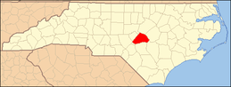 | |
| Towns | ||
| Townships | ||
| CDPs | ||
| Unincorporated communities | ||
| Footnotes | ‡This populated place also has portions in an adjacent county or counties | |
Greater Raleigh Metropolitan Region (Raleigh-Cary MSA, part of the Research Triangle) | ||
|---|---|---|
| Principal cities | 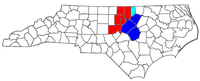 | |
| Other significant cities | ||
| Counties | ||
| Major universities |
| |
| Transportation | ||
| Miscellaneous | ||


| Authority control |
|
|---|