Morrisville, New York
Morrisville is a village in Madison County, New York, United States. The population was 2,199 at the 2010 census. The village is named after its founder, Thomas Morris.
Morrisville, New York | |
|---|---|
 Morrisville, New York Location within the state of New York | |
| Coordinates: 42°53′55″N 75°38′52″W | |
| Country | United States |
| State | New York |
| County | Madison |
| Area | |
| • Total | 1.2 sq mi (3.0 km2) |
| • Land | 1.2 sq mi (3.0 km2) |
| • Water | 0.0 sq mi (0.0 km2) |
| Elevation | 1,348 ft (411 m) |
| Population (2010) | |
| • Total | 2,199 |
| • Estimate (2018)[1] | 1,732 |
| • Density | 1,800/sq mi (730/km2) |
| Time zone | UTC-5 (Eastern (EST)) |
| • Summer (DST) | UTC-4 (EDT) |
| ZIP code | 13408 |
| Area code(s) | 315 |
| FIPS code | 36-48593 |
| GNIS feature ID | 0957706 |
The Village of Morrisville in the northwest part of the Town of Eaton on US Route 20. Its zip code is 13408. Morrisville State College is located in the village.
History
The community was named for Thomas Morris and was originally called "Morris Flats." It was made the county seat in 1817 when it was moved from Cazenovia. In 1907 the county seat was moved again this time to Wampsville.
In 1908, the New York State School of Agriculture was established and occupied the old county buildings that were left empty
The First National Bank of Morrisville, Morrisville Public Library, and Old Madison County Courthouse are listed on the National Register of Historic Places.[2]
Geography
Morrisville is located at 42°53′55″N 75°38′52″W (42.898541, -75.647717).[3]
According to the United States Census Bureau, the village has a total area of 1.1 square miles (2.8 km2), all of it land.
Demographics
| Historical population | |||
|---|---|---|---|
| Census | Pop. | %± | |
| 1870 | 570 | — | |
| 1880 | 741 | 30.0% | |
| 1890 | 726 | −2.0% | |
| 1900 | 624 | −14.0% | |
| 1910 | 500 | −19.9% | |
| 1920 | 497 | −0.6% | |
| 1930 | 583 | 17.3% | |
| 1940 | 666 | 14.2% | |
| 1950 | 1,250 | 87.7% | |
| 1960 | 1,304 | 4.3% | |
| 1970 | 2,296 | 76.1% | |
| 1980 | 2,707 | 17.9% | |
| 1990 | 2,732 | 0.9% | |
| 2000 | 2,148 | −21.4% | |
| 2010 | 2,199 | 2.4% | |
| Est. 2018 | 1,732 | [1] | −21.2% |
| U.S. Decennial Census[4] | |||
At the 2000 census there were 2,148 people, 362 households, and 195 families in the village. The population density was 1,863.4 people per square mile (721.2/km²). There were 398 housing units at an average density of 345.3 per square mile (133.6/km²). The racial makeup of the village was 79.93% White, 14.20% African American, 0.74% Native American, 2.23% Asian, 0.93% from other races, and 1.96% from two or more races. Hispanic or Latino of any race were 4.24%.[5]
Of the 362 households 27.1% had children under the age of 18 living with them, 41.7% were married couples living together, 10.8% had a female householder with no husband present, and 45.9% were non-families. 32.0% of households were one person and 10.5% were one person aged 65 or older. The average household size was 2.29 and the average family size was 2.92.
The age distribution was 9.0% under the age of 18, 60.8% from 18 to 24, 11.4% from 25 to 44, 8.3% from 45 to 64, and 10.6% 65 or older. The median age was 20 years. For every 100 females, there were 108.1 males. For every 100 females age 18 and over, there were 107.3 males.
The median household income was $34,375 and the median family income was $50,536. Males had a median income of $29,028 versus $24,643 for females. The per capita income for the village was $8,983. About 9.0% of families and 19.7% of the population were below the poverty line, including 27.2% of those under age 18 and 0.8% of those age 65 or over.
Education
This is the location of the Morrisville State College, which includes Morrisville fish hatchery, and the Morrisville Equestrian Center. Colgate University is 8 miles to the southeast, Cazenovia College is 12 miles west, and Syracuse University is 30 miles northwest.
Popular culture
In the 1980s cartoon series, The Real Ghostbusters, Morrisville was the hometown of Ray Stantz.
References
- "Population and Housing Unit Estimates". Retrieved December 19, 2019.
- "National Register Information System". National Register of Historic Places. National Park Service. March 13, 2009.
- "US Gazetteer files: 2010, 2000, and 1990". United States Census Bureau. 2011-02-12. Retrieved 2011-04-23.
- "Census of Population and Housing". Census.gov. Retrieved June 4, 2015.
- "U.S. Census website". United States Census Bureau. Retrieved 2008-01-31.
External links
Municipalities and communities of Madison County, New York, United States | ||
|---|---|---|
| City | 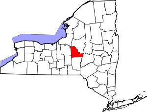 | |
| Towns |
| |
| Villages | ||
| CDP | ||
| Other hamlets | ||
| Indian reservations |
| |
| Footnotes | ‡This populated place also has portions in another county or counties | |