List of lakes of New Zealand
A lake's location is identified by the region and either the territorial authority or national park (N.P.).


This is a list of lakes in New Zealand.
There are:
- 41 lakes with a surface area larger than 10 km² (1000 ha)
- 229 lakes greater than 0.5 km² (50 ha)
- 3820 lakes greater than 0.01 km² (1 ha)
Largest
Lakes with a surface area of more than 10 square kilometres (3.9 sq mi)
| Rank | Name | Surface area | Region | Notes |
|---|---|---|---|---|
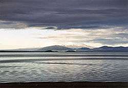
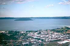
| 1 | Lake Taupo | 616 km2 (238 sq mi) | Waikato | Largest lake in New Zealand and the North Island; second-largest freshwater lake in Oceania |
| 2 | Lake Te Anau | 344 km2 (133 sq mi) | Southland | Largest lake in the South Island |
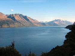
| 3 | Lake Wakatipu | 291 km2 (112 sq mi) | Otago | Longest lake in New Zealand (80 kilometres (50 mi)) |
| 4 | Lake Wānaka | 192 km2 (74 sq mi) | Otago | |
| 5= | Lake Ellesmere | 180 km2 (69 sq mi) | Canterbury | |
| 5= | Te Whanga Lagoon | 180 km2 (69 sq mi) | Chatham Island | Largest lake outside the North and South Islands |
| 7 | Lake Pukaki | 179 km2 (69 sq mi) | Canterbury | |
| 8 | Lake Manapouri | 142 km2 (55 sq mi) | Southland | Contains largest inland island within New Zealand, Pomona Island |
| 9 | Lake Hāwea | 141 km2 (54 sq mi) | Otago | |
| 10 | Lake Tekapo | 83 km2 (32 sq mi) | Canterbury | |
| 11 | Lake Rotorua | 79 km2 (31 sq mi) | Bay of Plenty | |
| 12 | Lake Wairarapa | 78 km2 (30 sq mi) | Wellington | |
| 13 | Lake Benmore | 75 km2 (29 sq mi) | Canterbury/Otago | Largest artificial lake in New Zealand |
| 14 | Lake Hauroko | 63 km2 (24 sq mi) | Southland | New Zealand's deepest lake |
| 15 | Lake Ohau | 63 km2 (24 sq mi) | Canterbury | |
| 16 | Lake Waikaremoana | 54 km2 (21 sq mi) | Hawke's Bay | |
| 17 | Lake Coleridge | 47 km2 (18 sq mi) | Canterbury | |
| 18 | Lake Poteriteri | 43 km2 (17 sq mi) | Southland | Largest lake in New Zealand without road access |
| 19 | Lake Brunner | 40 km2 (15 sq mi) | West Coast | |
| 20 | Lake Tarawera | 39 km2 (15 sq mi) | Bay of Plenty | |
| 21 | Lake Rotoiti | 35 km2 (14 sq mi) | Bay of Plenty | |
| 22 | Lake Waikare | 34 km2 (13 sq mi) | Waikato | |
| 23 | Lake Monowai | 31 km2 (12 sq mi) | Southland | |
| 24 | Lake Aviemore | 29 km2 (11 sq mi) | Canterbury | Artificial |
| 25 | Lake McKerrow | 28 km2 (11 sq mi) | Southland | |
| 26 | Lake Dunstan | 26 km2 (10 sq mi) | Otago | Artificial |
| 27 | Lake Kaniere | 22 km2 (8.5 sq mi) | West Coast | |
| 28= | Lake Omapere | 14 km2 (5.4 sq mi) | Northland | |
| 28= | Lake Sumner | 14 km2 (5.4 sq mi) | Canterbury | |
| 30 | Lake Rotoaira | 13 km2 (5.0 sq mi) | Waikato | |
| 31= | Ōkārito Lagoon | 12 km2 (4.6 sq mi) | West Coast | |
| 31= | Lake Ohakuri | 12 km2 (4.6 sq mi) | Waikato | Artificial |
| 33 | Lake Rotoma | 11.2 km2 (4.3 sq mi) | Bay of Plenty | |
| +8 other lakes | >10 km² |
Deepest lakes
- Lake Hauroko – 462 m
- Lake Manapouri – 444 m
- Lake Te Anau – 417 m
- Lake Hāwea – 392 m
- Lake Wakatipu – 380 m
These five lakes are all in the South Island. The deepest lake in the North Island is Lake Waikaremoana which has a depth of 248 m.[1]
North Island
Northland
The following lakes are located in the Northland Region.
Auckland
The following lakes are located in the Auckland Region.
Many of the lakes in the Auckland Region are man made reservoirs, constructed in the hilly catchment areas of the Waitakere and Hunua ranges in order to provide a water supply for the Auckland urban area.
Waikato
The following lakes are located in the Waikato region. The various pools of the Tongariro River system, as listed below, can be found in detail on their own page at Pools of the Tongariro River.
| Lake | Location | Area | Notes | Coordinates |
|---|---|---|---|---|
| Alum Lake | Taupo District | 0.08 km²[2] | West of Wairakei | 38°37′05″S 176°03′40″E |
| Blue Lake | Tongariro N.P. | 0.17 km²[3] | On Mount Tongariro. Watershed of 0.71 km²[3] | 39°07′30″S 175°39′40″E |
| Champagne Pool | Southern Rotorua Lakes | Fed from a hot spring | 38°21′33″S 176°22′08″E | |
| Emerald Lakes | Tongariro N.P. | 0.01 km²[3] | On Mount Tongariro. Watershed of 2.64 km²[3] | 39°08′05″S 175°39′15″E |
| Hamareha Lakes | South Waikato District | 0.01 km²[3] | Watershed of 10.55 km²[3] | 38°01′45″S 175°52′50″E |
| Hardcastle Lagoon | Taupo District | Oxbow lake of Waikato River | 38°30′40″S 176°19′40″E | |
| Hendersons Pond | Waipa District | 0.0088 km²[4] | Peat lake. Watershed of 0.31 km²[4] | 37°53′27″S 175°16′27″E |
| Horseshoe Lake (Lake Waiwhakareke) | Hamilton City | 0.03 km²[4] | Drains into Lake Rotokauri. Watershed of 0.66 km²[4] | 37°46′14″S 175°13′33″E |
| Kopuatai Burn Pools | Hauraki District | 0.02 km²[4] | Peat lakes on Kopuatai Peat Dome. Watershed of 1.83 km²[4] | 37°24′30″S 175°36′00″E |
| Lake A (Lake Whakatangi) | Waikato District | 0.027 km²[4] | Peat lake. Watershed of 1.7 km²[4] | 37°41′20″S 175°15′30″E |
| Lake Arapuni | South Waikato and Waipa Districts | 9 km² | Hydroelectric reservoir, aquatic vegetation monitored[5] | 38°08′00″S 175°38′00″E |
| Lake Aratiatia | Taupo District | 0.60 km²[3] | Hydroelectric reservoir, aquatic vegetation monitored.[5] Watershed of 1,478.8 km²[3] | 38°37′00″S 176°07′55″E |
| Lake Areare | Waikato District | 0.33 km²[4] | East of Ngāruawāhia. Peat lake, aquatic vegetation monitored.[5] Watershed of 2.62 km²[4] | 37°40′05″S 175°12′00″E |
| Lake Atiamuri | South Waikato and Taupo Districts | 2.3 km2 | Hydroelectric reservoir, aquatic vegetation monitored.[5] | 38°23′10″S 176°02′00″E |
| Lake B (or Lake Kaituna)[6] | Waikato District | 0.12 km²[4] | Peat lake, aquatic vegetation monitored.[5] Watershed of 5.8 km²[4] | 37°40′45″S 175°14′50″E |
| Lake C (or Lake Komakorau)[6] | Waikato District | 0.026 km²[4] | Restoration study done.[7] Watershed of 6.19 km²[4] | 37°40′30″S 175°14′43″E |
| Lake Cameron (Lake Kareaotahi) | Waipa District | 0.034 km²[4] | Peat lake. Watershed of 0.31 km²[4] | 37°51′20″S 175°18′10″E |
| Lake D (Lake Kainui) | Waikato District | 0.25 km²[4] | Peat lake, aquatic vegetation monitored.[5] Watershed of 1.32 km²[4] | 37°40′40″S 175°14′00″E |
| Lake Disappear | Waikato District | up to 2 km long when full | Seasonal. Pakihi Stream dammed by lava flow (which also formed Bridal Veil waterfall) and drained through limestone sinkhole (see also Turlough and Polje). Watershed of 6.0 km²[4] | 37°55′35″S 174°55′02″E |
| Lake E (Lake Tunawhakaheke) | Waikato District | 0.067 km²[4] | Peat lake, aquatic vegetation monitored.[5] Watershed of 1.0 km²[4] See Lake Rototuna | 37°42′08″S 175°16′15″E |
| Lake Hakanoa | Waikato District | 0.52 km²[4] | riverine lake,[8] aquatic vegetation monitored.[5] Watershed of 6.13 km²[4] | 37°33′10″S 175°10′00″E |
| Lake Harihari | Waitomo District | 0.184 km² | Sand dune lake (see Lake Ototoa), aquatic vegetation monitored.[5] Watershed of 1.34 km²[4] | 38°12′40″S 174°43′20″E |
| Lake Hinemaiaia | Taupo District | 0.12 km²[9] | Hydroelectric reservoir, aquatic vegetation monitored[5] | 38°53′30″S 176°05′40″E |
| Lake Hotoananga | Waikato District | 0.19 km²[4] | East of Ngāruawāhia. Peat lake, aquatic vegetation monitored.[5] Watershed of 0.71 km²[4] | 37°39′25″S 175°11′00″E |
| Lake Karapiro | Waipa District | 7.7 km2 | Hydroelectric reservoir, aquatic vegetation monitored[5] | 37°56′40″S 175°34′00″E |
| Lake Kimihia | Waikato District | 0.58 km²[4] | riverine lake, aquatic vegetation monitored.[5] Watershed of 14.85 km²[4] | 37°31′40″S 175°11′30″E |
| Lake Kopuera | Waikato District | 0.52 km²[4] | Near Rangiriri. Watershed of 2.5 km²[4] | 37°25′25″S 175°08′15″E |
| Lake Koraha | Otorohanga District | 0.008 km²[4] | Drains via a small cave. Watershed of 1.768 km²[4] | 38°09′49″S 174°55′19″E |
| Lake Koromatua | Waipa District | 0.099 km²[4] | Eutrophic lake[10] 0.22 km² total area,[11] aquatic vegetation monitored.[5] Watershed of 2.0 km²[4] | 37°50′15″S 175°13′25″E |
| Lake Kuratau | Taupo District | 1.03 km²[3] | Hydroelectric reservoir. Watershed of 183.67 km²[3] | 38°52′05″S 175°42′40″E |
| Lake Mangahia | Waipa District | 0.084 km²[4] | Peat lake, aquatic vegetation monitored.[5] Watershed of 3.54 km²[4] | 37°52′45″S 175°13′40″E |
| Lake Mangakaware | Waipa District | 0.129 km²[4] | Peat lake, aquatic vegetation monitored.[5] Watershed of 2.38 km²[4] | 37°56′00″S 175°13′12″E |
| Lake Maraetai | South Waikato and Taupo Districts | 4.4 km² | Hydroelectric reservoir, aquatic vegetation monitored[5] | 38°22′00″S 175°47′10″E |
| Lake Maratoto | Waipa District | 0.18 km²[4] | Peat lake, aquatic vegetation monitored.[5] Watershed of 0.88 km²[4] | 37°53′10″S 175°18′15″E |
| Lake Milicich | Waipa District | 0.022 km²[4] | Peat lake, aquatic vegetation monitored.[5] Watershed of 0.54 km²[4] | 37°53′07″S 175°14′55″E |
| Lake Moananui | South Waikato District | 0.08 km²[3] | Watershed of 27.06 km²[3] | 38°14′10″S 175°51′10″E |
| Lake Ngāhewa | Southern Rotorua Lakes | 0.084 km²[4] | Volcanic, aquatic vegetation monitored.[5] Watershed of 7.46 km²[4] | 38°18′55″S 176°22′25″E |
| Lake Ngakoro | Southern Rotorua Lakes | 0.12 km²[3] | Geothermal. Watershed of 2.35 km²[3] | 38°21′55″S 176°22′03″E |
| Lake Ngapouri (Lake Opouri) | Southern Rotorua Lakes | 0.235 km²[3] | Volcanic. Watershed of 6.36 km²[3] | 38°20′20″S 176°20′05″E |
| Lake Ngaroto | Waipa District | 1.08 km²[4] | Peat lake, aquatic vegetation monitored.[5] Watershed of 18.46 km²[4] | 37°57′20″S 175°17′20″E |
| Lake Ngarotoiti | Waipa District | 0.034 km²[4] | Peat lake. Watershed of 5.04 km²[4] | 37°56′35″S 175°17′45″E |
| Lake Numiti | Waitomo District | 0.158 km²[12] | Near Taharoa | 38°10′45″S 174°43′45″E |
| Lake Ohakuri | South Waikato and Taupo Districts | 12 km² | Hydroelectric reservoir, aquatic vegetation monitored[5] | 38°25′00″S 176°07′00″E |
| Lake Ohinewai | Waikato District | 0.16 km²[4] | Peat lake, aquatic vegetation monitored.[5] Watershed of 3.47 km²[4] | 37°29′40″S 175°10′20″E |
| Lake Okoroire | South Waikato District | 0.035 km²[4] | Peat lake. Watershed of 1.47 km²[4] | 37°55′05″S 175°47′25″E |
| Lake Okowhao | Waikato District | 0.21 km²[4] | riverine lake, aquatic vegetation monitored[5] | 37°31′35″S 175°08′30″E |
| Lake Opuatia | Waikato District | 0.07 km² approx[4] | Peat lake | 37°26′07″S 175°03′48″E |
| Lake Orotu | Southern Rotorua Lakes | Volcanic. Watershed of 5.82 km²[3] | 38°22′15″S 176°21′53″E | |
| Lake Otamatearoa | Waikato District | 0.049 km²[4] | Sand dune lake, aquatic vegetation monitored.[5] Watershed of 0.683 km²[4] | 37°17′45″S 174°41′10″E |
| Lake Parangi | Otorohanga District | 0.122 km²[4] | North of Kawhia Harbour. Sand dune lake, aquatic vegetation monitored.[5] Watershed of 1.22 km²[4] | 38°02′15″S 174°48′40″E |
| Lake Pataka | Waipa District | 0.046 km²[4] | Peat lake, aquatic vegetation monitored.[5] Watershed of 0.55 km²[4] | 37°50′50″S 175°13′10″E |
| Lake Pataka South (Lake Posa) | Waipa District | 0.0205 km²[4] | Peat lake, aquatic vegetation monitored.[5] Watershed of 0.95 km²[4] | 37°51′05″S 175°13′00″E |
| Lake Patetonga | Hauraki District | 0.049 km²[4] | Artificial tidal lake with sluice, for duck shooting | 37°24′00″S 175°31′00″E |
| Lake Penewaka (Penewaka Lagoon) | Waikato District | 0.04 km²[4] | In Lake Waikare wildlife management reserve | 37°26′10″S 175°09′35″E |
| Lake Pikopiko | Waikato District | 0.064[4] | East of Ngāruawāhia. Watershed of 0.94 km²[4] | 37°39′45″S 175°11′33″E |
| Lake Piopio | Waitomo District | 0.002 km²[4] | Sand dune lake near Taharoa. Watershed of 0.28 km²[4] | 38°11′39″S 174°43′07″E |
| Lake Puketi | Waikato District | 0.059 km²[13] | Sand dune lake,[14] aquatic vegetation monitored.[5] Watershed of 1.141 km²[4] | 37°16′45″S 174°40′35″E |
| Lake Puketirini | Waikato District | 1.04 km²[15] | Weavers opencast coal-mine until December 1993 | 37°34′00″S 175°08′30″E |
| Lake Rotoaira | Taupo District | 13 km² | Volcanic, aquatic vegetation monitored.[5] Watershed of 141.9 km²[3] | 39°03′30″S 175°43′00″E |
| Lake Rotohoko | South Waikato District | 38°03′50″S 175°56′07″E | ||
| Lake Rotoiti | Waikato District | 0.012 km²[4] | Sand dune lake, aquatic vegetation monitored.[5] Watershed of 0.4193 km²[4] | 37°16′42″S 174°40′30″E |
| Lake Rotokaeo | Hamilton City | 0.031 km²[4] | Peat lake | 37°46′25″S 175°15′05″E |
| Lake Rotokaraka | Waikato District | 0.07 km² approx[4] | 37°36′38″S 175°20′15″E | |
| Lake Rotokauri | Hamilton City | 0.42 km²[4] | Near Rotokauri, aquatic vegetation monitored.[5] Watershed of 9.33 km²[4] | 37°45′40″S 175°11′50″E |
| Lake Rotokawa | Taupo District | 0.62 km²[3] | Geothermal lake northeast of Taupo. Watershed of 10.9 km²[3] | 38°37′50″S 176°11′20″E |
| Lake Rotokawau | Waikato District | 0.22 km²[4] | Peat lake linked to Lake Waikare, aquatic vegetation monitored.[5] Watershed of 18.04 km²[4] | 37°28′50″S 175°11′30″E |
| Lake Rotokura | Taupo District | 39°00′45″S 175°39′40″E | ||
| Lake Rotokotuku | Waitomo District | 0.011 km²[4] | Peat lake southeast of Te Kuiti. Watershed of 0.185 km²[4] | 38°22′02″S 175°12′50″E |
| Lake Rotomanuka | Waipa District | 0.123 km² (North) 0.054 km² (South)[4] | Peat lake, aquatic vegetation monitored.[5] Watershed of 4.79 km²[4] | 37°55′30″S 175°18′55″E |
| Lake Rotongaio | Taupo District | 0.34 km²[3] | Volcanic lake immediately to the east of Lake Taupo. Watershed of 5.06 km²[3] | 38°48′30″S 176°03′20″E |
| Lake Rotongaro | Waikato District | 2.92 km²[4] | riverine lake, aquatic vegetation monitored.[5] Watershed of 19.5 km²[4] | 37°29′10″S 175°07′00″E |
| Lake Rotongaroiti | Waikato District | 0.23 km²[4] | riverine lake, aquatic vegetation monitored.[5] Watershed of 21.05 km²[4] | 37°28′40″S 175°06′30″E |
| Lake Rotongata | Waipa District | 0.053 km²[4] | Peat lake. Watershed of 1.44 km²[4] | 38°07′50″S 175°35′37″E |
| Lake Rotopotaka | Waipa District | 0.028 km²[4] | Peat lake. Watershed of 0.76 km²[4] | 37°57′57″S 175°19′37″E |
| Lake Rotopounamu | Tongariro N.P. | 0.055 km²[4] | Crater lake north of Lake Rotoaira. Aquatic vegetation monitored.[5] Watershed of 5.25 km²[4] | 39°01′40″S 175°44′20″E |
| Lake Rotoroa (Hamilton) | Hamilton City | 0.55 km²[4] | Peat lake, aquatic vegetation monitored.[5] Watershed of 2.58 km²[4] | 37°48′00″S 175°16′30″E |
| Lake Rotoroa | Waitomo District | 0.224 km²[4] | 38°11′00″S 174°43′30″E | |
| Lake Rototapu | Waitomo District | 0.02 km²[4] | Sand dune lake near Taharoa. Watershed of 0.28 km²[4] | 38°11′45″S 174°43′03″E |
| Lake Ruatuna | Waipa District | 0.13 km²[4] | Peat lake, aquatic vegetation monitored.[5] Watershed of 1.9 km²[4] | 37°55′40″S 175°17′30″E |
| Lake Serpentine (Rotopiko) | Waipa District | 0.053 km² (north) 0.083 km² (south) 0.016 km² (east)[4] | Peat lake, aquatic vegetation monitored.[5] Watershed of 1.63 km²[4] | 37°57′00″S 175°19′05″E |
| Lake Taharoa | Waitomo District | 2.16 km²[4] | Sand dune lake, aquatic vegetation monitored[5] | 38°10′00″S 174°44′30″E |
| Lake Taupo (Taupomoana) | Taupo District | 616 km² | Crater lake, aquatic vegetation monitored. New Zealand's largest lake.[5] | 38°48′00″S 175°54′00″E |
| Lake Te Kapa | Waikato District | 0.01 km²[4] | Peat lake | 37°27′33″S 175°05′58″E |
| Lake Te Ko Utu (Te Koutu Lake) | Waipa District | 0.06 km²[3] | Oxbow lake in Cambridge. Watershed of 4.16 km²[3] | 37°53′20″S 175°28′10″E |
| Lake Te Rotopupu | Otorohanga District | 0.0095 km²[4] | Small sand dune lake immediately south of Kawhia Harbour. Watershed of 2.4 km²[4] | 38°06′15″S 174°52′30″E |
| Lake Tutaeinanga | Southern Rotorua Lakes | 0.031 km²[4] | Volcanic, aquatic vegetation monitored.[5] Watershed of 5.01 km²[4] | 38°20′00″S 176°19′20″E |
| Lake Waahi | Waikato District | 5.22 km²[16] | riverine lake, aquatic vegetation monitored.[5] Watershed of 92.21 km²[4] | 37°33′30″S 175°07′30″E |
| Lake Waikare | Waikato District | 34 km² | riverine lake, aquatic vegetation monitored.[5] Watershed of 210 km²[4] | 37°26′00″S 175°12′00″E |
| Lake Waipapa | South Waikato and Waipa Districts | 1.5 km²[3] | Hydroelectric reservoir, aquatic vegetation monitored.[5] Watershed of 254.09 km²[3] | 38°18′00″S 175°41′00″E |
| Lake Waitamoumou | Waikato District | 0.024 km²[4] | Sand dune lake (see Lake Ototoa). | 37°47′25″S 174°50′38″E |
| Lake Waiwhata | Waikato District | 0.089 km²[4] | Peat lake | 37°27′55″S 175°06′05″E |
| Lake Whatihua | Waikato District | Near the border of Waikato and Auckland. | 37°16′31″S 174°40′14.2″E | |
| Lake Whakamaru | South Waikato and Waipa Districts | 7.80 km²[3] | Hydroelectric reservoir, aquatic vegetation monitored.[5] Watershed of 811.48 km²[3] | 38°26′20″S 175°50′00″E |
| Lake Whangape | Waikato District | 14.5 km²[4] | riverine lake, aquatic vegetation monitored.[5] Watershed of 317 km²[4] | 37°28′00″S 175°03′30″E |
| Leesons Pond | Matamata-Piako District | 0.04 km² approx[4] | Peat lake | 37°38′20″S 175°27′50″E |
| Opal Lake | Southern Rotorua Lakes | 38°18′39″S 176°23′17″E | ||
| Parkinsons Lake (Kohahuake) | Waikato District | 0.0192 km² | Eutrophic sand dune lake, aquatic vegetation monitored.[5] Watershed of 1.077 km²[4] | 37°18′53″S 174°41′05″E |
| Pukuriri Lagoon | Taupo District | Small wetland area east of Taupo | 38°44′12″S 176°17′15″E | |
| Rotowhero (Green Lake) | Southern Rotorua Lakes | 0.026 km²[3] | Geothermal. Watershed of 11.01 km²[3] | 38°19′20″S 176°22′27″E |
| Sulphur Lagoon | Tongariro N.P. | 0.02 km²[3] | Volcanic. Watershed of 1.97 km²[3] | 39°06′12″S 175°40′20″E |
| Te Otamanui Lagoon | Waikato District | 0.054 km²[4] | Alluvial and pumice dammed valley | 37°43′20″S 175°08′08″E |
| Turnwald Pond | Waipa District | 37°55′05″S 175°18′43″E | ||
| Whangioterangi (Echo Lake) | Southern Rotorua Lakes | 0.05 km²[3] | Geothermal. Watershed of 0.70 km².[3] | 38°21′39″S 176°22′30″E |
| Whiritoa Lagoon | Thames-Coromandel District | At Whiritoa | 37°17′30″S 175°54′30″E | |
Pools of the Tongariro River
The following is a list of named pools on the Tongariro River. Full details of these pools, many of which are little more than widenings of the river or clear areas of the river's delta marshes, can be found at Pools of the Tongariro River.
- Admirals Pool
- Bain Pool
- Barlows Pool
- Beggs Pool
- Big Bend Pool
- Blue Pool
- Boulder Pool
- Breakaway Pool
- Breakfast Pool
- Cattle Rustlers Pool
- Cherry Pool
- Cliff Pool
- Cobham Pool
- Dans Pool
- DeLatours Pool
- Downs Pool
- Duchess Pool
- Fan Pool
- Fence Pool
- Graces Pool
- Hydro Pool
- Island Pool
- Jellicoe Pool
- Jones Pool
- Judges Pool
- Kamahi Pool
- Log Pool
- Lonely Pool
- Lower Birch Pool
- Major Jones Pool
- Never Fail Pool
- Poplar Pool
- Poutu Pool
- Red Hut Pool
- Reed Pool
- Sand Pool
- Shag Pool
- Silly Pool
- Stag Pool
- Swirl Pool
- The Bends Pool
- The Rip
- Upper Birch Pool
- Upper Island Pool
- Waddells Pool
- Whitikau Pool
Bay of Plenty
The following lakes are located in the Bay of Plenty Region.
Gisborne
The following lakes are located in the Gisborne Region.
| Lake | Location | Area | Notes | Coordinates |
|---|---|---|---|---|
| Lake Karangata | Gisborne District | Between Gisborne and Wairoa, south of the Tiniroto Lakes | 38°46′20″S 177°32′40″E | |
| Lake Repongaere | Gisborne District | North of Patutahi | 38°35′45″S 177°52′30″E | |
| Lake Rotokaha | Gisborne District | Between Gisborne and Wairoa, southeast of the Tiniroto Lakes | 38°46′30″S 177°33′30″E | |
| Otopotehetehe Lake | Gisborne District | West of Hicks Bay | 37°36′55″S 178°08′20″E | |
| Tiniroto Lakes | Gisborne District | Between Gisborne and Wairoa | 38°46′05″S 177°32′30″E | |
| Wherowhero Lagoon | Gisborne District | Close to Muriwai at the south end of Poverty Bay | 38°44′30″S 177°56′10″E | |
Hawke's Bay
The following lakes are located in the Hawke's Bay Region.
| Lake | Location | Area | Notes | Coordinates |
|---|---|---|---|---|
| Awamate Lagoons | Wairoa District | South of Frasertown | 38°59′20″S 177°23′40″E | |
| Blue Lake | Hastings District | 39°09′44″S 176°49′03″E | ||
| Hatuma Lake (Lake Whatumā) | Central Hawke's Bay District | South of Waipukurau | 40°01′20″S 176°31′30″E | |
| Hikaka | Wairoa District | Southeast of Lake Waikaremoana | 38°48′48″S 177°06′55″E | |
| Hine Rere | Wairoa District | Northeast of Lake Waikaremoana | 38°42′50″S 177°08′19″E | |
| Horseshoe Lake | Central Hawke's Bay District | West of Elsthorpe | 39°55′20″S 176°45′45″E | |
| Kaipo Lagoon | Wairoa District | Northeast of Lake Waikaremoana | 38°40′55″S 177°12′05″E | |
| Lake Horotea | Northeast Rangitikei District | 39°17′45″S 176°08′40″E | ||
| Lake Kaitawa | Wairoa District | Southeast of Lake Waikaremoana | 38°48′10″S 177°08′10″E | |
| Lake Kiriopukae | Wairoa District | Southeast of Lake Waikaremoana | 38°48′23″S 177°06′45″E | |
| Lake Opouahi | Hastings District | 39°08′50″S 176°50′10″E | ||
| Lake Orakai | Hastings District | South of Lake Tūtira | 39°14′10″S 176°53′20″E | |
| Lake Pohue | Hastings District | 39°15′00″S 176°41′10″E | ||
| Lake Poukawa | Hastings District | 1.4 km² | 39°47′00″S 176°42′00″E | |
| Lake Rotongaio | Wairoa District | 38°56′35″S 177°00′40″E | ||
| Lake Rotonuiaha | Wairoa District | 0.44 km² | 38°56′50″S 177°02′20″E | |
| Lake Rotoroa | Wairoa District | 38°56′50″S 177°01′45″E | ||
| Lake Ruapani | Wairoa District | Northeast of Lake Waikaremoana | 38°43′50″S 177°07′40″E | |
| Lake Ruapapa | Wairoa District | 38°55′20″S 177°09′30″E | ||
| Lake Tamaharau | Wairoa District | 39°02′38″S 177°01′48″E | ||
| Lake Tūtira | Hastings District | 1.8 km² | North of Napier | 39°13′30″S 176°53′35″E |
| Lake Waikareiti | Wairoa District | Northeast of Lake Waikaremoana | 38°43′00″S 177°10′00″E | |
| Lake Waikaremoana | Wairoa District | 54 km² | 38°46′00″S 177°05′00″E | |
| Lake Waikopiro | Hastings District | South of Lake Tūtira | 39°14′05″S 176°53′40″E | |
| Lake Whakamarino | Wairoa District | Southeast of Lake Waikaremoana | 38°48′40″S 177°09′00″E | |
| Lake Whalehole | Hastings District | 39°31′42″S 176°13′50″E | ||
| Lake Wherowhero | Wairoa District | Southeast of Lake Waikaremoana | 38°48′20″S 177°07′47″E | |
| Long Range Lake | Central Hawke's Bay District | 40°08′05″S 176°46′35″E | ||
| Maungawhio Lagoon | Wairoa District | At isthmus of Mahia Peninsula | 39°04′10″S 177°53′00″E | |
| Mauriahea | Wairoa District | Southeast of Lake Waikaremoana | 38°49′22″S 177°07′25″E | |
| Nga Whanau A Ruapani Tarns | Wairoa District | North of Lake Waikaremoana | 38°42′50″S 177°06′30″E | |
| Ngamotu Lagoon | Wairoa District | East of the mouth of the Wairoa River | 39°03′30″S 177°26′30″E | |
| Ngutu Manu | Wairoa District | Northeast of Lake Waikaremoana | 38°42′57″S 177°08′18″E | |
| Ohuia Lagoon | Wairoa District | East of Wairoa | 39°02′50″S 177°29′00″E | |
| Oingo Lake | Hastings District | 0.8 km² | Southwest of Napier | 39°33′45″S 176°45′00″E |
| Pakiaka | Wairoa District | Southeast of Lake Waikaremoana | 38°49′13″S 177°07′13″E | |
| Potaka | Wairoa District | Southeast of Lake Waikaremoana. Not to be confused with Potaka Lake | 38°49′22″S 177°07′48″E | |
| Potaka Lake | Hastings District | Southwest of Napier. Not to be confused with Potaka | 39°34′40″S 176°44′50″E | |
| Purimu Lake | Central Hawke's Bay District | 40°08′20″S 176°29′00″E | ||
| Runanga Lake | Hastings District | 1.1 km² | Southwest of Napier | 39°34′40″S 176°42′20″E |
| Te Paeroa Lagoon | Wairoa District | East of Wairoa | 39°02′35″S 177°31′00″E | |
| Te Roto Kare | Hastings District | Southwest of Napier | 39°33′45″S 176°47′50″E | |
| Te Rotookiwa | Central Hawke's Bay District | 39°49′05″S 176°39′35″E | ||
| Te Whakatutu | Wairoa District | Southeast of Lake Waikaremoana | 38°49′00″S 177°08′12″E | |
| The Lakes | Hastings District | 39°21′40″S 176°21′50″E | ||
| Umuomahu | Wairoa District | Southeast of Lake Waikaremoana | 38°49′18″S 177°06′30″E | |
| Wairau Lagoon | Wairoa District | East of Wairoa | 39°02′50″S 177°30′00″E | |
| Whakaki Lagoon | Wairoa District | 4.7 km² | East of Wairoa | 39°02′35″S 177°33′00″E |
| Whakamahi Lagoon | Wairoa District | West of the mouth of the Wairoa River | 39°03′50″S 177°24′20″E | |
| Whano O Ruapani | Wairoa District | Northeast of Lake Waikaremoana | 38°43′20″S 177°07′30″E | |
Taranaki
The following lakes are located in the Taranaki Region.
Manawatu-Wanganui
The following lakes are located in the Manawatū-Whanganui region.
Wellington
The following lakes are located in the Wellington Region.
South Island
Tasman
The following lakes are located in the Tasman Region.
Nelson
The following lakes are located in the Nelson Region.
| Lake | Location | Area | Notes | Coordinates |
|---|---|---|---|---|
| Dew Lakes | Nelson | 41°19′31″S 173°24′38″E | ||
| Maitai Dam | Nelson | Reservoir | 41°17′40″S 173°22′30″E | |
| Rush Pool | Nelson | 41°18′42″S 173°23′12″E | ||
Marlborough
The following lakes are located in the Marlborough Region.
| Lake | Location | Area | Notes | Coordinates |
|---|---|---|---|---|
| Argyle Pond | Marlborough District | In Wairau Valley to south of Wairau River | 41°40′30″S 173°12′00″E | |
| Big Lagoon | Marlborough District | East of Blenheim, close to the mouth of the Wairau River | 41°33′00″S 174°06′00″E | |
| Bowscale Tarn | Marlborough District | One of a cluster of lakes in the upper Wairau Valley | 42°07′40″S 172°57′15″E | |
| Chandlers Lagoon | Marlborough District | Arm of Big Lagoon | 41°33′10″S 174°04′00″E | |
| Lake Elterwater | Marlborough District | Small lake north of Ward | 41°48′00″S 174°09′20″E | |
| Fish Lake | Marlborough District | One of a cluster of lakes in the upper Wairau Valley | 42°07′15″S 172°56′00″E | |
| Island Lake | Marlborough District | One of a cluster of lakes in the upper Wairau Valley | 42°09′15″S 172°56′15″E | |
| Lake Alexander | Marlborough District | 41°44′50″S 173°39′45″E | ||
| Lake Chalice | Marlborough District | In Mount Richmond F.P. north of Wairau River | 41°34′10″S 173°18′30″E | |
| Lake Grassmere/Kapara Te Hau | Marlborough District | Shallow lagoon, used for salt production | 41°44′00″S 174°10′00″E | |
| Lake Jasper | Marlborough District | On the floodplain of the Awatere River west of Seddon | 41°39′45″S 173°58′30″E | |
| Lake McRae | Marlborough District | In the Inland Kaikoura Range. Feeds a tributary of the Clarence River | 42°11′00″S 173°20′00″E | |
| Lake Sedgemere | Marlborough District | One of a cluster of lakes in the upper Wairau Valley | 42°08′08″S 172°55′00″E | |
| Lake Timara | Marlborough District | On the floodplain of the Wairau River just south of Renwick | 41°31′45″S 173°48′40″E | |
| Upper Lagoon | Marlborough District | Arm of Big Lagoon | 41°32′30″S 174°04′00″E | |
| Waikarapi Lagoon | Marlborough District | Arm of Big Lagoon | 41°32′30″S 174°05′00″E |
West Coast
The following lakes are located in the West Coast region.
Canterbury
The following lakes are located in the Canterbury region.
Otago
The following lakes are located in the Otago region.
Southland
The following lakes are located in the Southland region.
Other islands
Auckland Islands
| Lake | Location | Area | Notes | Coordinates |
|---|---|---|---|---|
| Lake Hinemoa | Northern Auckland Island | 0.17 km2 | Upper reaches of a moraine-dammed fjord. Lower reaches form Musgrave Inlet.[19] | 50°38′55″S 166°08′20″E |
| Lake Speight | Southwestern Auckland Island | 0.04 km2 | Stream flows from lake to Coleridge Bay, Carnley Harbour.[19] | 50°49′15″S 165°58′50″E |
| Lake Turbott | Southern Adams Island | 0.20 km2 | Moraine dammed fjord.[19] | 50°54′30″S 166°02′50″E |
| Lake Tutanekai | Northern Auckland Island | 0.08 km2 | Upper reaches of a moraine-dammed fjord. Lower reaches form Granger Inlet.[19] | 50°37′40″S 166°09′20″E |
| Teal Lake | Enderby Island | 0.003 km2 | Small pool close to south shore of the island.[19] | 50°30′21″S 166°18′31″E |
Campbell Island
| Lake | Location | Area | Notes | Coordinates |
|---|---|---|---|---|
| Six Foot Lake | Southern Campbell Island | 0.08 km2 | Separated from Monument Harbour on the south coast by a narrow channel.[20] | 52°35′20″S 169°08′50″E |
Chatham Islands
Many of the lakes in the Chatham Islands are either lagoons filling sinkholes in the island's limestone structure, or low-lying peat lakes. The island chain is dominated by Te Whanga Lagoon, which occupies the centre of the main island and accounts for one sixth of the surface area of the archipelago.
Cook Islands
| Lake | Location | Area | Notes | Coordinates |
|---|---|---|---|---|
| Lake Tiriara | Mangaia | 21°57′03″S 157°55′45″W | ||
| Lake Tiroto | Aitu Island | 20°00′35″S 158°07′25″W | ||
| Te Rotonui | Mitiaro | 19°52′02″S 157°41′34″W |
Kermadec Islands
| Lake | Location | Area | Notes | Coordinates |
|---|---|---|---|---|
| Blue Lake | Raoul Island | 0.80 km² | Crater lake | 29°15′20″S 177°54′50″W |
| Green Lake | Raoul Island | 0.15 km² | Crater lake | 29°15′50″S 177°55′09″W |
Ross Dependency
The following lakes are located in Ross Dependency, New Zealand's claim in Antarctica.
See also
- List of lakes
- List of reservoirs and dams in New Zealand
- List of islands of New Zealand#In rivers and lakes
References
- Lowe, D.J.; Green, J.D. (1987). Viner, A.B. (ed.). Inland waters of New Zealand. Wellington: DSIR Science Information Publishing Centre. pp. 471–474. ISBN 0-477-06799-9.
- "Bromley exhibits" (PDF). Waikato Regional Council.
- "Waikato Regional Council Technical Report 2011/05 Significant Natural Areas of the Waikato Region – Lake Ecosystems" (PDF).
- "Shallow lakes management plan: Volume 2" (PDF). Waikato Regional Council. 10 October 2014.
- "How we monitor". Waikato Regional Council. Retrieved 3 October 2017.
- "Lake Kaituna (B)". www.waikatoregion.govt.nz. Retrieved 4 January 2016.
- Peters, Monica. "Monitoring & Management Plan" (PDF). Landcare.
- "Huntly Domain and Lake Hakanoa Reserve Management Plan" (PDF). Waikato District Council. 28 August 2012.
- "Environment Waikato Technical Report 2008/36 The Condition of 43 Lakes in the Waikato Region Using Lake SPI" (PDF).
- Peters, Monica (14 September 2015). "Lake Koromatua: One = 1000 community restoration projects". monicalogues. Retrieved 31 August 2016.
- "Waipa District Council Draft Lake Management Plan para 11.1" (PDF). www.waipadc.govt.nz. Retrieved 31 August 2016.
- "Significant Natural Areas of the Waikato Region – Lake Ecosystems" (PDF). Waikato Regional Council. p. 205. Archived from the original (PDF) on 5 October 2013.
- NIWA (December 2005). "The condition of lakes in the Waikato Region using SPI" (PDF). Archived from the original (PDF) on 29 October 2013.
- "Field Trip to Twin Dune Lakes • Awhitu Landcare". www.awhitu.org.nz. Retrieved 21 June 2016.
- "Puketirini management plan" (PDF). Waikato District Council. 2009.
- "Land, Air, Water Aotearoa – Lake Waahi". www.lawa.org.nz. Retrieved 28 May 2017.
- "A Directory of Wetlands in New Zealand" (PDF). Department of Conservation.
- "Canterbury high country lakes water quality monitoring programme 2007 Table 2.1" (PDF).
- "Auckland Islands," Te Ara: The Encyclopedia of New Zealand. Retrieved 31 March 2019.
- "Campbell Island," Te Ara: The Encyclopedia of New Zealand. Retrieved 31 March 2019.
External links
| Wikimedia Commons has media related to Lakes of New Zealand. |
- Land Information New Zealand – New Zealand Government department.