Lake Wakatipu
Lake Wakatipu is an inland lake (finger lake) in the South Island of New Zealand. It is in the southwest corner of the Otago region, near its boundary with Southland. Lake Wakatipu comes from the original Māori word Whakatipu wai-māori.[1]
| Lake Wakatipu | |
|---|---|
 Lake Wakatipu and The Remarkables | |
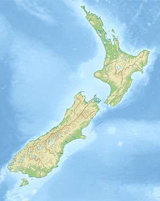 Lake Wakatipu Lake Wakatipu is in the Otago Region of the South Island. | |
| Location | Queenstown-Lakes District, Otago Region, South Island |
| Coordinates | 45°3′S 168°30′E |
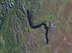
| Lake type | Glacial lake |
| Primary inflows | Dart River, Rees River |
| Primary outflows | Kawarau River |
| Catchment area | 2,674 km2 (1,032 sq mi) |
| Basin countries | New Zealand |
| Max. length | 75.2 km (46.7 mi) |
| Max. width | 5 km (3.1 mi) |
| Surface area | 289 km2 (112 sq mi) |
| Average depth | 230 metres (750 ft) |
| Max. depth | 380 metres (1,250 ft) |
| Residence time | c. 12 years |
| Surface elevation | 310 m (1,020 ft) |
| Islands | Pig Island, Pigeon Island, Tree Island & Hidden Island. |
| Settlements | Kingston, Queenstown, Glenorchy |
With a length of 80 kilometres (50 mi), it is New Zealand's longest lake, and, at 291 km2 (112 sq mi), its third largest. The lake is also very deep, its floor being below sea level, with a maximum depth of 380 metres (1,250 ft). It is at an altitude of 310 metres (1,020 ft), towards the southern end of the Southern Alps. The general topography is a reversed "N" shape or "dog leg". The Dart River flows into the northern end, the lake then runs south for 30 kilometres before turning abruptly to the east. Twenty kilometres (12.4 mi) further along, it turns sharply to the south, reaching its southern end 30 kilometres (19 mi) further south, near Kingston.
The lake is drained by the Kawarau River, which flows out from the lake's only arm, the Frankton Arm, 8 km (5.0 mi) east of Queenstown. Until about 18,000 years ago the Mataura River drained Lake Wakatipu. The Kingston Flyer follows part of the former river bed now blocked by glacial moraine.[2] Queenstown is on the northern shore of the lake close to eastern end of its middle section. It has a seiche of period 26.7 minutes which, in Queenstown Bay, causes the water level to rise and fall some 200 millimetres (7.9 in).[3]
Lake Wakatipu is renowned for its scenic beauty, being surrounded by mountains. The Remarkables mountain range lies along its southeastern edge. It is a popular venue for adventure tourism, with skifields, paragliding, bungy jumping and tramping tracks within easy reach. A vintage steamboat, the TSS Earnslaw regularly plies its waters. Several vineyards are nearby in Gibbston.

Etymology
The original form and meaning of the name are not known for certain. The name is believed to originate from the Waitaha people, who were later displaced by Kāti Māmoe. Taken literally, Wakatipu would mean "growing canoe" or possibly "growing bay" if the original was Whakatipu and the h elided as a result of the Southern Māori dialect.[4] The dialect is also known for dropping final vowels, and Wakatipua or Whakatipua (Canoe/Bay of spirits) have also been recorded historically, as has Wakatapu (sacred vessel). A legend says that the lake bed was formed when a giant ogre, Kopu-wai was burned while lying asleep, leaving only his heart behind, which according to the same legend is the cause of the rhythmic rise and fall of the lake's seiche. Waka can also mean 'hollow'.[4]
Flooding
Lake Wakatipu has experienced periodic flooding [5] affecting the lakeside communities of Kingston, Glenorchy and Queenstown. Notable flooding events include the 1878 Queenstown floods, which affected a large part of the outlying Queenstown and Otago areas, the 1995 Queenstown floods, and most notably the 1999 Queenstown floods, which significantly damaged the Queenstown CBD and road infrastructure resulting in approximately $50 million worth of damage.[6][7][8]

Wildlife
Lake Wakatipu is a habitat for the longfin eel (a specimen caught in 1886 is the largest known of this species[9]), brown trout, salmon and rainbow trout.[10] These and other fish support predators such as the pied shag. The black-billed gull is often found around the lake while the most common birds are the black-billed gull and the introduced mallard. A smaller bird often not noticed because of its size is the New Zealand scaup.
In popular culture

Film
Lake Wakatipu has many geographical similarities to Loch Ness. Therefore, it doubled as the famous Scottish Loch Ness in the film The Water Horse: Legend of the Deep (2007) and was one of the main filming locations in the movie.[11]
- It is a backdrop for several scenes in The Lord of the Rings: The Fellowship of the Ring, including Amon Hen.
Television
- It is the eponymous lake in BBC murder mystery television series Top of the Lake (2013).[12]
See also
- List of lakes in New Zealand
References
- "Māori name for Lake". Archived from the original on 2012-12-20. Retrieved 2012-06-09.
- Turnbull, I M (2000), Geology of the southeastern Eyre Mountains relevant to tenure review (PDF), Wellington, N.Z.: Department of Conservation, ISSN 1171-9834
- "Lake Wakatipu at Willow Place". www.orc.govt.nz. Retrieved 2019-05-31.
- H. Beattie (1920). "Art. XII.—The Southern Maori, and Greenstone: Addenda". Transactions and Proceedings of the Royal Society of New Zealand. 52: 51–52.
- "Lake Wakatipu flood hazard (ORC)" (PDF).
- "Flood events 1995-2004". www.civildefence.govt.nz. Retrieved 2019-05-31.
- Williams, Guy (2014-11-15). "Learning from the big flood". Otago Daily Times Online News. Retrieved 2019-05-31.
- "Back in the Day: Queenstown hit by extreme flooding". TVNZ. Retrieved 2019-05-31.
- Fishing World Records
- "Lake Wakatipu Fishing". Archived from the original on 2014-12-20. Retrieved 2011-04-28.
- Miller, Gerri. "Inside 'The Water Horse'". HowStuffWorks, Inc. Retrieved 2008-07-07.
- Lane, Megan (August 17, 2013). "Top of the Lake: Is New Zealand's greatest actor New Zealand itself?". BBC News Magazine.
External links
| Wikimedia Commons has media related to Lake Wakatipu. |
- Queenstown/Wakatipu at the Department of Conservation