Pencarrow Head
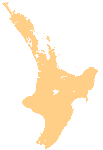
Pencarrow Head, also known as Pencarrow, is a headland in the Wellington Region of New Zealand and the name of the surrounding area. It had a population of 549, as of the 2013 New Zealand census.[1]
Pencarrow Head Pencarrow | |
|---|---|
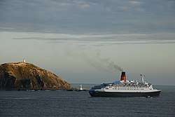 Ocean liner Queen Elizabeth 2 at Pencarrow Head | |
 Pencarrow Head Location of Pencarrow Head | |
| Coordinates: 41.3594°S 174.8482°E | |
| Country | New Zealand |
| Region | Wellington |
| Territorial authority | Lower Hutt |
| Population (2013)[1] | |
| • Total | 549 |
| Time zone | UTC+12 (NZST) |
| • Summer (DST) | UTC+13 (NZDT) |
| Postcode(s) | 5013 |
| Area code(s) | 04 |
It is the eastern headland that marks the entrance to Wellington Harbour. The area is located south of Eastbourne and is part of Lower Hutt. The area is hilly and has no road access; a walking or mountain biking track follows the coast line.[2] The head marks the northern end of Fitzroy Bay.
The main attraction of Pencarrow Head is the Pencarrow Head Lighthouse, the first permanent lighthouse in New Zealand constructed in 1859. It is one of Wellington's most notable heritage locations and New Zealand's only female lighthouse keeper, Mary Bennett, worked here. The return walk from Eastbourne takes four hours.[2][3]
The Pencarrow lakes, Lake Kohangapiripiri and Lake Kohangatera, are freshwater wetlands that were blocked from the sea by earthquake activity. Stock grazing was discontinued in 2004 and the wetlands are recovering from stock and farming impacts. The area is under joint management by the Department of Conservation and the Greater Wellington Regional Council.[4]
References
- 2013 Census QuickStats about a place : Pencarrow Head
- "Pencarrow Heads Light House Walk". FreeWalks NZ. Retrieved 31 October 2018.
- "Pencarrow Coast". Hutt City Council. Retrieved 31 October 2018.
- "Pencarrow Lakes". Department of Conservation. Retrieved 31 October 2018.
| Wikimedia Commons has media related to Pencarrow Head. |