Waimate District
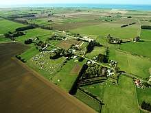
Waimate District is a territorial authority located in the Canterbury Region of the South Island of New Zealand. The main town is Waimate, while there are many smaller rural communities dispersed throughout the area. Its boundary to the south is the Waitaki River, to the west Lake Benmore and to the north-east the Pareora River.
Waimate District | |
|---|---|
 | |
| Country | New Zealand |
| Region | Canterbury region |
| District | Waimate District Council |
| Wards | Hakataramea-Waihaorunga Lower Waihao Pareora-Otaio-Makikihi Waimate |
| Government | |
| • Mayor | Craig Rowley |
| • Deputy Mayor | Sharyn Cain |
| Area | |
| • Total | 3,582.19 km2 (1,383.09 sq mi) |
| Population (June 2019)[1] | |
| • Total | 8,080 |
| • Density | 2.3/km2 (5.8/sq mi) |
| Time zone | UTC+12 (NZST) |
| • Summer (DST) | UTC+13 (NZDT) |
| Postcode(s) | |
| Postcode(s) | 7924, 7972, 7971, 7977, 7978, 7979, 7980, 7984, 7988, 7999, 9498 |
| Area code(s) | 03 |
| Website | Waimate District Council Explore Waimate |
The district is administered by the Waimate District Council and regionally by the Canterbury Regional Council. John Coles, who was first elected as a councillor in 1994, was mayor from 2004 to his retirement at the 2013 local elections.[2]
The district is the only part of New Zealand where Bennett's wallabies are prolific, after their introduction from Australia in the 19th century. The animals are a mixed blessing locally, attracting tourists but being a farm pest, and culling measures have been taken in their slowly expanding territory.[3]
Demographics
| Historical population | ||
|---|---|---|
| Year | Pop. | ±% p.a. |
| 2006 | 7,209 | — |
| 2013 | 7,536 | +0.64% |
| 2018 | 7,815 | +0.73% |
| Source: [4] | ||
Waimate District had a population of 7,815 at the 2018 New Zealand census, an increase of 279 people (3.7%) since the 2013 census, and an increase of 606 people (8.4%) since the 2006 census. There were 3,291 households. There were 3,963 males and 3,852 females, giving a sex ratio of 1.03 males per female. Of the total population, 1,359 people (17.4%) were aged up to 15 years, 1,152 (14.7%) were 15 to 29, 3,540 (45.3%) were 30 to 64, and 1,770 (22.6%) were 65 or older. Figures may not add up to the total due to rounding.
Ethnicities were 90.8% European/Pākehā, 7.3% Māori, 1.0% Pacific peoples, 5.0% Asian, and 1.9% other ethnicities. People may identify with more than one ethnicity.
The percentage of people born overseas was 14.9, compared with 27.1% nationally.
Although some people objected to giving their religion, 49.6% had no religion, 38.2% were Christian, and 3.2% had other religions.
Of those at least 15 years old, 729 (11.3%) people had a bachelor or higher degree, and 1,749 (27.1%) people had no formal qualifications. The median income was $26,900. The employment status of those at least 15 was that 3,081 (47.7%) people were employed full-time, 966 (15.0%) were part-time, and 177 (2.7%) were unemployed.[4]
Populated places
Waimate District consists of the following towns, localities, settlements and communities:
|
|
|
|
- Notes: bold - main town; bold & italics - minor town; normal text - locality; italics - minor locality; DC - former populated place of defunct Deep Creek Ward; WH - former populated place of defunct Waihao Ward
References
- "Subnational Population Estimates: At 30 June 2019". Statistics New Zealand. 22 October 2019. Retrieved 11 January 2020.
- Williams, Al (25 April 2013). "Coles calls it quits as Waimate mayor". The Timaru Herald. Retrieved 13 September 2013.
- McNeilly, H. "Wallabies invade Richie McCaw country", stuff.co.nz, 30 October 2015. Retrieved 26 April 2016.
- "Statistical area 1 dataset for 2018 Census". Statistics New Zealand. March 2020. Waimate District (066). 2018 Census place summary: Waimate District