Whanganui Inlet
Whanganui Inlet is a large natural indentation in the northwest coast of the South Island of New Zealand.
| Whanganui Inlet | |
|---|---|
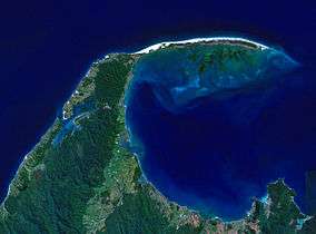 NASA satellite image of Farewell Spit. Whanganui Inlet can be seen centre left. | |
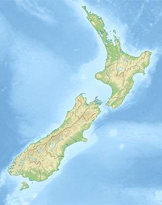 | |
| Location | Tasman District |
| Nearest city | Nelson |
| Coordinates | 40°36′S 172°33′E |
The inlet is a drowned river valley running parallel to the west coast. It is some 13 kilometres (8.1 mi) in length and on average is about 2.5 kilometres (1.6 mi) wide. A narrow channel halfway along the valley connects the inlet to the Tasman Sea.[1] This channel is located 19 kilometres (12 mi) southwest of Farewell Spit.[2]
It is still in a largely unspoilt natural state, with seagrass and salt marsh providing an environment friendly to sea life. It is a popular site for fishing and boating, and much of the inlet is protected by a wildlife management area and by the Westhaven Marine Reserve.[3]
References
- Freeman, L., "Westhaven (Whanganui Inlet) marine and wildlife reserve", AA New Zealand. Retrieved 15 September 2018.
- Walrond, C., "Whanganui Inlet", Te Ara - the Encyclopedia of New Zealand. 22 Apr 2015. Retrieved 15 September 2018
- "Whanganui Inlet", Tasman District Council. 13 November 2017. Retrieved 15 September 2018.
This article is issued from Wikipedia. The text is licensed under Creative Commons - Attribution - Sharealike. Additional terms may apply for the media files.