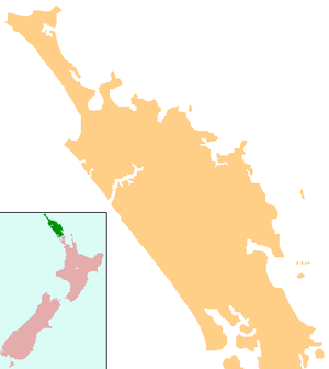
Karikari Peninsula
The Karikari Peninsula on the east coast of the far north of Northland is between Rangaunu Harbour to the west, and Doubtless Bay to the southeast. It is a right-angled land mass of two relatively distinct parts. The rocky northern part, which has an east–west orientation and is approximately 17 km long, was originally an island[1] but is now connected to the mainland by a low sandy tombolo approximately 11 km long, which has a north–south orientation.[2][3][4] The spiritually significant Puwheke sits high above the north-facing beaches.[5]
Demographics
| Historical population | ||
|---|---|---|
| Year | Pop. | ±% p.a. |
| 2006 | 942 | — |
| 2013 | 1,164 | +3.07% |
| 2018 | 1,251 | +1.45% |
| Source: [6] | ||
Karikari Peninsula had a population of 1,251 at the 2018 New Zealand census, an increase of 87 people (7.5%) since the 2013 census, and an increase of 309 people (32.8%) since the 2006 census. There were 465 households. There were 630 males and 624 females, giving a sex ratio of 1.01 males per female. Of the total population, 225 people (18.0%) were aged up to 15 years, 123 (9.8%) were 15 to 29, 579 (46.3%) were 30 to 64, and 324 (25.9%) were 65 or older. Figures may not add up to the total due to rounding.
Ethnicities were 69.5% European/Pākehā, 44.4% Māori, 5.8% Pacific peoples, 1.4% Asian, and 1.9% other ethnicities. People may identify with more than one ethnicity.
The percentage of people born overseas was 10.3, compared with 27.1% nationally.
Although some people objected to giving their religion, 45.8% had no religion, 43.9% were Christian, and 4.6% had other religions.
Of those at least 15 years old, 96 (9.4%) people had a bachelor or higher degree, and 222 (21.6%) people had no formal qualifications. The median income was $22,400. The employment status of those at least 15 was that 399 (38.9%) people were employed full-time, 165 (16.1%) were part-time, and 63 (6.1%) were unemployed.[6]
History and culture
The local iwi are Ngāti Kahu.[7] In Māori mythology, the waka Waipapa, captained by Kaiwhetu and Wairere, made its first landing in New Zealand at Karikari.[8]
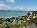
The two largest settlements are Whatuwhiwhi, which is situated the south side of the north-eastern part of the peninsula and nearby Tokerau Beach, which lies at the northern end of the eastern side of the sandy strip. Maitai Bay (also known as Matai Bay) on the northeast coast and Rangiputa on the west coast are popular tourist destinations.[9]
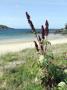
The tombolo once had kauri forests, but now the only vegetation is short scrub, some gorse and wīwī (rushes).[10] Grapes are grown on the northern side of Karikari.[1]
Marae
The Karikari Peninsula has two marae affiliated with Ngāti Kahu hapū.[11] Haiti-tai-marangai Marae and meeting house are affiliated with Te Rorohuri / Te Whānau Moana. Werowero Marae is affiliated with Ngāti Tara ki Werowero.[12]
Notes
| Wikimedia Commons has media related to Karikari. |
- "Mangonui and district". Te Ara: The Encyclopedia of New Zealand.
- Parkes, W. F. (c. 1965). The Visitors' Guide to the Far North - Mangonui County (3rd ed.). p. 26.
- Peter Dowling (editor) (2004). Reed New Zealand Atlas. Reed Books. pp. map 3. ISBN 0-7900-0952-8.CS1 maint: extra text: authors list (link)
- Roger Smith, GeographX (2005). The Geographic Atlas of New Zealand. Robbie Burton. pp. map 17. ISBN 1-877333-20-4.
- "Puwheke". Retrieved 24 November 2011.
- "Statistical area 1 dataset for 2018 Census". Statistics New Zealand. March 2020. Karikari Peninsula (100400). 2018 Census place summary: Karikari Peninsula
- "Ngāti Kurī, Ngāi Takoto, Te Pātū and Ngāti Kahu". Te Ara: The Encyclopedia of New Zealand.
- "Canoe traditions - Other northern canoes". Te Ara: The Encyclopedia of New Zealand.
- "All about the Doubtless Bay area". Doubtless Bay Promotion Inc.
- "Doubtless Bay". An Encyclopedia of New Zealand 1966, Te Ara. Retrieved 12 December 2011.
- "Māori Maps". maorimaps.com. Te Potiki National Trust.
- "Te Kāhui Māngai directory". tkm.govt.nz. Te Puni Kōkiri.