Clarkesville, Georgia
Clarkesville is a city that is the county seat of Habersham County, Georgia, United States. As of the 2010 census it had a population of 1,733,[5] up from 1,248 at the 2000 census.
Clarkesville, Georgia | |
|---|---|
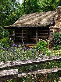 Historic Big Holly Cabin at the Mauldin House in Clarkesville | |
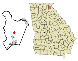 Location in Habersham County and the state of Georgia | |
| Coordinates: 34°36′38″N 83°31′30″W | |
| Country | United States |
| State | Georgia |
| County | Habersham |
| Named for | John C. Clarke |
| Area | |
| • Total | 2.49 sq mi (6.44 km2) |
| • Land | 2.46 sq mi (6.37 km2) |
| • Water | 0.03 sq mi (0.07 km2) |
| Elevation | 1,355 ft (413 m) |
| Population (2010) | |
| • Total | 1,733 |
| • Estimate (2018)[2] | 1,841 |
| • Density | 748.98/sq mi (289.22/km2) |
| Time zone | UTC-5 (Eastern (EST)) |
| • Summer (DST) | UTC-4 (EDT) |
| ZIP code | 30523-4712 |
| Area code(s) | 706 |
| FIPS code | 13-16460[3] |
| GNIS feature ID | 0355174[4] |
| Website | clarkesvillega |
History
Clarkesville was founded in 1821 as the seat of Habersham County.[6] The community was named after John Clark.[7]
Geography
Clarkesville is located in central Habersham County at 34°36′38″N 83°31′30″W (34.610521, -83.525056),[8] on the south side of the Soquee River, a southwest-flowing tributary of the Chattahoochee River. It is 4 miles (6 km) north of Demorest, 15 miles (24 km) east of Cleveland, 13 miles (21 km) west of Toccoa, and 13 miles southwest of Tallulah Falls.
According to the United States Census Bureau, the city has a total area of 2.49 square miles (6.45 km2), of which 2.46 square miles (6.37 km2) are land and 0.03 square miles (0.08 km2), or 1.20%, are water.[5]
Demographics
| Historical population | |||
|---|---|---|---|
| Census | Pop. | %± | |
| 1850 | 502 | — | |
| 1870 | 263 | — | |
| 1880 | 291 | 10.6% | |
| 1890 | 396 | 36.1% | |
| 1900 | 491 | 24.0% | |
| 1910 | 528 | 7.5% | |
| 1920 | 542 | 2.7% | |
| 1930 | 617 | 13.8% | |
| 1940 | 850 | 37.8% | |
| 1950 | 1,106 | 30.1% | |
| 1960 | 1,352 | 22.2% | |
| 1970 | 1,294 | −4.3% | |
| 1980 | 1,348 | 4.2% | |
| 1990 | 1,151 | −14.6% | |
| 2000 | 1,248 | 8.4% | |
| 2010 | 1,733 | 38.9% | |
| Est. 2018 | 1,841 | [2] | 6.2% |
| U.S. Decennial Census[9] | |||
As of the census[3] of 2000, there were 1,248 people, 580 households, and 335 families residing in the city. The population density was 670.6 people per square mile (259.1/km2). There were 639 housing units at an average density of 343.3 per square mile (132.6/km2). The racial makeup of the city was 90.06% White, 7.77% African American, 0.16% Native American, 0.72% Asian, 0.32% from other races, and 0.96% from two or more races. Hispanic or Latino of any race were 1.36% of the population.
There were 580 households, out of which 20.9% had children under the age of 18 living with them, 42.1% were married couples living together, 13.8% had a female householder with no husband present, and 42.2% were non-families. 39.0% of all households were made up of individuals, and 23.6% had someone living alone who was 65 years of age or older. The average household size was 2.06 and the average family size was 2.72.
In the city, the population was spread out, with 19.1% under the age of 18, 7.9% from 18 to 24, 25.0% from 25 to 44, 20.8% from 45 to 64, and 27.2% who were 65 years of age or older. The median age was 44 years. For every 100 females, there were 80.9 males. For every 100 females age 18 and over, there were 80.0 males.
The median income for a household in the city was $27,880, and the median income for a family was $39,148. Males had a median income of $26,316 versus $23,977 for females. The per capita income for the city was $20,265. About 9.9% of families and 14.9% of the population were below the poverty line, including 19.8% of those under age 18 and 16.6% of those age 65 or over.
Education
The Habersham County School District holds pre-school to grade twelve, and consists of eight elementary schools, three middle schools, and two high schools.[10] The district has 367 full-time teachers and over 5,955 students.[11]
Government
The current mayor is Barrie Aycock, the second female mayor in Clarkesville's history.[12] She replaced previous mayor, Dr. Terry Greene,[13] who died on 14 December 2015, following a self-inflicted gunshot wound to the head.[14]
Notable people
- Red Barron, football and baseball player
- McKenzie Coan, 2016 Paralympic gold medalist[15]
- Oliver Clyde Fuller, banker, financier, and golfer
- April Masini, advice columnist, relationship expert and entertainment industry executive
- Johnny Mize, baseball player
- Benjamin Purcell, U.S. Army officer and state legislator
Other
The 2012 film Wanderlust was mostly filmed in Clarkesville, largely near or on New Liberty Road. This message appears at the end of the movie's credits: "Thank you to the residents of Clarkesville, Georgia, for your hospitality."
References
- "2018 U.S. Gazetteer Files". United States Census Bureau. Retrieved Feb 12, 2020.
- "Population and Housing Unit Estimates". Retrieved June 4, 2019.
- "U.S. Census website". United States Census Bureau. Retrieved 2008-01-31.
- "US Board on Geographic Names". United States Geological Survey. 2007-10-25. Retrieved 2008-01-31.
- "Geographic Identifiers: 2010 Demographic Profile Data (G001): Clarkesville city, Georgia". American Factfinder. U.S. Census Bureau. Retrieved May 15, 2017.
- Hellmann, Paul T. (May 13, 2013). Historical Gazetteer of the United States. Routledge. p. 223. Retrieved 30 November 2013.
- Krakow, Kenneth K. (1975). Georgia Place-Names: Their History and Origins (PDF). Macon, GA: Winship Press. p. 44. ISBN 0-915430-00-2.
- "US Gazetteer files: 2010, 2000, and 1990". United States Census Bureau. 2011-02-12. Retrieved 2011-04-23.
- "Census of Population and Housing". Census.gov. Retrieved June 4, 2015.
- Georgia Board of Education, Retrieved June 11, 2010.
- School Stats, Retrieved June 11, 2010.
- http://accesswdun.com/article/2016/2/371565/aycock-begins-service-as-clarkesvilles-second-female-mayor
- Regional election results for North Georgia November 5, 2013 Access NorthGA
- GBI: Clarkesville mayor died of a self-inflicted gunshot wound December 17, 2015 AJC.com
- http://www.teamusa.org/News/2016/September/09/McKenzie-Coan-Leads-Team-USAs-Three-Medal-Day-In-The-Pool-With-50-Meter-Freestyle-Gold
External links
| Wikimedia Commons has media related to Clarkesville, Georgia. |
- Official website
- Grace Protestant Episcopal Church historical marker
Municipalities and communities of Habersham County, Georgia, United States | ||
|---|---|---|
| Cities | 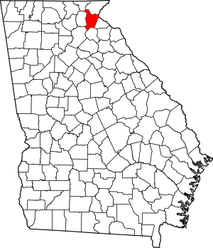 Map of Georgia highlighting Habersham County | |
| Towns | ||
| CDP | ||
| Unincorporated communities | ||
| Footnotes | ‡This populated place also has portions in an adjacent county or counties | |
| Authority control |
|
|---|