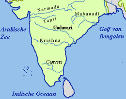
Malkangiri district
Malkangiri district is the southwesternmost district of the state of Odisha. It has two Vidhan sabha constituencies and has more than 600,000 population.
Malkangiri | |
|---|---|
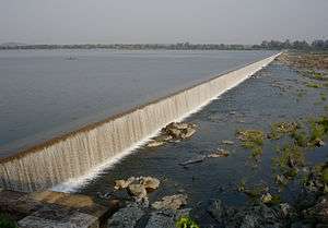
 Malkangiri dam | |
 Location in Odisha, India | |
| Coordinates: 18.25°N 82.13°E | |
| Country | India |
| State | Odisha |
| Headquarters | Malkangiri |
| Government | |
| • Collector & District Magistrate | Shri Manish Agarwal, IAS |
| • Divisional Forest Officer Cum Wildlife Warden | Shri Mirase Pradeep Devidas, IFS |
| • Superintendent of Police | Shri Rishikesh Dnyandeo Khilari, IPS |
| Area | |
| • Total | 5,791 km2 (2,236 sq mi) |
| Elevation | 195 m (640 ft) |
| Population (2011) | |
| • Total | 613,192 |
| • Density | 83/km2 (210/sq mi) |
| Languages | |
| • Official | Odia, English |
| Time zone | UTC+5:30 (IST) |
| PIN | 764 xxx |
| Vehicle registration | OD-30 |
| Sex ratio | 1.004 ♂/♀ |
| Literacy | 49.49%[1] |
| Lok Sabha constituency | Nabarangpur(ST) |
| Vidhan Sabha constituency | 2
|
| Climate | Aw (Köppen) |
| Precipitation | 1,700 millimetres (67 in) |
| Avg. summer temperature | 47 °C (117 °F) |
| Avg. winter temperature | 13 °C (55 °F) |
| Website | www |
| This article is part of a series on |
| Odisha |
|---|
 |
| Governance |
|
| Topics |
| GI Products |
|
|
Districts Divisions |
|
|
Economy
In 2006 the Ministry of Panchayati Raj named Malkangiri one of the country's 250 most backward districts (out of a total of 640).[2] It is one of the 19 districts in Odisha currently receiving funds from the Backward Regions Grant Fund Programme (BRGF).[2]
Demographics
According to the 2011 census Malkangiri district has a population of 613,192,[3] roughly equal to the nation of Solomon Islands[4] or the US state of Vermont.[5] This gives it a ranking of 523rd in India (out of a total of 640).[3] The district has a population density of 106 inhabitants per square kilometre (270/sq mi) .[3] Its population growth rate over the decade 2001-2011 was 21.53%.[3] Malkangiri has a sex ratio of 1016 females for every 1000 males,[3] and a literacy rate of 49.49%.[3]
At the time of the 2011 Census of India, 41.99% of the population in the district spoke Odia, 23.40% Koya, 21.48% Bengali, 2.97% Telugu, 2.59% Kuvi, 1.36% Halbi, 0.59% Gutob, 0.52% Hindi and 0.49% Santali as their first language.[6]
| Historical population | ||
|---|---|---|
| Year | Pop. | ±% p.a. |
| 1901 | 58,275 | — |
| 1911 | 70,059 | +1.86% |
| 1921 | 67,874 | −0.32% |
| 1931 | 80,047 | +1.66% |
| 1941 | 94,894 | +1.72% |
| 1951 | 106,637 | +1.17% |
| 1961 | 141,955 | +2.90% |
| 1971 | 268,865 | +6.60% |
| 1981 | 335,169 | +2.23% |
| 1991 | 422,326 | +2.34% |
| 2001 | 504,198 | +1.79% |
| 2011 | 613,192 | +1.98% |
| source:[7] | ||
Politics
Vidhan sabha constituencies
The following is the 2 Vidhan sabha constituencies[8][9] of Malkangiri district and the elected members[10] of that area
| No. | Constituency | Reservation | Extent of the Assembly Constituency (Blocks) | Member of 14th Assembly | Party |
|---|---|---|---|---|---|
| 146 | Malkangiri | ST | Malkangiri (NAC), Kalimela, Malkangiri, Podia, Korukunda (part) | Manas Madkami | BJD |
| 147 | Chitrakonda | ST | Balimela (NAC), Mathili, Kudumulugumma, Khairaput, Korukonda (part) | Dambaru Sisa | BJD |
References
- http://ordistricts.nic.in/district_profile/dist_glance.php
- Ministry of Panchayati Raj (September 8, 2009). "A Note on the Backward Regions Grant Fund Programme" (PDF). National Institute of Rural Development. Archived from the original (PDF) on April 5, 2012. Retrieved September 27, 2011.
- "District Census 2011". Census2011.co.in. 2011. Retrieved 2011-09-30.
- US Directorate of Intelligence. "Country Comparison:Population". Retrieved 2011-10-01.
Solomon Islands 571,890 July 2011 est.
- "2010 Resident Population Data". U. S. Census Bureau. Archived from the original on 2011-10-28. Retrieved 2011-09-30.
Vermont 625,741
- 2011 Census of India, Population By Mother Tongue
- Decadal Variation In Population Since 1901
- Assembly Constituencies and their EXtent
- Seats of Odisha
- "List of Member in Fourteenth Assembly". ws.ori.nic.in. Archived from the original on 2 May 2007. Retrieved 19 February 2013.
Member Name
External links
Places adjacent to Malkangiri district | ||||||||||
|---|---|---|---|---|---|---|---|---|---|---|
| ||||||||||
Capital: Bhubaneswar | |||||||
| Governance |
|  | |||||
| Topics | |||||||
| GI products | |||||||
| Districts by division |
| ||||||
| Cities | |||||||