Angul district
Angul is an administrative and municipal district, one of the thirty in Odisha, India. The city of Angul is the district of Angul's headquarters.
Angul district | |
|---|---|
 | |
 Seal | |
 | |
| Coordinates: 20.833°N 85.1°E | |
| Country | |
| State | Odisha |
| Established | 1 April 1993 |
| Headquarters | Angul |
| Government | |
| • Type | Municipality |
| • Collector & District Magistrate | Manoj Kumar Mohanty |
| • Divisional Forest Officer Cum Wildlife Warden | Karthick V |
| Area | |
| • Total | 6,232 km2 (2,406 sq mi) |
| Elevation | 875.5 m (2,872.4 ft) |
| Population (2011) | |
| • Total | 1,273,821[1] |
| • Density | 199/km2 (520/sq mi) |
| Languages | |
| • Official | Odia, English |
| Time zone | UTC+5:30 (IST) |
| PIN | 759100–759xxx |
| Telephone code | 06764 |
| Vehicle registration | Angul OD-19, Talcher OD-35 |
| Nearest cities | Cuttack, Bhubaneswar, Sambalpur |
| Sex ratio | 0.942 ♂/♀ |
| Literacy | 78.96% |
| Vidhan Sabha constituency | 5 |
| Climate | Aw (Köppen) |
| Precipitation | 1,421 mm (55.9 in) |
| Average summer temperature | 47 °C (117 °F) |
| Average winter temperature | 10 °C (50 °F) |
| Website | angul |
| Subdivisions: | 4 |
| Blocks: | 8 |
| Municipalities: | 2 |
| N.A.C.: | 2 |
| Tehsils: | 5 |
| Forest Coverage: | 2,716.82 km2 (1,048.97 sq mi) |
| Villages: | 1,922 |
| Grama panchayat: | 180 |
| Towns: | 9 |
Geography
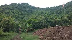
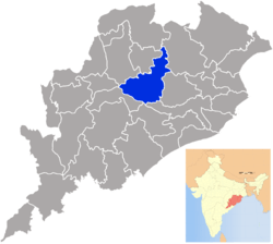
Angul is located in the centre of the state of Odisha and lies between the latitudes of 20°31′N and 21°40′N and longitudes of 84°15′E and 85°23′E. The altitude is between 564 and 1,187 metres (1,850 and 3,894 ft).[2] The district has an area of 6,232 km2 (2,406 sq mi). It is bounded by Dhenkanal and Cuttack district in the east, Deogarh, Kendujhar and Sundargarh district in north, Sambalpur and Sonepur in west and Boudh and Nayagarh in the south side. The district is abundant with natural resources. Angul, The district headquarters is about 150 kilometres (93 mi) from the state capital Bhubaneswar.
A study jointly conducted by Indian Institute of Technology, Delhi (IIT-D) and Central Pollution Control Board (CPCB) reveals that Angul district is among the top ten most polluted Indian cities where the pollution level reached a "very alarming" level.[3]
Divisions
The following is the list of blocks, tehsils and subdivisions in the district of Angul:
Subdivisions
Blocks
- Angul Sadar
- Athamalik Sadar
- Chhendipada
- Talcher Sadar
- Pallahada Sadar
- Banarpal
- Kishorenagar
- Kaniha
Tehsils
- Angul
- Athamalik
- Talcher
- Pallahada
- Chendipada
- Banarpal
- Kishorenagar
- Kaniha
Demographics
According to the 2011 census, Angul district has a population of 1,273,821,[4] roughly equal to the nation of Estonia[5] or the US state of New Hampshire.[6] This gives it a ranking of 380th in India (out of a total of 640).[4] The district has a population density of 199 inhabitants per square kilometre (520/sq mi).[4] Its population growth rate over the decade 2001–2011 was 11.55%.[4] Anugul has a sex ratio of 942 females for every 1000 males,[4] and a literacy rate of 78.96%.[4]
At the time of the 2011 Census of India, 95.50% of the population in the district spoke Odia, 1.40% Ho, 1.30% Hindi and 0.51% Santali as their first language.[7]
| Historical population | ||
|---|---|---|
| Year | Pop. | ±% p.a. |
| 1901 | 278,144 | — |
| 1911 | 287,294 | +0.32% |
| 1921 | 250,480 | −1.36% |
| 1931 | 309,044 | +2.12% |
| 1941 | 360,714 | +1.56% |
| 1951 | 408,041 | +1.24% |
| 1961 | 500,033 | +2.05% |
| 1971 | 628,537 | +2.31% |
| 1981 | 785,734 | +2.26% |
| 1991 | 961,037 | +2.03% |
| 2001 | 1,140,003 | +1.72% |
| 2011 | 1,273,821 | +1.12% |
| source:[8] | ||
Politics
Legislative Assembly Constituencies
The following are the five Vidhan Sabha constituencies[9][10] of Angul district and the elected members[11] of the Angul district:
| No. | Constituency | Reservation | Extent of the Assembly Constituency (Blocks) | Member of 14th Assembly | Party |
|---|---|---|---|---|---|
| 59 | Pallahara | None | Pallahara, Kaniha (part) | Mahesh Sahoo | BJD |
| 60 | Talcher | None | Talcher (M), Talcher, Kaniha (part) | Braja Kishore Pradhan | BJD |
| 61 | Angul | None | Angul (M), NALCO (C. T), Angul (part), Banarpal (part) | Rajani Kant Singh | BJD |
| 62 | Chhendipada | SC | Chhendipada, Banarpal (part) | Sushanta Behera | BJD |
| 63 | Athmallik | None | Athmallik (NAC), Athmallik, Kishorenagar, Angul (part) | Surendra Sai | BJD |
Lok Sabha constituencies
Since 2008, Angul district is represented in Dhenkanal (Lok Sabha constituency) and Sambalpur (Lok Sabha constituency).
Angul (Lok Sabha constituency) does not exist in 1952 general elections to 1st Lok Sabha. However it is created from 2nd till 5th Lok Sabha during 1957 till 1976. Badakumar Pratap Gangadeb got elected in 1957 and 1971 for 2nd and 5th Lok Sabha while Harekrushna Mahatab was elected in 1962 to 3rd and D. N. Deb was elected in 1967 to 4th Lok Sabha. Angul Seat ceased after the creation of Deogarh (Lok Sabha constituency) in 1977 from 6th Lok Sabha. Deogarh seat was also delimited in 2008.[12]
References
- "Anugul (Angul) District Population Census 2011, Orissa literacy sex ratio and density". census2011.co.in. Archived from the original on 6 January 2015. Retrieved 9 February 2015.
- "Census of India 2001: Data from the 2001 Census, including cities, villages and towns (Provisional)". Census Commission of India. Archived from the original on 16 June 2004. Retrieved 1 November 2008.
- "Angul-Talcher seventh most polluted industrial cluster in the country". The Hindu. 5 January 2010.
- "District Census 2011". Census2011.co.in. 2011. Archived from the original on 11 June 2011. Retrieved 30 September 2011.
- US Directorate of Intelligence. "Country Comparison:Population". Archived from the original on 27 September 2011. Retrieved 1 October 2011.
Estonia 1,282,963 July 2011 est.
- "2010 Resident Population Data". U. S. Census Bureau. Archived from the original on 19 October 2013. Retrieved 30 September 2011.
New Hampshire 1,316,470
- 2011 Census of India, Population By Mother Tongue
- Decadal Variation In Population Since 1901
- "Assembly Constituencies and their EXtent" (PDF). Archived (PDF) from the original on 5 March 2016. Retrieved 28 February 2013.
- "Seats of Odisha". Archived from the original on 5 March 2016. Retrieved 28 February 2013.
- "List of Member in Fourteenth Assembly". ws.ori.nic.in. Archived from the original on 2 May 2007. Retrieved 19 February 2013.
MEMBER NAME
- "All Members of Lok Sabha (Since 1952) Members Biographical Sketches". Archived from the original on 29 July 2017. Retrieved 21 December 2017.
External links
| Wikimedia Commons has media related to Angul district. |
Places adjacent to Angul district | ||||||||||
|---|---|---|---|---|---|---|---|---|---|---|
| ||||||||||
Capital: Bhubaneswar | |||||||
| Governance |
|  | |||||
| Topics | |||||||
| GI products | |||||||
| Districts by division |
| ||||||
| Cities | |||||||