Warren, Pennsylvania
| Warren | |
|---|---|
| City | |
| City of Warren | |
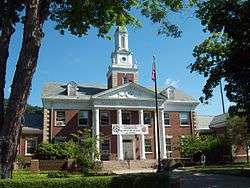 Warren Municipal Building, July 2012 | |
| Etymology: General Joseph Warren | |
| Motto(s): "On the Banks of the Allegheny" | |
 Location of Warren in Warren County, Pennsylvania. | |
 Location of Pennsylvania in the United States | |
 Warren Location of Warren within Pennsylvania | |
| Coordinates: 41°50′39″N 79°8′33″W / 41.84417°N 79.14250°WCoordinates: 41°50′39″N 79°8′33″W / 41.84417°N 79.14250°W | |
| Country | United States |
| State | Pennsylvania |
| County | Warren County |
| Founded | 1795 |
| Government | |
| • Mayor | Maurice Cashman |
| Area[1] | |
| • Total | 3.09 sq mi (8.00 km2) |
| • Land | 2.91 sq mi (7.55 km2) |
| • Water | 0.17 sq mi (0.45 km2) |
| Elevation | 1,210 ft (370 m) |
| Population (2010) | |
| • Total | 9,710 |
| • Estimate (2016)[2] | 9,244 |
| • Density | 3,173.36/sq mi (1,225.17/km2) |
| Time zone | UTC-5 (EST) |
| • Summer (DST) | UTC-4 (EDT) |
| ZIP Code | 16365 |
| Area code(s) | 814 |
| FIPS code | 42-81000 |
| Website | www.cityofwarrenpa.org |
Warren is a city in Warren County, Pennsylvania, United States, located along the Allegheny River. The population was 9,710 at the 2010 census. It is the county seat of Warren County.[3] It is home to the headquarters of the Allegheny National Forest and the Cornplanter State Forest. It is also the headquarters for the Chief Cornplanter Council, the oldest continuously chartered Boy Scouts of America Council, and the catalog company Blair. Warren is the principal city of the Warren, PA Micropolitan Statistical Area.
History
Warren was initially inhabited by Native Americans of the Seneca nation. French explorers had longstanding claims to the area which they acted to secure in an unambiguous fashion with a military-Amerindian expedition in 1749 that buried a succession of plaques claiming the territory as France's in response to the formation of the colonial Ohio Company—and the first of these was buried in Warren[4] but ultimately control was transferred to the British after the French and Indian War. After the Revolutionary War, General William Irvine and Andrew Ellicott were sent to the area to lay out a town in 1795. It was named after Major General Joseph Warren.[5] The first permanent structure in Warren, a storehouse built by the Holland Land Company, was completed in 1796. Daniel McQuay of Ireland was the first permanent inhabitant of European descent. Lumber was the main industry from 1810–1840, as the abundance of wood and access to water made it profitable to float lumber down the Allegheny River to Pittsburgh.
David Beaty discovered oil in Warren in 1875 while drilling for natural gas in his wife's flower garden. Oil came to dominate the city's economy. Many of the town's large Victorian homes were built with revenue generated by the local oil and timber industries.
In recent years, Warren has struggled through hard economic times and a steady decline in population (after peaking at nearly 15,000 residents in 1940), but the city is attempting to bounce back with the Impact Warren project, a riverfront development project in downtown Warren. The completed project will include new townhouses and senior citizen housing, retail and commercial development, a parking garage, convention center and bus depot.

Major employers include Walmart, the United Refining Company (gas supplier for Kwik Fill and Red Apple Food Mart gas stations), Allegheny National Forest, Northwest Savings Bank, Whirley-Drinkworks, Superior Tire and Rubber Corporation, Pennsylvania General Energy, Betts Industries, Inc, Blair Corporation, Sheetz, and Interlectric.
The Warren Historic District, A.J. Hazeltine House, John P. Jefferson House, Struthers Library Building, Warren Armory, Warren County Courthouse, Wetmore House, Guy Irvine House ("The Locusts") and Woman's Club of Warren are listed on the National Register of Historic Places.[6]
Geography
Warren is located at 41°50′39″N 79°8′33″W / 41.84417°N 79.14250°W (41.844133, -79.142443).[7] The city is located at the confluence of the Allegheny River and the Conewango Creek. The Conewango Creek flows between New York State and Warren, and the Allegheny Reservoir and Kinzua Dam are nearby.
According to the United States Census Bureau, the city has a total area of 3.1 square miles (8.0 km2), of which 2.9 square miles (7.5 km2) is land and 0.2 square miles (0.52 km2) (6.11%) is water.
The Allegheny River from the Kinzua Dam to the City of Warren has been designated a "Recreational Waterway" by the United States Congress.
Climate
| Climate data for Warren, Pennsylvania | |||||||||||||
|---|---|---|---|---|---|---|---|---|---|---|---|---|---|
| Month | Jan | Feb | Mar | Apr | May | Jun | Jul | Aug | Sep | Oct | Nov | Dec | Year |
| Record high °F (°C) | 74 (23) |
75 (24) |
83 (28) |
92 (33) |
93 (34) |
97 (36) |
102 (39) |
111 (44) |
104 (40) |
90 (32) |
84 (29) |
74 (23) |
111 (44) |
| Average high °F (°C) | 32 (0) |
35 (2) |
45 (7) |
58 (14) |
74 (23) |
81 (27) |
83 (28) |
84 (29) |
78 (26) |
66 (19) |
48 (9) |
36 (2) |
60 (16) |
| Daily mean °F (°C) | 25 (−4) |
27 (−3) |
35 (2) |
47 (8) |
57 (14) |
66 (19) |
70 (21) |
69 (21) |
62 (17) |
51 (11) |
40 (4) |
29 (−2) |
48 (9) |
| Average low °F (°C) | 17 (−8) |
18 (−8) |
24 (−4) |
35 (2) |
54 (12) |
60 (16) |
64 (18) |
66 (19) |
63 (17) |
48 (9) |
32 (0) |
22 (−6) |
42 (6) |
| Record low °F (°C) | −23 (−31) |
−34 (−37) |
−18 (−28) |
10 (−12) |
21 (−6) |
29 (−2) |
37 (3) |
36 (2) |
26 (−3) |
14 (−10) |
2 (−17) |
−12 (−24) |
−34 (−37) |
| Average precipitation inches (mm) | 3.2 (81) |
2.8 (71) |
3.3 (84) |
3.9 (99) |
4.3 (109) |
5.0 (127) |
4.8 (122) |
4.4 (112) |
4.0 (102) |
3.6 (91) |
4.1 (104) |
3.9 (99) |
47.3 (1,201) |
| Source: [8] | |||||||||||||
Demographics
| Historical population | |||
|---|---|---|---|
| Census | Pop. | %± | |
| 1840 | 737 | — | |
| 1850 | 1,013 | 37.4% | |
| 1860 | 1,738 | 71.6% | |
| 1870 | 2,014 | 15.9% | |
| 1880 | 2,810 | 39.5% | |
| 1890 | 4,332 | 54.2% | |
| 1900 | 8,043 | 85.7% | |
| 1910 | 11,080 | 37.8% | |
| 1920 | 14,272 | 28.8% | |
| 1930 | 14,863 | 4.1% | |
| 1940 | 14,891 | 0.2% | |
| 1950 | 14,849 | −0.3% | |
| 1960 | 14,505 | −2.3% | |
| 1970 | 12,998 | −10.4% | |
| 1980 | 12,146 | −6.6% | |
| 1990 | 11,122 | −8.4% | |
| 2000 | 10,259 | −7.8% | |
| 2010 | 9,710 | −5.4% | |
| Est. 2016 | 9,244 | [2] | −4.8% |
| Sources:[9][10][11][12] | |||
As of the census[11] of 2000, there were 10,259 people, 4,565 households, and 2,606 families residing in the city. The population density was 3,508.3 people per square mile (1,356.5/km²). There were 5,046 housing units at an average density of 1,725.6 per square mile (667.2/km²). The racial makeup of the city was 98.53% White, 0.20% African American, 0.20% Native American, 0.36% Asian, 0.02% Pacific Islander, 0.13% from other races, and 0.56% from two or more races. Hispanic or Latino of any race were 0.39% of the population.
There were 4,566 households out of which 27.2% had children under the age of 18 living with them, 43.0% were married couples living together, 10.8% had a female householder with no husband present, and 42.9% were non-families. 37.6% of all households were made up of individuals and 16.4% had someone living alone who was 65 years of age or older. The average household size was 2.17 and the average family size was 2.87.
In the city, the population was spread out with 23.1% under the age of 18, 7.0% from 18 to 24, 28.4% from 25 to 44, 23.4% from 45 to 64, and 18.1% who were 65 years of age or older. The median age was 39 years. For every 100 females, there were 88.5 males. For every 100 females age 18 and over, there were 83.9 males.
The median income for a household in the city was $32,384, and the median income for a family was $41,986. Males had a median income of $32,049 versus $22,969 for females. The per capita income for the city was $18,272. About 8.0% of families and 10.7% of the population were below the poverty line, including 11.5% of those under age 18 and 6.0% of those age 65 or over.
Notable people
- William Clinger, Jr., U.S. Representative
- Ed O'Neil, NFL player & All American
- Gudrun Ensslin, founder member of German terrorist group the Red Army Faction, spent a year in the United States aged eighteen, where she attended high school in Warren. She graduated in the Honor Group at Warren High School in 1959.
- Earl Hanley Beshlin (April 28, 1870 – July 12, 1971) was a Democratic member of the U.S. House of Representatives from Pennsylvania.
He was born in Conewango Township, Pennsylvania. He graduated from Warren High School in Warren, Pennsylvania. He became a lawyer and engaged in private practice. He was elected Burgess of Warren County, Pennsylvania, from 1906 to 1909. He served as borough solicitor of Warren County from 1914 to 1918. Elected as a Democrat and Prohibitionist to the Sixty-fifth Congress, by special election, to fill the vacancy caused by the resignation of United States Representative Orrin D. Bleakley. He was a member and later chairman of the Board of Education of Warren County from 1919-35. He was also a hospital executive. He died in 1971, in Warren, Pennsylvania and was interred in Oakland Mausoleum.
In popular culture
- Johnny Cash co-wrote and sang "As Long as the Grass Shall Grow", about the loss of Seneca nation land due to the construction of the Kinzua Dam 6 miles east (10 km) of Warren, on his October, 1964 album Bitter Tears.
- Warren was one of the featured locations in History's Revelation: The End of Days. No actual filming took place in Warren.
See also
References
- ↑ "2016 U.S. Gazetteer Files". United States Census Bureau. Retrieved Aug 14, 2017.
- 1 2 "Population and Housing Unit Estimates". Retrieved June 9, 2017.
- ↑ "Find a County". National Association of Counties. Retrieved 2011-06-07.
- ↑
Commissioners: Thomas Lynch Montgomery, Henry Melchior Muhlenberg Richards, John M. Buckalew, George Dallas Albert, Sheldon Reynolds, Jay Gilfillan Weiser, report compiled by George Dallas Albert. The frontier forts of western Pennsylvania. W.S. Ray, state printer. Report By the Commission to Locate the Site of the Frontier Forts of Pennsylvania. p. 4 (Introduction). Retrieved 2010-11-29.
Thereupon to counteract the designs of the English, the Governor-General of Canada, the Marquis de la Galissoniere, sent Celoron in 1749 down the Allegheny and Ohio riversm to take possession of the country in the name of the King of France. His command consisted of 215 French and Canadian soldiers and 55 Indians of various tribes. ... omitted ... Provided with a number of leaden plates, the left... omitted ... by means of Chatauqua creek, a portage, Chautauqua Lake and Conewango creek, they came on the 29th, to the Allegheny river, near the point now occupied by the town of Warren, in Warren County, Pa. The first of the leaden plates was buried at this point. (Q.E.D.)
- ↑ "Profile for Warren, Pennsylvania". ePodunk. Retrieved 2010-05-15.
- ↑ National Park Service (2010-07-09). "National Register Information System". National Register of Historic Places. National Park Service.
- ↑ "US Gazetteer files: 2010, 2000, and 1990". United States Census Bureau. 2011-02-12. Retrieved 2011-04-23.
- ↑ "Warren, PA Monthly weather forecast". Weather Channel. Retrieved 4 November 2016.
- ↑ "Number of Inhabitants: Pennsylvania" (PDF). 18th Census of the United States. U.S. Census Bureau. Retrieved 22 November 2013.
- ↑ "Pennsylvania: Population and Housing Unit Counts" (PDF). U.S. Census Bureau. Retrieved 22 November 2013.
- 1 2 "American FactFinder". United States Census Bureau. Retrieved 2008-01-31.
- ↑ "Annual Estimates of the Resident Population". U.S. Census Bureau. Archived from the original on 19 October 2013. Retrieved 22 November 2013.
External links
| Wikimedia Commons has media related to Warren, Pennsylvania. |
Municipalities and communities of Warren County, Pennsylvania, United States | ||
|---|---|---|
| City | 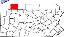 | |
| Boroughs | ||
| Townships | ||
| CDPs | ||
| Unincorporated communities | ||
| Ghost towns | ||