Hanover Township, Lehigh County, Pennsylvania
| Hanover Township | |
|---|---|
| Township | |
.JPG) Lehigh Valley International Airport | |
.svg.png) Location of Pennsylvania in the United States | |
| Coordinates: 40°38′30″N 75°27′29″W / 40.64167°N 75.45806°WCoordinates: 40°38′30″N 75°27′29″W / 40.64167°N 75.45806°W | |
| Country | United States |
| State | Pennsylvania |
| County | Lehigh |
| Area[1] | |
| • Total | 4.24 sq mi (10.97 km2) |
| • Land | 4.21 sq mi (10.89 km2) |
| • Water | 0.03 sq mi (0.07 km2) |
| Elevation | 377 ft (115 m) |
| Population (2010) | |
| • Total | 1,571 |
| • Estimate (2016)[2] | 1,588 |
| • Density | 377.56/sq mi (145.78/km2) |
| Time zone | UTC-5 (EST) |
| • Summer (DST) | UTC-4 (EDT) |
| ZIP code | 18109 |
| Area code(s) | 610 |
| FIPS code | 42-077-32400 |
| Website |
www |
Hanover Township is a township in Lehigh County, Pennsylvania, in the United States. Hanover Township is a suburb of Allentown and Bethlehem, in the Lehigh Valley region of the state.
The township's population was 1,913 at the 2000 census.
Hanover Township is best known as the home of Lehigh Valley International Airport, which serves the Lehigh Valley and surrounding areas.
Geography
According to the United States Census Bureau, the township has a total area of 4.2 square miles (11 km2), of which, 4.2 square miles (11 km2) of it is land and 0.04 square miles (0.10 km2) of it (0.47%) is water. The Lehigh River drains it and separates it from Whitehall Township.
Neighboring municipalities
- Bethlehem (east)
- Allentown (south)
- Whitehall Township (west)
- Catasauqua (west)
- North Catasauqua, Northampton County (tangent to the northwest)
- Allen Township, Northampton County (north)
- Hanover Township, Northampton County (northeast)
Demographics
| Historical population | |||
|---|---|---|---|
| Census | Pop. | %± | |
| 2000 | 1,913 | — | |
| 2010 | 1,571 | −17.9% | |
| Est. 2016 | 1,588 | [2] | 1.1% |
| U.S. Decennial Census[3] | |||
As of the census[4] of 2000, there were 1,913 people, 892 households, and 498 families residing in the township. The population density was 454.6 people per square mile (175.4/km²). There were 937 housing units at an average density of 222.7 per square mile (85.9/km²). The racial makeup of the township was 86.15% White, 5.54% African American, 0.05% Native American, 4.70% Asian, 1.99% from other races, and 1.57% from two or more races. Hispanic or Latino of any race were 6.12% of the population.
There were 892 households, out of which 20.6% had children under the age of 18 living with them, 41.1% were married couples living together, 11.3% had a female householder with no husband present, and 44.1% were non-families. 34.1% of all households were made up of individuals, and 8.9% had someone living alone who was 65 years of age or older. The average household size was 2.14 and the average family size was 2.77.
In the township the population was spread out, with 18.3% under the age of 18, 8.7% from 18 to 24, 32.9% from 25 to 44, 26.2% from 45 to 64, and 13.8% who were 65 years of age or older. The median age was 38 years. For every 100 females, there were 96.4 males. For every 100 females age 18 and over, there were 93.8 males.
The median income for a household in the township was $35,061, and the median income for a family was $41,680. Males had a median income of $31,848 versus $27,014 for females. The per capita income for the township was $20,265. About 4.0% of families and 5.6% of the population were below the poverty line, including 6.3% of those under age 18 and 8.5% of those age 65 or over.
Education
The Township is served by the Catasauqua Area School District. Its high school, for grades nine through 12, is Catasauqua High School.
Transportation
U.S. Route 22 crosses it east-to-west and interchanges in the township with Airport Road, which extends northeast toward Bath as Pennsylvania Route 987 and south into Allentown. Other local roads of note include Catasauqua Road, Dauphin Street, Irving Street, Pennsylvania Avenue, Postal Road, Race Street, and Schoenersville Road (pronounced "SHAY-nerz-vil.") The latter two meet Route 987 in the village of Schoenersville (also in Northampton County.)
Lehigh Valley International Airport is in Hanover Township.
References
- ↑ "2016 U.S. Gazetteer Files". United States Census Bureau. Retrieved Aug 14, 2017.
- 1 2 "Population and Housing Unit Estimates". Retrieved June 9, 2017.
- ↑ "Census of Population and Housing". Census.gov. Retrieved June 4, 2016.
- ↑ "American FactFinder". United States Census Bureau. Retrieved 2008-01-31.
External links
| Wikimedia Commons has media related to Hanover Township, Lehigh County, Pennsylvania. |
Municipalities and communities of Lehigh County, Pennsylvania, United States | ||
|---|---|---|
| Cities | 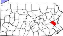 | |
| Boroughs | ||
| Townships | ||
| CDPs | ||
| Unincorporated communities |
| |
| Footnotes | ‡This populated place also has portions in an adjacent county or counties | |