Trébabu
| Trébabu Trebabu | |
|---|---|
| Commune | |
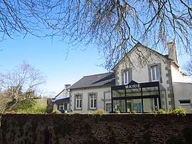 The town hall in Trébabu | |
 Trébabu Location within Brittany region  Trébabu | |
| Coordinates: 48°22′16″N 4°44′02″W / 48.3711°N 4.7339°WCoordinates: 48°22′16″N 4°44′02″W / 48.3711°N 4.7339°W | |
| Country | France |
| Region | Brittany |
| Department | Finistère |
| Arrondissement | Brest |
| Canton | Saint-Renan |
| Intercommunality | Pays d'Iroise |
| Government | |
| • Mayor (2014–2020) | Lucien Kérébel |
| Area1 | 4.36 km2 (1.68 sq mi) |
| Population (2008)2 | 371 |
| • Density | 85/km2 (220/sq mi) |
| Time zone | UTC+1 (CET) |
| • Summer (DST) | UTC+2 (CEST) |
| INSEE/Postal code | 29282 /29217 |
| Elevation | 1–58 m (3.3–190.3 ft) |
|
1 French Land Register data, which excludes lakes, ponds, glaciers > 1 km2 (0.386 sq mi or 247 acres) and river estuaries. 2 Population without double counting: residents of multiple communes (e.g., students and military personnel) only counted once. | |
Trébabu (Breton: Trebabu) is a commune in the Finistère department of Brittany in north-western France.
Population
Inhabitants of Trébabu are called in French Trébabusiens.
| Historical population | ||
|---|---|---|
| Year | Pop. | ±% |
| 1962 | 204 | — |
| 1968 | 200 | −2.0% |
| 1975 | 173 | −13.5% |
| 1982 | 273 | +57.8% |
| 1990 | 346 | +26.7% |
| 1999 | 340 | −1.7% |
| 2008 | 371 | +9.1% |
See also
References
- Mayors of Finistère Association (in French);
External links
| Wikimedia Commons has media related to Trébabu. |
- French Ministry of Culture list for Trébabu (in French)
This article is issued from
Wikipedia.
The text is licensed under Creative Commons - Attribution - Sharealike.
Additional terms may apply for the media files.