Guiler-sur-Goyen
| Guiler-sur-Goyen Gwiler-Kerne | |
|---|---|
| Commune | |
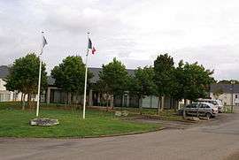 The town hall in Gwiler-sur-Goyen | |
 Guiler-sur-Goyen Location within Brittany region  Guiler-sur-Goyen | |
| Coordinates: 48°01′00″N 4°21′30″W / 48.0167°N 4.3583°WCoordinates: 48°01′00″N 4°21′30″W / 48.0167°N 4.3583°W | |
| Country | France |
| Region | Brittany |
| Department | Finistère |
| Arrondissement | Quimper |
| Canton | Plonéour-Lanvern |
| Intercommunality | Haut-Pays Bigouden |
| Government | |
| • Mayor (2014–2020) | Christian Jolivet |
| Area1 | 11.25 km2 (4.34 sq mi) |
| Population (2008)2 | 448 |
| • Density | 40/km2 (100/sq mi) |
| Time zone | UTC+1 (CET) |
| • Summer (DST) | UTC+2 (CEST) |
| INSEE/Postal code | 29070 /29710 |
| Elevation | 25–133 m (82–436 ft) |
|
1 French Land Register data, which excludes lakes, ponds, glaciers > 1 km2 (0.386 sq mi or 247 acres) and river estuaries. 2 Population without double counting: residents of multiple communes (e.g., students and military personnel) only counted once. | |
Guiler-sur-Goyen (Breton: Gwiler-Kerne) is a commune in the Finistère department of Brittany in north-western France.
Population
Inhabitants of Guiler-sur-Goyen are called in French Guileriens.
See also
References
- Mayors of Finistère Association (in French);
External links
| Wikimedia Commons has media related to Guiler-sur-Goyen. |
This article is issued from
Wikipedia.
The text is licensed under Creative Commons - Attribution - Sharealike.
Additional terms may apply for the media files.