Irvillac
| Irvillac Irvilhag | |
|---|---|
| Commune | |
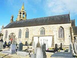 Saint Peter's church in Irvillac | |
 Irvillac Location within Brittany region  Irvillac | |
| Coordinates: 48°22′16″N 4°12′40″W / 48.3711°N 4.2111°WCoordinates: 48°22′16″N 4°12′40″W / 48.3711°N 4.2111°W | |
| Country | France |
| Region | Brittany |
| Department | Finistère |
| Arrondissement | Brest |
| Canton | Pont-de-Buis-lès-Quimerch |
| Intercommunality | Pays de Landerneau-Daoulas |
| Government | |
| • Mayor (2014–2020) | Jean-Noël Le Gall |
| Area1 | 29.60 km2 (11.43 sq mi) |
| Population (2013)2 | 1,406 |
| • Density | 48/km2 (120/sq mi) |
| Time zone | UTC+1 (CET) |
| • Summer (DST) | UTC+2 (CEST) |
| INSEE/Postal code | 29086 /29460 |
| Elevation | 3–134 m (9.8–439.6 ft) |
|
1 French Land Register data, which excludes lakes, ponds, glaciers > 1 km2 (0.386 sq mi or 247 acres) and river estuaries. 2 Population without double counting: residents of multiple communes (e.g., students and military personnel) only counted once. | |
Irvillac (Breton: Irvilhag) is a commune in the Finistère department and administrative region of Brittany in north-western France.
Population
In French the inhabitants of Irvillac are known as Irvillacois.
| Historical population | ||
|---|---|---|
| Year | Pop. | ±% |
| 1962 | 1,143 | — |
| 1968 | 983 | −14.0% |
| 1975 | 822 | −16.4% |
| 1982 | 935 | +13.7% |
| 1990 | 1,005 | +7.5% |
| 1999 | 1,011 | +0.6% |
| 2007 | 1,276 | +26.2% |
| 2013 | 1,406 | +10.2% |
See also
- Communes of the Finistère department
- Jean Joncourt, sculptor, born in Irvillac
- Roland Doré sculptor, sculptor of the calvary in Irvillac
References
- Mayors of Finistère Association (in French);
External links
| Wikimedia Commons has media related to Irvillac. |
This article is issued from
Wikipedia.
The text is licensed under Creative Commons - Attribution - Sharealike.
Additional terms may apply for the media files.