Plobannalec-Lesconil
| Plobannalec-Lesconil Plobanaleg-Leskonil | |
|---|---|
| Commune | |
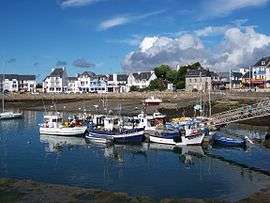 Boats in Lesconil harbour, in 2005 | |
 Plobannalec-Lesconil Location within Brittany region  Plobannalec-Lesconil | |
| Coordinates: 47°49′27″N 4°13′43″W / 47.8242°N 4.2286°WCoordinates: 47°49′27″N 4°13′43″W / 47.8242°N 4.2286°W | |
| Country | France |
| Region | Brittany |
| Department | Finistère |
| Arrondissement | Quimper |
| Canton | Pont-l'Abbé |
| Intercommunality | Pays Bigouden Sud |
| Government | |
| • Mayor (2014–2020) | Frédéric Le Loc'h |
| Area1 | 18.17 km2 (7.02 sq mi) |
| Population (2008)2 | 3,321 |
| • Density | 180/km2 (470/sq mi) |
| Time zone | UTC+1 (CET) |
| • Summer (DST) | UTC+2 (CEST) |
| INSEE/Postal code | 29165 /29740 |
| Elevation | 0–27 m (0–89 ft) |
|
1 French Land Register data, which excludes lakes, ponds, glaciers > 1 km2 (0.386 sq mi or 247 acres) and river estuaries. 2 Population without double counting: residents of multiple communes (e.g., students and military personnel) only counted once. | |
Plobannalec-Lesconil (Breton: Plobanaleg-Leskonil) is a commune in the Finistère department of Brittany in north-western France.
Population
Inhabitants of Plobannalec-Lesconil are called in French Lesconilois or Plobannalecois.
| Year | 1793 | 1800 | 1806 | 1821 | 1831 | 1836 | 1841 | 1846 | 1851 | 1856 |
|---|---|---|---|---|---|---|---|---|---|---|
| Population | 1518 | 1218 | 1285 | 1556 | 1531 | 1676 | 1728 | 1865 | 1880 | 1866 |
| Year | 1861 | 1866 | 1872 | 1876 | 1881 | 1886 | 1891 | 1896 | 1901 | 1906 |
|---|---|---|---|---|---|---|---|---|---|---|
| Population | 1910 | 1979 | 2011 | 2167 | 2208 | 2313 | 2289 | 2286 | 2565 | 2716 |
| Year | 1911 | 1921 | 1926 | 1931 | 1936 | 1946 | 1954 | 1962 | 1968 | 1975 |
|---|---|---|---|---|---|---|---|---|---|---|
| Population | 2922 | 2832 | 2822 | 2910 | 2878 | 2784 | 2765 | 2916 | 2831 | 2835 |
| Year | 1982 | 1990 | 1999 | 2008 |
|---|---|---|---|---|
| Population | 2844 | 3022 | 3007 | 3321 |
See also
- Communes of the Finistère department
- Entry on sculptor of local war memorial Jean Joncourt
References
- Mayors of Finistère Association (in French)
External links
| Wikimedia Commons has media related to Plobannalec-Lesconil. |
- Official website (in French)
- French Ministry of Culture list for Plobannalec-Lesconil (in French)
This article is issued from
Wikipedia.
The text is licensed under Creative Commons - Attribution - Sharealike.
Additional terms may apply for the media files.