Saint-Hernin
| Saint-Hernin Sant-Hern | |
|---|---|
| Commune | |
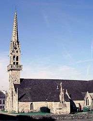 The church in Saint-Hernin | |
 Saint-Hernin Location within Brittany region  Saint-Hernin | |
| Coordinates: 48°13′06″N 3°37′59″W / 48.2183°N 3.6331°WCoordinates: 48°13′06″N 3°37′59″W / 48.2183°N 3.6331°W | |
| Country | France |
| Region | Brittany |
| Department | Finistère |
| Arrondissement | Châteaulin |
| Canton | Carhaix-Plouguer |
| Intercommunality | Poher |
| Government | |
| • Mayor (2014–2020) | Marie-Christine Jaouen |
| Area1 | 29.29 km2 (11.31 sq mi) |
| Population (2008)2 | 753 |
| • Density | 26/km2 (67/sq mi) |
| Time zone | UTC+1 (CET) |
| • Summer (DST) | UTC+2 (CEST) |
| INSEE/Postal code | 29250 /29270 |
| Elevation | 59–308 m (194–1,010 ft) |
|
1 French Land Register data, which excludes lakes, ponds, glaciers > 1 km2 (0.386 sq mi or 247 acres) and river estuaries. 2 Population without double counting: residents of multiple communes (e.g., students and military personnel) only counted once. | |
Saint-Hernin (Breton: Sant-Hern) is a commune in the Finistère department of Brittany in north-western France. The historian and librarian Georges Le Rider (1928-2014) was born in Saint-Hernin.
Population
Inhabitants of Saint-Hernin are called in French Saint-Herninois.
| Year | 1793 | 1806 | 1821 | 1831 | 1836 | 1841 | 1846 | 1851 | 1856 | 1861 |
|---|---|---|---|---|---|---|---|---|---|---|
| Population | 1211 | 1152 | 1150 | 1250 | 1347 | 1314 | 1356 | 1374 | 1350 | 1326 |
| Year | 1866 | 1872 | 1876 | 1881 | 1886 | 1891 | 1896 | 1901 | 1906 | 1911 |
|---|---|---|---|---|---|---|---|---|---|---|
| Population | 1456 | 1348 | 1351 | 1312 | 1433 | 1576 | 1653 | 1763 | 1830 | 1860 |
| Year | 1921 | 1926 | 1931 | 1936 | 1946 | 1954 | 1962 | 1968 | 1975 | 1982 |
|---|---|---|---|---|---|---|---|---|---|---|
| Population | 1908 | 1905 | 1902 | 1706 | 1603 | 1308 | 1134 | 956 | 826 | 765 |
| Year | 1990 | 1999 | 2008 |
|---|---|---|---|
| Population | 776 | 752 | 753 |
See also
References
- Mayors of Finistère Association (in French)
External links
| Wikimedia Commons has media related to Saint-Hernin. |
- Official website (in French)
- French Ministry of Culture list for Saint-Hernin (in French)
This article is issued from
Wikipedia.
The text is licensed under Creative Commons - Attribution - Sharealike.
Additional terms may apply for the media files.