Santec
| Santec Santeg | |
|---|---|
| Commune | |
 Île de Sieck seen from Dossen Beach, in Santec | |
 Santec Location within Brittany region  Santec | |
| Coordinates: 48°42′16″N 4°01′33″W / 48.7044°N 4.0258°WCoordinates: 48°42′16″N 4°01′33″W / 48.7044°N 4.0258°W | |
| Country | France |
| Region | Brittany |
| Department | Finistère |
| Arrondissement | Morlaix |
| Canton | Saint-Pol-de-Léon |
| Intercommunality | Pays Léonard |
| Government | |
| • Mayor (2014–2020) | Bernard Le Pors |
| Area1 | 8.06 km2 (3.11 sq mi) |
| Population (2008)2 | 2,280 |
| • Density | 280/km2 (730/sq mi) |
| Time zone | UTC+1 (CET) |
| • Summer (DST) | UTC+2 (CEST) |
| INSEE/Postal code | 29273 /29250 |
| Elevation | 0–41 m (0–135 ft) |
|
1 French Land Register data, which excludes lakes, ponds, glaciers > 1 km2 (0.386 sq mi or 247 acres) and river estuaries. 2 Population without double counting: residents of multiple communes (e.g., students and military personnel) only counted once. | |
Santec (Breton: Santeg) is a commune in the Finistère department of Brittany in north-western France.
Population
Inhabitants of Santec are called in French Santecois.
Sights
 Saint Adrien church
 Saint Claude chapel
 Île de Sieck
 Dossen beach
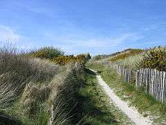 Dune
Dune
See also
References
- Mayors of Finistère Association (in French)
External links
| Wikimedia Commons has media related to Santec. |
- Official website (in French)
- French Ministry of Culture list for Santec (in French)
| Authority control |
|---|
This article is issued from
Wikipedia.
The text is licensed under Creative Commons - Attribution - Sharealike.
Additional terms may apply for the media files.