Saint-Évarzec
| Saint-Évarzec Sant-Evarzeg | ||
|---|---|---|
| Commune | ||
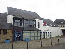 The town hall in Saint-Évarzec | ||
| ||
 Saint-Évarzec Location within Brittany region  Saint-Évarzec | ||
| Coordinates: 47°56′15″N 4°01′08″W / 47.9375°N 4.0189°WCoordinates: 47°56′15″N 4°01′08″W / 47.9375°N 4.0189°W | ||
| Country | France | |
| Region | Brittany | |
| Department | Finistère | |
| Arrondissement | Quimper | |
| Canton | Fouesnant | |
| Intercommunality | Pays Fouesnantais | |
| Government | ||
| • Mayor (2014–2020) | André Guillou | |
| Area1 | 24.65 km2 (9.52 sq mi) | |
| Population (2008)2 | 3,325 | |
| • Density | 130/km2 (350/sq mi) | |
| Time zone | UTC+1 (CET) | |
| • Summer (DST) | UTC+2 (CEST) | |
| INSEE/Postal code | 29247 /29170 | |
| Elevation | 8–102 m (26–335 ft) | |
|
1 French Land Register data, which excludes lakes, ponds, glaciers > 1 km2 (0.386 sq mi or 247 acres) and river estuaries. 2 Population without double counting: residents of multiple communes (e.g., students and military personnel) only counted once. | ||
.svg.png)
Saint-Évarzec (Breton: Sant-Evarzeg) is a commune in the Finistère department of Brittany in north-western France.
Population
Inhabitants of Saint-Évarzec are called in French Varzécois or Saint-Évarzecois.
Breton language
The municipality launched a linguistic plan through Ya d'ar brezhoneg on September 26, 2008.
See also
References
- Mayors of Finistère Association (in French)
External links
| Wikimedia Commons has media related to Saint-Évarzec. |
- Official website (in French)
- French Ministry of Culture list for Saint-Évarzec (in French)
This article is issued from
Wikipedia.
The text is licensed under Creative Commons - Attribution - Sharealike.
Additional terms may apply for the media files.