Kersaint-Plabennec
| Kersaint-Plabennec Kersent-Plabenneg | |
|---|---|
| Commune | |
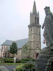 The church in Kersaint-Plabennec | |
 Kersaint-Plabennec Location within Brittany region  Kersaint-Plabennec | |
| Coordinates: 48°28′24″N 4°22′23″W / 48.4733°N 4.3731°WCoordinates: 48°28′24″N 4°22′23″W / 48.4733°N 4.3731°W | |
| Country | France |
| Region | Brittany |
| Department | Finistère |
| Arrondissement | Brest |
| Canton | Plabennec |
| Intercommunality | Plabennec et des Abers |
| Government | |
| • Mayor (2014–2020) | Jean-Yves Roquinarc'h |
| Area1 | 12 km2 (5 sq mi) |
| Population (2009[1])2 | 1,291 |
| • Density | 110/km2 (280/sq mi) |
| Time zone | UTC+1 (CET) |
| • Summer (DST) | UTC+2 (CEST) |
| INSEE/Postal code | 29095 /29860 |
| Elevation | 48–121 m (157–397 ft) |
|
1 French Land Register data, which excludes lakes, ponds, glaciers > 1 km2 (0.386 sq mi or 247 acres) and river estuaries. 2 Population without double counting: residents of multiple communes (e.g., students and military personnel) only counted once. | |
Kersaint-Plabennec (Breton: Kersent-Plabenneg) is a commune in the Finistère department of Brittany in northwestern France.
Population
Inhabitants of Kersaint-Plabennec are called in French Kersaintais.
| Year | 1999 | 2008 | 2009 |
|---|---|---|---|
| Population | 1106 | 1270 | 1291 |
See also
References
- INSEE
- Mayors of Finistère Association (in French);
External links
- Official website (in French)
- French Ministry of Culture list for Kersaint-Plabennec (in French)
| Wikimedia Commons has media related to Kersaint-Plabennec. |
This article is issued from
Wikipedia.
The text is licensed under Creative Commons - Attribution - Sharealike.
Additional terms may apply for the media files.