Treffiagat
| Treffiagat Triagad | |
|---|---|
| Commune | |
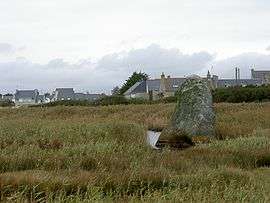 Ancient menhir at Treffiagat | |
 Treffiagat Location within Brittany region  Treffiagat | |
| Coordinates: 47°48′16″N 4°15′43″W / 47.8044°N 4.2619°WCoordinates: 47°48′16″N 4°15′43″W / 47.8044°N 4.2619°W | |
| Country | France |
| Region | Brittany |
| Department | Finistère |
| Arrondissement | Quimper |
| Canton | Pont-l'Abbé |
| Intercommunality | Pays Bigouden Sud |
| Government | |
| • Mayor (2014–2020) | David Chevrier |
| Area1 | 8.10 km2 (3.13 sq mi) |
| Population (2008)2 | 2,313 |
| • Density | 290/km2 (740/sq mi) |
| Time zone | UTC+1 (CET) |
| • Summer (DST) | UTC+2 (CEST) |
| INSEE/Postal code | 29284 /29730 |
| Elevation | −1–26 m (−3.3–85.3 ft) |
|
1 French Land Register data, which excludes lakes, ponds, glaciers > 1 km2 (0.386 sq mi or 247 acres) and river estuaries. 2 Population without double counting: residents of multiple communes (e.g., students and military personnel) only counted once. | |
Treffiagat (Breton: Triagad), also known as Treffiagat-Léchiagat, is a commune in the Finistère department of Brittany in north-western France.
Population
Inhabitants of Treffiagat are called in French Treffiagatistes.
See also
References
- Mayors of Finistère Association (in French)
External links
| Wikimedia Commons has media related to Treffiagat. |
- Official website (in French)
- French Ministry of Culture list for Treffiagat (in French)
This article is issued from
Wikipedia.
The text is licensed under Creative Commons - Attribution - Sharealike.
Additional terms may apply for the media files.