Clohars-Carnoët
| Clohars-Carnoët Kloar-Karnoed | ||
|---|---|---|
| Commune | ||
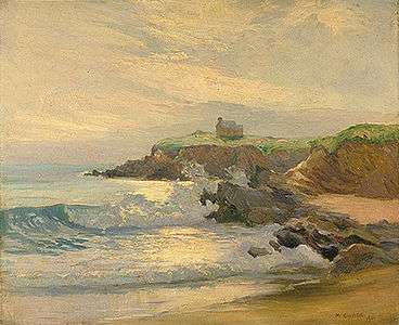 Le Pouldu, Clohars-Carnoët | ||
| ||
 Clohars-Carnoët Location within Brittany region  Clohars-Carnoët | ||
| Coordinates: 47°47′48″N 3°35′01″W / 47.7967°N 3.5836°WCoordinates: 47°47′48″N 3°35′01″W / 47.7967°N 3.5836°W | ||
| Country | France | |
| Region | Brittany | |
| Department | Finistère | |
| Arrondissement | Quimper | |
| Canton | Quimperlé | |
| Intercommunality | Pays Fouesnantais | |
| Government | ||
| • Mayor (2014–2020) | Jacques Juloux | |
| Area1 | 34.83 km2 (13.45 sq mi) | |
| Population (2008)2 | 3,999 | |
| • Density | 110/km2 (300/sq mi) | |
| Time zone | UTC+1 (CET) | |
| • Summer (DST) | UTC+2 (CEST) | |
| INSEE/Postal code | 29031 /29360 | |
| Elevation | 0–71 m (0–233 ft) | |
|
1 French Land Register data, which excludes lakes, ponds, glaciers > 1 km2 (0.386 sq mi or 247 acres) and river estuaries. 2 Population without double counting: residents of multiple communes (e.g., students and military personnel) only counted once. | ||
.svg.png)
Clohars-Carnoët (Breton: Kloar-Karnoed) is a commune in the Finistère department of Brittany in north-western France.
Geography
The commune has two small harbours: Le Pouldu and Doëlan.
Population
Inhabitants of Clohars-Carnoët are called in French Cloharsiens.
| Year | 1793 | 1800 | 1806 | 1821 | 1831 | 1836 | 1841 | 1846 | 1851 | 1856 |
|---|---|---|---|---|---|---|---|---|---|---|
| Population | 2469 | 2532 | 2353 | 2725 | 2795 | 2830 | 2850 | 3146 | 3332 | 3072 |
| Year | 1861 | 1866 | 1872 | 1876 | 1881 | 1886 | 1891 | 1896 | 1901 | 1906 |
|---|---|---|---|---|---|---|---|---|---|---|
| Population | 3125 | 3466 | 3389 | 3480 | 3572 | 3623 | 3717 | 3771 | 4010 | 4355 |
| Year | 1911 | 1921 | 1926 | 1931 | 1936 | 1946 | 1954 | 1962 | 1968 | 1975 |
|---|---|---|---|---|---|---|---|---|---|---|
| Population | 4539 | 4474 | 4328 | 4287 | 4284 | 4226 | 3931 | 3919 | 3539 | 3284 |
| Year | 1982 | 1990 | 1999 | 2008 |
|---|---|---|---|---|
| Population | 3406 | 3678 | 3867 | 3999 |
See also
- Communes of the Finistère department
- Entry on sculptor of war memorial Jean Joncourt
- Yann Larhantec Sculptor at calvaries in Clohars-Carnoët
References
- INSEE
- Mayors of Finistère Association (in French);
External links
- Official website (in French)
| Wikimedia Commons has media related to Clohars-Carnoët. |
This article is issued from
Wikipedia.
The text is licensed under Creative Commons - Attribution - Sharealike.
Additional terms may apply for the media files.