Locunolé
| Locunolé Lokunole | |
|---|---|
| Commune | |
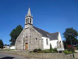 The church of Saint-Guénolé | |
 Locunolé Location within Brittany region  Locunolé | |
| Coordinates: 47°56′13″N 3°28′38″W / 47.9369°N 3.4772°WCoordinates: 47°56′13″N 3°28′38″W / 47.9369°N 3.4772°W | |
| Country | France |
| Region | Brittany |
| Department | Finistère |
| Arrondissement | Quimper |
| Canton | Quimperlé |
| Intercommunality | Pays de Quimperlé |
| Government | |
| • Mayor (2014–2020) | Murielle Le Rest |
| Area1 | 16.78 km2 (6.48 sq mi) |
| Population (2008)2 | 1,031 |
| • Density | 61/km2 (160/sq mi) |
| Time zone | UTC+1 (CET) |
| • Summer (DST) | UTC+2 (CEST) |
| INSEE/Postal code | 29136 /29310 |
| Elevation | 12–121 m (39–397 ft) |
|
1 French Land Register data, which excludes lakes, ponds, glaciers > 1 km2 (0.386 sq mi or 247 acres) and river estuaries. 2 Population without double counting: residents of multiple communes (e.g., students and military personnel) only counted once. | |
Locunolé (Breton: Lokunole) is a commune in the Finistère department of Brittany in north-western France.
Population
Inhabitants of Locunolé are called in French Locunolois.
| Year | 1800 | 1806 | 1821 | 1831 | 1841 | 1846 | 1851 | 1856 | 1861 | 1866 |
|---|---|---|---|---|---|---|---|---|---|---|
| Population | 422 | 412 | 417 | 431 | 463 | 502 | 480 | 435 | 977 | 1028 |
| Year | 1872 | 1876 | 1881 | 1886 | 1891 | 1896 | 1901 | 1906 | 1911 | 1921 |
|---|---|---|---|---|---|---|---|---|---|---|
| Population | 963 | 1109 | 1093 | 1170 | 1224 | 1263 | 1320 | 1343 | 1455 | 1453 |
| Year | 1926 | 1931 | 1936 | 1946 | 1954 | 1962 | 1968 | 1975 | 1982 | 1990 |
|---|---|---|---|---|---|---|---|---|---|---|
| Population | 1505 | 1434 | 1382 | 1330 | 1117 | 1018 | 852 | 824 | 836 | 875 |
| Year | 1999 | 2008 |
|---|---|---|
| Population | 869 | 1031 |
See also
- Communes of the Finistère department
- Entry on sculptor of local war memorial Jean Joncourt
References
- Mayors of Finistère Association (in French);
External links
| Wikimedia Commons has media related to Locunolé. |
- French Ministry of Culture list for Locunolé (in French)
This article is issued from
Wikipedia.
The text is licensed under Creative Commons - Attribution - Sharealike.
Additional terms may apply for the media files.