Gourlizon
| Gourlizon Gourlizon | ||
|---|---|---|
| Commune | ||
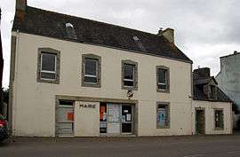 The town hall in Gourlizon | ||
| ||
 Gourlizon Location within Brittany region  Gourlizon | ||
| Coordinates: 48°01′14″N 4°15′56″W / 48.0206°N 4.2656°WCoordinates: 48°01′14″N 4°15′56″W / 48.0206°N 4.2656°W | ||
| Country | France | |
| Region | Brittany | |
| Department | Finistère | |
| Arrondissement | Quimper | |
| Canton | Plonéour-Lanvern | |
| Intercommunality | Haut-Pays Bigouden | |
| Government | ||
| • Mayor (2014–2020) | Emmanuelle Rasseneur | |
| Area1 | 9.91 km2 (3.83 sq mi) | |
| Population (2008)2 | 851 | |
| • Density | 86/km2 (220/sq mi) | |
| Time zone | UTC+1 (CET) | |
| • Summer (DST) | UTC+2 (CEST) | |
| INSEE/Postal code | 29065 /29710 | |
| Elevation | 67–159 m (220–522 ft) | |
|
1 French Land Register data, which excludes lakes, ponds, glaciers > 1 km2 (0.386 sq mi or 247 acres) and river estuaries. 2 Population without double counting: residents of multiple communes (e.g., students and military personnel) only counted once. | ||
.svg.png)
Gourlizon (Breton: Gourlizon) is a commune in the Finistère department of Brittany in north-western France.
Population
Inhabitants of Gourlizon are called in French Gourlizonnais.
See also
References
- Mayors of Finistère Association (in French);
External links
| Wikimedia Commons has media related to Gourlizon. |
This article is issued from
Wikipedia.
The text is licensed under Creative Commons - Attribution - Sharealike.
Additional terms may apply for the media files.