Saint-Ségal
| Saint-Ségal Sant-Segal | ||
|---|---|---|
| Commune | ||
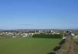 A general view of Saint-Ségal | ||
| ||
 Saint-Ségal Location within Brittany region  Saint-Ségal | ||
| Coordinates: 48°14′30″N 4°03′53″W / 48.2417°N 4.0647°WCoordinates: 48°14′30″N 4°03′53″W / 48.2417°N 4.0647°W | ||
| Country | France | |
| Region | Brittany | |
| Department | Finistère | |
| Arrondissement | Châteaulin | |
| Canton | Pont-de-Buis-lès-Quimerch | |
| Intercommunality | Aulne Maritime | |
| Government | ||
| • Mayor (2014–2020) | André Le Gall | |
| Area1 | 16.20 km2 (6.25 sq mi) | |
| Population (2008)2 | 963 | |
| • Density | 59/km2 (150/sq mi) | |
| Time zone | UTC+1 (CET) | |
| • Summer (DST) | UTC+2 (CEST) | |
| INSEE/Postal code | 29263 /29590 | |
| Elevation | 2–140 m (6.6–459.3 ft) | |
|
1 French Land Register data, which excludes lakes, ponds, glaciers > 1 km2 (0.386 sq mi or 247 acres) and river estuaries. 2 Population without double counting: residents of multiple communes (e.g., students and military personnel) only counted once. | ||
.svg.png)
Saint-Ségal (Breton: Sant-Segal) is a commune in the Finistère department of Brittany in north-western France.
Population
Inhabitants of Saint-Ségal are called in French Saint-Ségalais.
See also
References
- Mayors of Finistère Association (in French)
External links
| Wikimedia Commons has media related to Saint-Ségal. |
- Official website (in French)
- French Ministry of Culture list for Saint-Ségal (in French)
This article is issued from
Wikipedia.
The text is licensed under Creative Commons - Attribution - Sharealike.
Additional terms may apply for the media files.