Plouyé
| Plouyé Plouie | |
|---|---|
| Commune | |
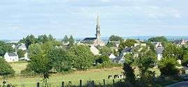 A general view of Plouyé | |
 Plouyé Location within Brittany region  Plouyé | |
| Coordinates: 48°18′58″N 3°44′11″W / 48.3161°N 3.7364°WCoordinates: 48°18′58″N 3°44′11″W / 48.3161°N 3.7364°W | |
| Country | France |
| Region | Brittany |
| Department | Finistère |
| Arrondissement | Châteaulin |
| Canton | Carhaix-Plouguer |
| Intercommunality | Yeun Elez |
| Government | |
| • Mayor (2014–2020) | Marcel Le Guern |
| Area1 | 37.55 km2 (14.50 sq mi) |
| Population (1999)2 | 675 |
| • Density | 18/km2 (47/sq mi) |
| Time zone | UTC+1 (CET) |
| • Summer (DST) | UTC+2 (CEST) |
| INSEE/Postal code | 29211 /29690 |
| Elevation | 67–246 m (220–807 ft) |
|
1 French Land Register data, which excludes lakes, ponds, glaciers > 1 km2 (0.386 sq mi or 247 acres) and river estuaries. 2 Population without double counting: residents of multiple communes (e.g., students and military personnel) only counted once. | |
Plouyé (Breton: Plouie "Parish of Ia"[1]) is a commune in the Finistère department of Brittany in northwestern France.
Population
Inhabitants of Plouyé are called in French Plouyéziens.
| Year | 1793 | 1800 | 1806 | 1821 | 1831 | 1836 | 1841 | 1846 | 1851 | 1856 |
|---|---|---|---|---|---|---|---|---|---|---|
| Population | 1310 | 1753 | 1710 | 1580 | 1940 | 1990 | 1998 | 2028 | 2135 | 2040 |
| Year | 1861 | 1866 | 1872 | 1876 | 1881 | 1886 | 1891 | 1896 | 1901 | 1906 |
|---|---|---|---|---|---|---|---|---|---|---|
| Population | 2053 | 2071 | 1936 | 1989 | 1913 | 1972 | 2031 | 2086 | 2272 | 2243 |
| Year | 1911 | 1921 | 1926 | 1931 | 1936 | 1946 | 1954 | 1962 | 1968 | 1975 |
|---|---|---|---|---|---|---|---|---|---|---|
| Population | 2323 | 2223 | 2195 | 1960 | 1789 | 1670 | 1423 | 1241 | 1048 | 958 |
| Year | 1982 | 1990 | 1999 | 2008 |
|---|---|---|---|---|
| Population | 836 | 726 | 675 | 675 |
See also
References
- ↑ Doble, Gilbert Hunter (1960). The Saints of Cornwall.
- Mayors of Finistère Association (in French)
External links
| Wikimedia Commons has media related to Plouyé. |
- Official website (in French)
This article is issued from
Wikipedia.
The text is licensed under Creative Commons - Attribution - Sharealike.
Additional terms may apply for the media files.