Solis Glacier
| Solis Glacier | |
|---|---|
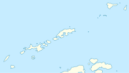
 Location of Greenwich Island in the South Shetland Islands | |
 Solis Glacier (Antarctica) Show map of Antarctica | |
| Location |
Greenwich Island South Shetland Islands |
| Coordinates | 62°31′30″S 59°43′24″W / 62.52500°S 59.72333°W / -62.52500; -59.72333Coordinates: 62°31′30″S 59°43′24″W / 62.52500°S 59.72333°W / -62.52500; -59.72333 |
| Length | 1.5 nmi (3 km; 2 mi) |
| Width | 1 nmi (2 km; 1 mi) |
| Thickness | unknown |
| Terminus | Yankee Harbour |
| Status | unknown |
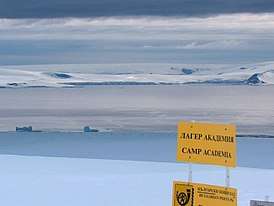
Solis Glacier (on the right) from Camp Academia, with Huron Glacier and McFarlane Strait in the foreground.
Solis Glacier is a glacier on Greenwich Island in the South Shetland Islands, Antarctica extending 2.8 km in southeast-northwest direction and 1.8 km in southwest-northeast direction and draining the north slopes of Breznik Heights to flow northwestwards into Yankee Harbour.
The feature was named by the 1952-53 Chilean Antarctic Expedition after a member of the party that made a hydrographic survey of Yankee Harbour.
Location
The glacier is centred at 62°31′30″S 59°43′24″W / 62.52500°S 59.72333°W / -62.52500; -59.72333 (Bulgarian mapping in 2005 and 2009).
See also
Maps
- L.L. Ivanov et al. Antarctica: Livingston Island and Greenwich Island, South Shetland Islands. Scale 1:100000 topographic map. Sofia: Antarctic Place-names Commission of Bulgaria, 2005.
- L.L. Ivanov. Antarctica: Livingston Island and Greenwich, Robert, Snow and Smith Islands. Scale 1:120000 topographic map. Troyan: Manfred Wörner Foundation, 2009. ISBN 978-954-92032-6-4
References

Topographic map of Livingston Island, Greenwich, Robert, Snow and Smith Islands.
| Types | |||||||
|---|---|---|---|---|---|---|---|
| Anatomy | |||||||
| Processes | |||||||
| Measurements | |||||||
| Volcanic relations | |||||||
| Landforms |
| ||||||
| |||||||
This article is issued from
Wikipedia.
The text is licensed under Creative Commons - Attribution - Sharealike.
Additional terms may apply for the media files.