Ogy-Montoy-Flanville
| Ogy-Montoy-Flanville | |
|---|---|
| Commune | |
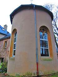 The chapel in Montoy | |
 Ogy-Montoy-Flanville Location within Grand Est region  Ogy-Montoy-Flanville | |
| Coordinates: 49°07′19″N 6°16′55″E / 49.122°N 6.282°ECoordinates: 49°07′19″N 6°16′55″E / 49.122°N 6.282°E | |
| Country | France |
| Region | Grand Est |
| Department | Moselle |
| Arrondissement | Metz |
| Canton | Le Pays Messin |
| Intercommunality | Haut Chemin-Pays de Pange |
| Area1 | 10.06 km2 (3.88 sq mi) |
| Population (2013)2 | 1,651 |
| • Density | 160/km2 (430/sq mi) |
| Time zone | UTC+1 (CET) |
| • Summer (DST) | UTC+2 (CEST) |
| INSEE/Postal code | 57482 /57530, 57645 |
|
1 French Land Register data, which excludes lakes, ponds, glaciers > 1 km2 (0.386 sq mi or 247 acres) and river estuaries. 2 Population without double counting: residents of multiple communes (e.g., students and military personnel) only counted once. | |
Ogy-Montoy-Flanville (German: Ogingen-Montingen-Flanheim) is a commune in the department of Moselle, northeastern France. The municipality was established on 1 January 2017 by merger of the former communes of Montoy-Flanville (the seat) and Ogy.[1]
See also
References
| Wikimedia Commons has media related to Ogy-Montoy-Flanville. |
- ↑ Arrêté préfectoral 22 December 2016 (in French)
This article is issued from
Wikipedia.
The text is licensed under Creative Commons - Attribution - Sharealike.
Additional terms may apply for the media files.