Beyren-lès-Sierck
| Beyren-lès-Sierck | ||
|---|---|---|
| Commune | ||
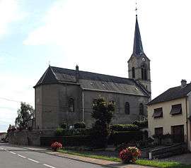 The church in Beyren-lès-Sierck | ||
| ||
 Beyren-lès-Sierck Location within Grand Est region  Beyren-lès-Sierck | ||
| Coordinates: 49°28′19″N 6°17′16″E / 49.4719°N 6.2878°ECoordinates: 49°28′19″N 6°17′16″E / 49.4719°N 6.2878°E | ||
| Country | France | |
| Region | Grand Est | |
| Department | Moselle | |
| Arrondissement | Thionville | |
| Canton | Yutz | |
| Intercommunality | Cattenom et environs | |
| Government | ||
| • Mayor (2008–2014) | Emile Reicher | |
| Area1 | 9.28 km2 (3.58 sq mi) | |
| Population (2009)2 | 472 | |
| • Density | 51/km2 (130/sq mi) | |
| Time zone | UTC+1 (CET) | |
| • Summer (DST) | UTC+2 (CEST) | |
| INSEE/Postal code | 57076 /57570 | |
| Elevation |
154–268 m (505–879 ft) (avg. 162 m or 531 ft) | |
|
1 French Land Register data, which excludes lakes, ponds, glaciers > 1 km2 (0.386 sq mi or 247 acres) and river estuaries. 2 Population without double counting: residents of multiple communes (e.g., students and military personnel) only counted once. | ||
.svg.png)
Beyren-lès-Sierck (German: Beiern) is a commune in the Moselle department in Grand Est in northeastern France.
The locality of Gandren (German: Gandern) is incorporated in the commune since 1812.
Population
| Historical population | ||
|---|---|---|
| Year | Pop. | ±% |
| 1962 | 302 | — |
| 1968 | 307 | +1.7% |
| 1975 | 308 | +0.3% |
| 1982 | 353 | +14.6% |
| 1990 | 430 | +21.8% |
| 1999 | 426 | −0.9% |
| 2006 | 462 | +8.5% |
| 2009 | 472 | +2.2% |
See also
References
| Wikimedia Commons has media related to Beyren-lès-Sierck. |
This article is issued from
Wikipedia.
The text is licensed under Creative Commons - Attribution - Sharealike.
Additional terms may apply for the media files.