Courcelles-Chaussy
| Courcelles-Chaussy | ||
|---|---|---|
| Commune | ||
 The château of Urville | ||
| ||
 Courcelles-Chaussy Location within Grand Est region  Courcelles-Chaussy | ||
| Coordinates: 49°06′36″N 6°24′21″E / 49.11°N 6.4058°ECoordinates: 49°06′36″N 6°24′21″E / 49.11°N 6.4058°E | ||
| Country | France | |
| Region | Grand Est | |
| Department | Moselle | |
| Arrondissement | Metz | |
| Canton | Le Pays Messin | |
| Intercommunality | Communauté de communes de Pange | |
| Government | ||
| • Mayor (2008–2014) | Jean-Marie Gori | |
| Area1 | 19.02 km2 (7.34 sq mi) | |
| Population (1999)2 | 2,392 | |
| • Density | 130/km2 (330/sq mi) | |
| Time zone | UTC+1 (CET) | |
| • Summer (DST) | UTC+2 (CEST) | |
| INSEE/Postal code | 57155 /57530 | |
| Elevation |
207–307 m (679–1,007 ft) (avg. 220 m or 720 ft) | |
|
1 French Land Register data, which excludes lakes, ponds, glaciers > 1 km2 (0.386 sq mi or 247 acres) and river estuaries. 2 Population without double counting: residents of multiple communes (e.g., students and military personnel) only counted once. | ||
.svg.png)
Courcelles-Chaussy (German: Kurzel an der Straße) is a commune in the Moselle department in Grand Est in north-eastern France.
See also
Gallery
 Courcelels-Chaussy monument
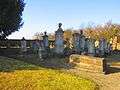 Courcelles-Chaussy Jewish cemetery
 Courcelles-Chaussy Protestant cemetery
![]()
This article is issued from
Wikipedia.
The text is licensed under Creative Commons - Attribution - Sharealike.
Additional terms may apply for the media files.