Le Ban-Saint-Martin
| Le Ban-Saint-Martin | ||
|---|---|---|
| Commune | ||
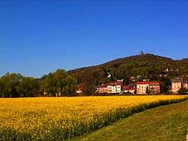 A general view of Le Ban-Saint-Martin | ||
| ||
 Le Ban-Saint-Martin Location within Grand Est region  Le Ban-Saint-Martin | ||
| Coordinates: 49°07′21″N 6°09′04″E / 49.1225°N 6.1511°ECoordinates: 49°07′21″N 6°09′04″E / 49.1225°N 6.1511°E | ||
| Country | France | |
| Region | Grand Est | |
| Department | Moselle | |
| Arrondissement | Metz | |
| Canton | Montigny-lès-Metz | |
| Intercommunality | Metz Métropole | |
| Government | ||
| • Mayor (2008–2014) | Henri Hasser | |
| Area1 | 1.59 km2 (0.61 sq mi) | |
| Population (2009)2 | 4,314 | |
| • Density | 2,700/km2 (7,000/sq mi) | |
| Time zone | UTC+1 (CET) | |
| • Summer (DST) | UTC+2 (CEST) | |
| INSEE/Postal code | 57049 /57050 | |
| Elevation |
165–325 m (541–1,066 ft) (avg. 310 m or 1,020 ft) | |
|
1 French Land Register data, which excludes lakes, ponds, glaciers > 1 km2 (0.386 sq mi or 247 acres) and river estuaries. 2 Population without double counting: residents of multiple communes (e.g., students and military personnel) only counted once. | ||
.svg.png)
Le Ban-Saint-Martin (German: Sankt Martinsbann) is a commune in the Moselle department in Grand Est in northeastern France.
Population
| Historical population | ||
|---|---|---|
| Year | Pop. | ±% |
| 1999 | 4,275 | — |
| 2007 | 4,435 | +3.7% |
| 2009 | 4,314 | −2.7% |
See also
References
| Wikimedia Commons has media related to Le Ban-Saint-Martin. |
This article is issued from
Wikipedia.
The text is licensed under Creative Commons - Attribution - Sharealike.
Additional terms may apply for the media files.