Lixing-lès-Rouhling
| Lixing-lès-Rouhling | ||
|---|---|---|
| Commune | ||
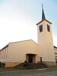 The church in Lixing-lès-Rouhling | ||
| ||
 Lixing-lès-Rouhling Location within Grand Est region  Lixing-lès-Rouhling | ||
| Coordinates: 49°09′16″N 6°59′43″E / 49.1544°N 6.9953°ECoordinates: 49°09′16″N 6°59′43″E / 49.1544°N 6.9953°E | ||
| Country | France | |
| Region | Grand Est | |
| Department | Moselle | |
| Arrondissement | Sarreguemines | |
| Canton | Sarreguemines | |
| Intercommunality | Sarreguemines Confluences | |
| Government | ||
| • Mayor (2008–2014) | Michel Bour | |
| Area1 | 4.22 km2 (1.63 sq mi) | |
| Population (1999)2 | 830 | |
| • Density | 200/km2 (510/sq mi) | |
| Time zone | UTC+1 (CET) | |
| • Summer (DST) | UTC+2 (CEST) | |
| INSEE/Postal code | 57408 /57520 | |
| Elevation | 210–343 m (689–1,125 ft) | |
|
1 French Land Register data, which excludes lakes, ponds, glaciers > 1 km2 (0.386 sq mi or 247 acres) and river estuaries. 2 Population without double counting: residents of multiple communes (e.g., students and military personnel) only counted once. | ||
.svg.png)
Lixing-lès-Rouhling (German: Lixingen) is a commune in the Moselle department in Grand Est in north-eastern France.
Changes in population
| Year | 1962 | 1968 | 1975 | 1982 | 1990 | 1999 |
|---|---|---|---|---|---|---|
| Population | 652 | 675 | 734 | 717 | 789 | 830 |
| From the year 1968 on: No double counting—residents of multiple communes (e.g. students and military personnel) are counted only once. | ||||||
See also
References
| Wikimedia Commons has media related to Lixing-lès-Rouhling. |
This article is issued from
Wikipedia.
The text is licensed under Creative Commons - Attribution - Sharealike.
Additional terms may apply for the media files.