Eincheville
| Eincheville | ||
|---|---|---|
| Commune | ||
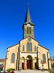 The church in Eincheville | ||
| ||
 Eincheville Location within Grand Est region  Eincheville | ||
| Coordinates: 48°59′01″N 6°36′20″E / 48.9836°N 6.6056°ECoordinates: 48°59′01″N 6°36′20″E / 48.9836°N 6.6056°E | ||
| Country | France | |
| Region | Grand Est | |
| Department | Moselle | |
| Arrondissement | Forbach-Boulay-Moselle | |
| Canton | Sarralbe | |
| Intercommunality | Communauté de communes du Centre mosellan | |
| Government | ||
| • Mayor (2008–2014) | Pierre Hostrenko | |
| Area1 | 6.78 km2 (2.62 sq mi) | |
| Population (1999)2 | 189 | |
| • Density | 28/km2 (72/sq mi) | |
| Time zone | UTC+1 (CET) | |
| • Summer (DST) | UTC+2 (CEST) | |
| INSEE/Postal code | 57189 /57340 | |
| Elevation |
249–312 m (817–1,024 ft) (avg. 250 m or 820 ft) | |
|
1 French Land Register data, which excludes lakes, ponds, glaciers > 1 km2 (0.386 sq mi or 247 acres) and river estuaries. 2 Population without double counting: residents of multiple communes (e.g., students and military personnel) only counted once. | ||
.svg.png)
Eincheville (Lorraine Franconian Enschwiller/Äschwiller, German: Enschweiler) is a commune in the Moselle department in Grand Est in north-eastern France.
See also
| Wikimedia Commons has media related to Eincheville. |
This article is issued from
Wikipedia.
The text is licensed under Creative Commons - Attribution - Sharealike.
Additional terms may apply for the media files.